 |
|
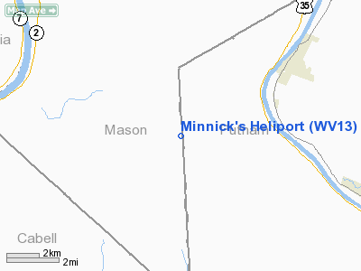
Location & QuickFacts
| FAA Information Effective: | 2008-09-25 |
| Airport Identifier: | WV13 |
| Airport Status: | Operational |
| Longitude/Latitude: | 082-03-44.5040W/38-34-15.3100N
-82.062362/38.570919 (Estimated) |
| Elevation: | 830 ft / 252.98 m (Estimated) |
| Land: | 0 acres |
| From nearest city: | 1 nautical miles NE of Upland, WV |
| Location: | Mason County, WV |
| Magnetic Variation: | 05W (1985) |
Owner & Manager
| Ownership: | Privately owned |
| Owner: | Jim Minnick's Parts/engs Inc |
| Address: | 520 Old Goff Mtn Rd
Charleston, WV 25313 |
| Phone number: | 304-776-2200 |
| Manager: | James A. Minnick |
| Address: | 520 Old Goff Mtn Rd
Charleston, WV 25313 |
| Phone number: | 304-776-2200 |
Airport Operations and Facilities
| Airport Use: | Private |
| Wind indicator: | Yes |
| Segmented Circle: | No |
| Control Tower: | No |
| Landing fee charge: | No |
| Sectional chart: | Cincinnati |
| Region: | AEA - Eastern |
| Boundary ARTCC: | ZID - Indianapolis |
| Tie-in FSS: | EKN - Elkins |
| FSS on Airport: | No |
| FSS Toll Free: | 1-800-WX-BRIEF |
Airport Communications
Runway Information
Helipad H1
| Dimension: | 22 x 22 ft / 6.7 x 6.7 m |
| Surface: | CONC,
HELIPORT WITHIN 500'X 100' TURF AREA. |
| |
Runway H1 |
Runway |
| Traffic Pattern: | Left | Left |
|
Radio Navigation Aids
| ID |
Type |
Name |
Ch |
Freq |
Var |
Dist |
| AJY | FAN MARKER | Ashland | | | 03W | 34.4 nm |
| GAS | NDB | Gallipolis | | 420.00 | 07W | 16.4 nm |
| PMH | NDB | Portsmouth | | 373.00 | 04W | 38.8 nm |
| UGS | NDB | University | | 250.00 | 06W | 41.4 nm |
| GTC | NDB | Guyandot | | 293.00 | 03W | 48.0 nm |
| HNN | VORTAC | Henderson | 106X | 115.90 | 03W | 11.1 nm |
| HVQ | VORTAC | Charleston | 121X | 117.40 | 03W | 19.1 nm |
| YRK | VORTAC | York | 075X | 112.80 | 05W | 43.2 nm |
| ECB | VORTAC | Newcombe | 041X | 110.40 | 02W | 47.0 nm |
| CRW | VOT | Charleston Kanawha | | 108.80 | | 25.1 nm |
Images and information placed above are from
http://www.airport-data.com/airport/WV13/
We thank them for the data!
| General Info
|
| Country |
United States
|
| State |
WEST VIRGINIA
|
| FAA ID |
WV13
|
| Latitude |
38-34-15.310N
|
| Longitude |
082-03-44.504W
|
| Elevation |
830 feet
|
| Near City |
UPLAND
|
We don't guarantee the information is fresh and accurate. The data may
be wrong or outdated.
For more up-to-date information please refer to other sources.
|
|


