 |
|
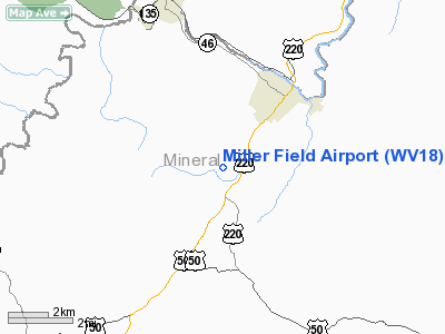
Location & QuickFacts
| FAA Information Effective: | 2008-09-25 |
| Airport Identifier: | WV18 |
| Airport Status: | Operational |
| Longitude/Latitude: | 079-00-49.1020W/39-24-30.3450N
-79.013639/39.408429 (Estimated) |
| Elevation: | 1050 ft / 320.04 m (Estimated) |
| Land: | 0 acres |
| From nearest city: | 3 nautical miles SW of Keyser, WV |
| Location: | Mineral County, WV |
| Magnetic Variation: | 08W (1985) |
Owner & Manager
| Ownership: | Privately owned |
| Owner: | Miller Family |
| Address: | Rr 4 Box 120
Keyser, WV 26726 |
| Phone number: | 304-788-3477 |
| Manager: | Garold Garrett |
| Address: | Rr 4 Box 120
Keyser, WV 26726 |
| Phone number: | 304-788-3477 |
Airport Operations and Facilities
| Airport Use: | Private |
| Wind indicator: | Yes |
| Segmented Circle: | No |
| Control Tower: | No |
| Landing fee charge: | No |
| Sectional chart: | Cincinnati |
| Region: | AEA - Eastern |
| Boundary ARTCC: | ZDC - Washington |
| Tie-in FSS: | EKN - Elkins |
| FSS on Airport: | No |
| FSS Toll Free: | 1-800-WX-BRIEF |
Airport Services
| Airframe Repair: | NONE |
| Power Plant Repair: | NONE |
| Bottled Oxygen: | NONE |
| Bulk Oxygen: | NONE |
Runway Information
Runway 15/33
| Dimension: | 1700 x 130 ft / 518.2 x 39.6 m |
| Surface: | TURF, |
| |
Runway 15 |
Runway 33 |
| Traffic Pattern: | Left | Left |
| Runway End Identifier: | No | No |
| Centerline Lights: | No | No |
| Touchdown Lights: | No | No |
|
Radio Navigation Aids
| ID |
Type |
Name |
Ch |
Freq |
Var |
Dist |
| CBE | NDB | Cumberland | | 317.00 | 07W | 19.0 nm |
| SYS | NDB | Stoystown | | 209.00 | 08W | 41.0 nm |
| VV | NDB | Camor | | 299.00 | 08W | 44.2 nm |
| TZ | NDB | Cogan | | 364.00 | 10W | 48.1 nm |
| LUA | NDB | Caverns | | 245.00 | 09W | 49.6 nm |
| ESL | VOR/DME | Kessel | 045X | 110.80 | 06W | 11.1 nm |
| GRV | VOR/DME | Grantsville | 070X | 112.30 | 06W | 13.7 nm |
| IHD | VORTAC | Indian Head | 019X | 108.20 | 06W | 37.6 nm |
| MGW | VORTAC | Morgantown | 053X | 111.60 | 05W | 40.3 nm |
Remarks
- RNWY ROUGH AND ROLLING. UPHILL TO NW AND CURVING
- EXISTED PRIOR TO 1959
Images and information placed above are from
http://www.airport-data.com/airport/WV18/
We thank them for the data!
| General Info
|
| Country |
United States
|
| State |
WEST VIRGINIA
|
| FAA ID |
WV18
|
| Latitude |
39-24-30.345N
|
| Longitude |
079-00-49.102W
|
| Elevation |
1050 feet
|
| Near City |
KEYSER
|
We don't guarantee the information is fresh and accurate. The data may
be wrong or outdated.
For more up-to-date information please refer to other sources.
|
|


