 |
|
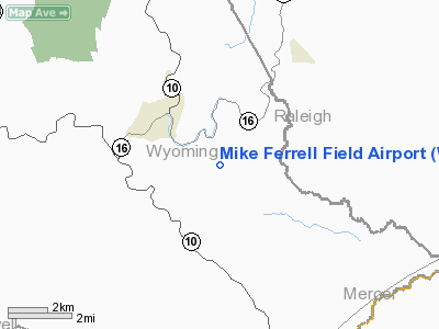
Mike Ferrell Field Airport |
Location & QuickFacts
| FAA Information Effective: | 2008-09-25 |
| Airport Identifier: | WV09 |
| Airport Status: | Operational |
| Longitude/Latitude: | 081-21-02.3670W/37-33-31.4120N
-81.350658/37.558726 (Estimated) |
| Elevation: | 2220 ft / 676.66 m (Estimated) |
| Land: | 186 acres |
| From nearest city: | 1 nautical miles S of Corinne, WV |
| Location: | Wyoming County, WV |
| Magnetic Variation: | 05W (1985) |
Owner & Manager
| Ownership: | Privately owned |
| Owner: | Michael R Ferrell |
| Address: | Po Box 1018
Logan, WV 25601 |
| Phone number: | 304-752-1350 |
| Manager: | Michael R Ferrell |
| Address: | Po Box 1018
Logan, WV 25601 |
| Phone number: | 304-752-1350 |
Airport Operations and Facilities
| Airport Use: | Private |
| Wind indicator: | Yes |
| Segmented Circle: | No |
| Control Tower: | No |
| Landing fee charge: | No |
| Sectional chart: | Cincinnati |
| Region: | AEA - Eastern |
| Boundary ARTCC: | ZID - Indianapolis |
| Tie-in FSS: | EKN - Elkins |
| FSS on Airport: | No |
| FSS Toll Free: | 1-800-WX-BRIEF |
Airport Services
| Airframe Repair: | NONE |
| Power Plant Repair: | NONE |
Runway Information
Runway 09/27
| Dimension: | 1900 x 50 ft / 579.1 x 15.2 m |
| Surface: | ASPH, Good Condition |
| |
Runway 09 |
Runway 27 |
| Traffic Pattern: | Left | Left |
|
Radio Navigation Aids
| ID |
Type |
Name |
Ch |
Freq |
Var |
Dist |
| GTC | NDB | Guyandot | | 293.00 | 03W | 29.8 nm |
| MK | NDB | Suzze | | 335.00 | 06W | 38.7 nm |
| IJZ | NDB | Nicholas | | 272.00 | 05W | 42.3 nm |
| LW | NDB | Bushi | | 346.00 | 06W | 44.1 nm |
| TEC | NDB | Tech | | 368.00 | 06W | 49.9 nm |
| RNL | VOR | Rainelle | | 116.60 | 04W | 36.0 nm |
| LWB | VOR/DME | Greenbrier | 107Y | 116.05 | 08W | 49.1 nm |
| BLF | VORTAC | Bluefield | 037X | 110.00 | 03W | 16.9 nm |
| BKW | VORTAC | Beckley | 124X | 117.70 | 06W | 17.2 nm |
| PSK | VORTAC | Pulaski | 115X | 116.80 | 06W | 41.6 nm |
Remarks
- PRVDD VFR; NO IFR OPNS; ALL CONDITIONS ON CURRENT AMR REMAIN THE SAME & ARPT OPERATED TO MINIMIZE NOISE OVER RESIDENCES NEAR ARPT.
Images and information placed above are from
http://www.airport-data.com/airport/WV09/
We thank them for the data!
| General Info
|
| Country |
United States
|
| State |
WEST VIRGINIA
|
| FAA ID |
WV09
|
| Latitude |
37-33-31.412N
|
| Longitude |
081-21-02.367W
|
| Elevation |
2220 feet
|
| Near City |
CORINNE
|
We don't guarantee the information is fresh and accurate. The data may
be wrong or outdated.
For more up-to-date information please refer to other sources.
|
|


