|
|
Mid-ohio Valley Rgnl Airport |
| Mid-Ohio Valley Regional Airport |
 |
| IATA: PKB – ICAO: KPKB – FAA LID: PKB |
| Summary |
| Airport type |
Public |
| Operator |
Wood County Airport Authority |
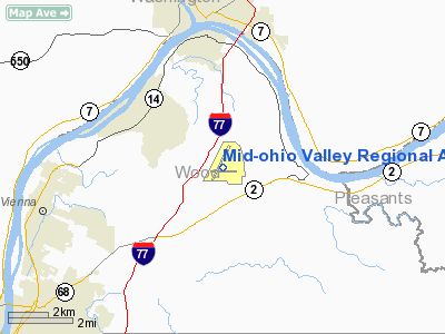
| Location |
Parkersburg, West Virginia |
| Elevation AMSL |
858 ft / 261.5 m |
| Coordinates |
39°20′42″N 81°26′21″W / 39.345°N 81.43917°W / 39.345; -81.43917Coordinates: 39°20′42″N 81°26′21″W / 39.345°N 81.43917°W / 39.345; -81.43917 |
| Runways |
| Direction |
Length |
Surface |
| ft |
m |
| 3/21 |
6,781 |
2,067 |
Asphalt |
| 10/28 |
4,000 |
1,219 |
Asphalt |
| Helipads |
| Number |
Length |
Surface |
| ft |
m |
| H1 |
24 |
7 |
Concrete |
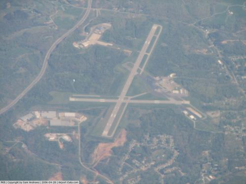
Mid-Ohio Valley Regional Airport (IATA: PKB, ICAO: KPKB, FAA LID: PKB), also known as Wood County Airport or Gill Robb Wilson Field, is a public airport located six miles (10 km) northeast of the central business district (CBD) of Parkersburg, a city in Wood County, West Virginia, USA. It serves the general Mid-Ohio Valley metropolitan area which includes the Ohio cities of Marietta and Belpre and the West Virginia cities of Williamstown, Parkersburg and Vienna.
The airport covers 1,103 acres (446 ha) and has two runways and a helipad. It is mostly used for general aviation, but is also served by one commercial airline. Service is subsidized by the Essential Air Service program.
Airline and destinations
| Airlines |
Destinations |
| Continental Connection operated by Gulfstream International Airlines |
Cleveland |
The above content comes from Wikipedia and is published under free licenses – click here to read more.
 |
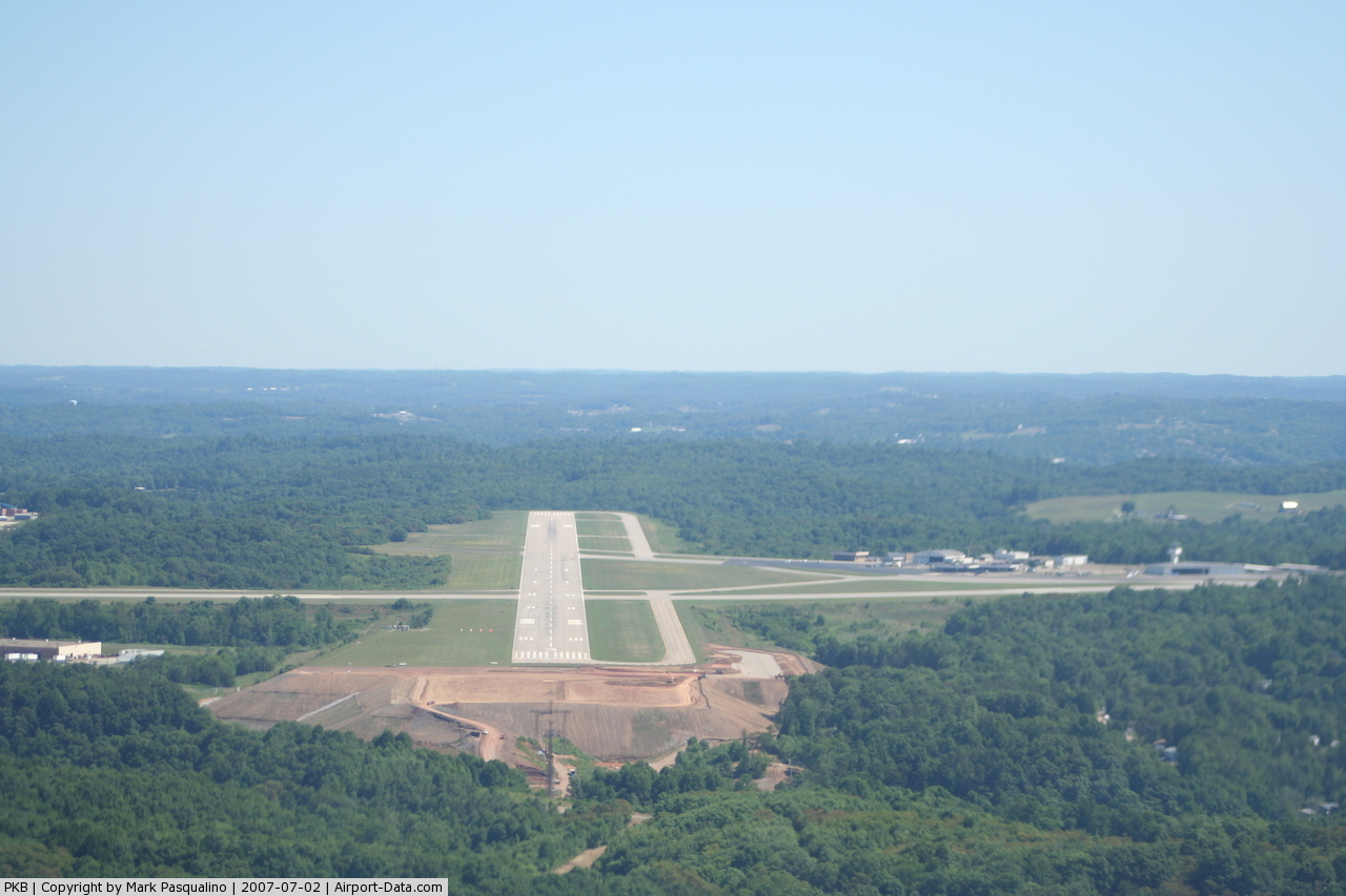
(Click on the photo to enlarge) |
 |
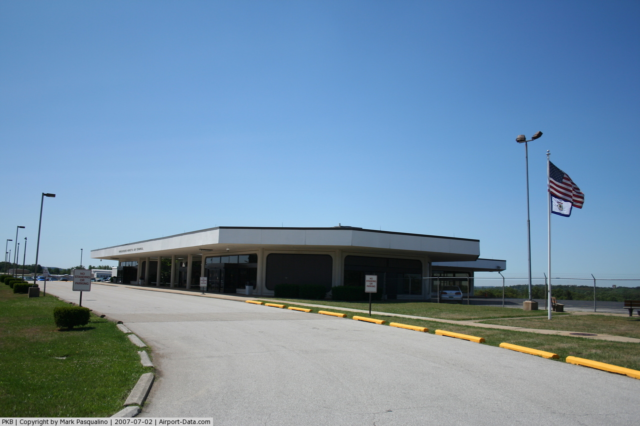
(Click on the photo to enlarge) |
 |
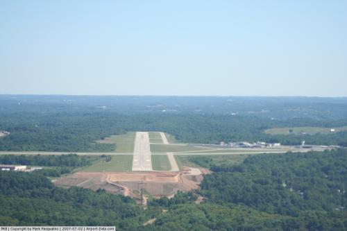
(Click on the photo to enlarge) |
Location & QuickFacts
| FAA Information Effective: | 2008-09-25 |
| Airport Identifier: | PKB |
| Airport Status: | Operational |
| Longitude/Latitude: | 081-26-21.1311W/39-20-42.3741N
-81.439203/39.345104 (Estimated) |
| Elevation: | 858 ft / 261.52 m (Surveyed) |
| Land: | 1103 acres |
| From nearest city: | 6 nautical miles NE of Parkersburg, WV |
| Location: | Wood County, WV |
| Magnetic Variation: | 07W (2000) |
Owner & Manager
| Ownership: | Publicly owned |
| Owner: | Wood Co. Arpt Auth |
| Address: | Airport Road, P.o. Box 4089, Box 4089
Parkersburg, WV 26104-4089
FEDEX DELIVERY: ROUTE 31 & AIRPORT RD, WILLIAMSTOWN, WV 26187 |
| Phone number: | 304-464-5113 |
| Manager: | Terry H. Moore |
| Address: | Airport Rd, Box 4089
Williamstown, WV 26187 |
| Phone number: | 304-464-5113 |
Airport Operations and Facilities
| Airport Use: | Open to public |
| Wind indicator: | Yes |
| Segmented Circle: | No |
| Control Tower: | Yes |
| Lighting Schedule: | DUSK-DAWN
WHEN ATCT CLSD ACTVT HIRL RYS 03/21 & 10/28; TWY LGTS; MALSR RY 03; REIL RY 10 - CTAF. |
| Beacon Color: | Clear-Green (lighted land airport) |
| Landing fee charge: | Yes |
| Sectional chart: | Cincinnati |
| Region: | AEA - Eastern |
| Boundary ARTCC: | ZID - Indianapolis |
| Tie-in FSS: | EKN - Elkins |
| FSS on Airport: | No |
| FSS Toll Free: | 1-800-WX-BRIEF |
| NOTAMs Facility: | PKB (NOTAM-d service avaliable) |
| Certification type/date: | I A S 11/1980
PPR 30 MIN FOR UNSCHEDULED ACR OPNS WITH MORE THAN 30 PSGR SEATS; CALL AMGR (304) 464-5113. |
| Federal Agreements: | NGYH |
Airport Communications
| CTAF: | 123.700 |
| Unicom: | 122.950 |
Airport Services
| Fuel available: | 100LLA |
| Airframe Repair: | MINOR |
| Power Plant Repair: | MINOR |
| Bottled Oxygen: | NONE |
| Bulk Oxygen: | NONE |
Runway Information
Runway 03/21
| Dimension: | 6781 x 150 ft / 2066.8 x 45.7 m |
| Surface: | ASPH, Good Condition |
| Surface Treatment: | Saw-cut or plastic Grooved |
| Weight Limit: | Single wheel: 85000 lbs.
Dual wheel: 100000 lbs.
Dual tandem wheel: 175000 lbs. |
| Edge Lights: | High |
| |
Runway 03 |
Runway 21 |
| Longitude: | 081-26-36.2885W | 081-26-03.9544W |
| Latitude: | 39-20-16.2170N | 39-21-18.3529N |
| Elevation: | 806.00 ft | 858.00 ft |
| Alignment: | 22 | 127 |
| ILS Type: | ILS
| |
| Traffic Pattern: | Left | Left |
| Markings: | Precision instrument, Good Condition | Precision instrument, Good Condition |
| Crossing Height: | 71.00 ft | 56.00 ft |
| VASI: | 4-light PAPI on left side | 4-box on right side
VASI RY 21 UNUSABLE BYD 5 DEGREES LEFT AND 9 DEGREES RIGHT OF CENTERLINE. |
| Visual Glide Angle: | 3.00° | 3.00° |
| RVR Equipment: | touchdown | |
| Approach lights: | MALSR | |
| Runway End Identifier: | | Yes |
|
Runway 10/28
| Dimension: | 4000 x 150 ft / 1219.2 x 45.7 m |
| Surface: | ASPH, Good Condition |
| Surface Treatment: | Saw-cut or plastic Grooved |
| Weight Limit: | Single wheel: 50000 lbs.
Dual wheel: 75000 lbs.
Dual tandem wheel: 135000 lbs. |
| Edge Lights: | High |
| |
Runway 10 |
Runway 28 |
| Longitude: | 081-26-48.1967W | 081-25-57.4828W |
| Latitude: | 39-20-35.7684N | 39-20-32.3250N |
| Elevation: | 830.00 ft | 838.00 ft |
| Alignment: | 95 | 127 |
| Traffic Pattern: | Left | Left |
| Markings: | Non-precision instrument, Good Condition | Non-precision instrument, Good Condition |
| Crossing Height: | 51.00 ft | 52.00 ft |
| VASI: | 2-light PAPI on left side | 2-light PAPI on left side
PAPI UNUSBL BYD 8 DEG LEFT AND 8 DEG RIGHT OF RY CNTRLN. |
| Visual Glide Angle: | 3.00° | 3.00° |
| Runway End Identifier: | Yes | Yes |
|
Helipad H1
| Dimension: | 24 x 24 ft / 7.3 x 7.3 m |
| Surface: | CONC, Good Condition |
| |
Runway H1 |
Runway |
| Traffic Pattern: | Left | Left |
| Markings: | Basic, Good Condition
RY H1 MARKINGS FADED | ,
RY H1 MARKINGS FADED |
|
Radio Navigation Aids
| ID |
Type |
Name |
Ch |
Freq |
Var |
Dist |
| PKB | FAN MARKER | Marietta Ohio | | | 03W | 2.7 nm |
| UGS | NDB | University | | 250.00 | 06W | 32.4 nm |
| HRA | NDB | Zanesville | | 204.00 | 06W | 40.4 nm |
| GAS | NDB | Gallipolis | | 420.00 | 07W | 45.6 nm |
| ZZV | VOR/DME | Zanesville | 051X | 111.40 | 06W | 41.5 nm |
| AIR | VOR/DME | Bellaire | 118X | 117.10 | 07W | 49.6 nm |
| JPU | VORTAC | Parkersburg | 023X | 108.60 | 03W | 6.5 nm |
| HNN | VORTAC | Henderson | 106X | 115.90 | 03W | 44.9 nm |
Remarks
- DEER ON & INVOF ARPT.
- NO LANDING FEE FOR ACFT LESS THAN 6500 LBS; FOR ACFT GREATER THAN 6500, LNDG FEE WAIVED WITH FUEL PURCHASES.
Images and information placed above are from
http://www.airport-data.com/airport/PKB/
We thank them for the data!
| General Info
|
| Country |
United States
|
| State |
WEST VIRGINIA
|
| FAA ID |
PKB
|
| Latitude |
39-20-42.372N
|
| Longitude |
081-26-21.127W
|
| Elevation |
858 feet
|
| Near City |
PARKERSBURG
|
We don't guarantee the information is fresh and accurate. The data may
be wrong or outdated.
For more up-to-date information please refer to other sources.
|
|