 |
|
Location & QuickFacts
| FAA Information Effective: | 2008-09-25 |
| Airport Identifier: | WV17 |
| Airport Status: | Operational |
| Longitude/Latitude: | 078-09-21.0080W/39-23-36.3570N
-78.155836/39.393432 (Estimated) |
| Elevation: | 510 ft / 155.45 m (Estimated) |
| Land: | 80 acres |
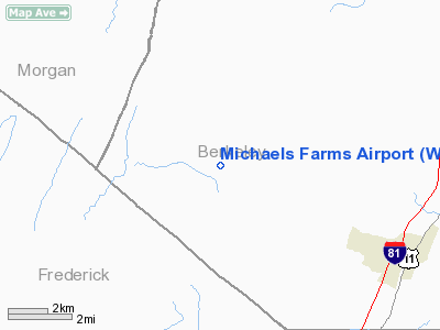
| From nearest city: | 8 nautical miles SW of Martinsburg, WV |
| Location: | Berkeley County, WV |
| Magnetic Variation: | 09W (1990) |
Owner & Manager
| Ownership: | Privately owned |
| Owner: | David J. Michaels |
| Address: | 808 Back Creek Valley Rd.
Hedgesville, WV 25427 |
| Phone number: | 304-229-0936 |
| Manager: | David J. Michaels |
| Address: | 808 Back Creek Valley Rd
Hedgesville, WV 25427 |
| Phone number: | 304-229-0936 |
Airport Operations and Facilities
| Airport Use: | Private |
| Wind indicator: | Yes |
| Segmented Circle: | No |
| Control Tower: | No |
| Sectional chart: | Washington |
| Region: | AEA - Eastern |
| Boundary ARTCC: | ZDC - Washington |
| Tie-in FSS: | EKN - Elkins |
| FSS on Airport: | No |
| FSS Toll Free: | 1-800-WX-BRIEF |
Runway Information
Runway 01/19
| Dimension: | 2000 x 60 ft / 609.6 x 18.3 m |
| Surface: | TURF-DIRT, |
| |
Runway 01 |
Runway 19 |
| Traffic Pattern: | Left | Left |
| Obstruction: | | 25 ft pole, 1200.0 ft from runway |
|
Radio Navigation Aids
| ID |
Type |
Name |
Ch |
Freq |
Var |
Dist |
| TZ | NDB | Cogan | | 364.00 | 10W | 18.9 nm |
| GDX | NDB | Goodwin Lake | | 227.00 | 08W | 30.4 nm |
| CBE | NDB | Cumberland | | 317.00 | 07W | 31.4 nm |
| LUA | NDB | Caverns | | 245.00 | 09W | 44.2 nm |
| GAI | NDB | Gaithersburg | | 385.00 | 09W | 48.0 nm |
| HGR | VOR | Hagerstown | | 109.80 | 07W | 23.0 nm |
| FDK | VOR | Frederick | | 109.00 | 08W | 36.3 nm |
| ESL | VOR/DME | Kessel | 045X | 110.80 | 06W | 40.1 nm |
| GRV | VOR/DME | Grantsville | 070X | 112.30 | 06W | 44.0 nm |
| MRB | VORTAC | Martinsburg | 058X | 112.10 | 07W | 14.3 nm |
| LDN | VORTAC | Linden | 090X | 114.30 | 06W | 32.5 nm |
| THS | VORTAC | St Thomas | 097X | 115.00 | 07W | 33.8 nm |
| AML | VORTAC | Armel | 082X | 113.50 | 08W | 42.3 nm |
| CSN | VORTAC | Casanova | 110X | 116.30 | 06W | 47.2 nm |
Remarks
- PRVDD VFR DALGT OPNS ONLY.
Images and information placed above are from
http://www.airport-data.com/airport/WV17/
We thank them for the data!
| General Info
|
| Country |
United States
|
| State |
WEST VIRGINIA
|
| FAA ID |
WV17
|
| Latitude |
39-23-36.357N
|
| Longitude |
078-09-21.008W
|
| Elevation |
510 feet
|
| Near City |
MARTINSBURG
|
We don't guarantee the information is fresh and accurate. The data may
be wrong or outdated.
For more up-to-date information please refer to other sources.
|
|


