 |
|
Coordinates: 37°17′45″N 081°12′28″W / 37.29583°N 81.20778°W / 37.29583; -81.20778
- For the airport in Mercer County, New Jersey, see Trenton-Mercer Airport.
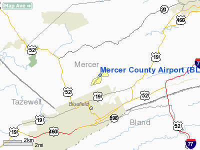
Mercer County Airport (IATA: BLF, ICAO: KBLF, FAA LID: BLF) is a public airport located three miles (5 km) northeast of the central business district of Bluefield and about nine miles (14 km) southwest of Princeton, both cities in Mercer County, West Virginia, United States. It is used for general aviation, but has been served by commercial airlines in the past. Service was subsidized by the Essential Air Service program until August 1, 2006.
As per Federal Aviation Administration records, the airport had 1,885 passenger boardings (enplanements) in calendar year 2005. Commercial passenger service ceased in 2007. Facilities and aircraft
Mercer County Airport covers an area of 144 acres (58 ha) which contains one asphalt paved runway (5/23) measuring 4,742 x 100 ft (1,445 x 30 m).
For the 12-month period ending October 17, 2006, the airport had 16,680 aircraft operations, an average of 45 per day: 87% general aviation, 12% scheduled commercial and 1% military. There are 41 aircraft based at this airport: 73% single engine, 10% multi-engine, 7% helicopter, 7% ultralight and 2% jet.
Airline and destinations
None at this time.
Former airlines
- Appalachian Airlines (discontinued operations in 1980)
- Colgan Air (discontinued operations November 12, 2007)
The above content comes from Wikipedia and is published under free licenses – click here to read more.
Location & QuickFacts
| FAA Information Effective: | 2008-09-25 |
| Airport Identifier: | BLF |
| Airport Status: | Operational |
| Longitude/Latitude: | 081-12-27.6880W/37-17-44.8625N
-81.207691/37.295795 (Estimated) |
| Elevation: | 2857 ft / 870.81 m (Surveyed) |
| Land: | 144 acres |
| From nearest city: | 3 nautical miles NE of Bluefield, WV |
| Location: | Mercer County, WV |
| Magnetic Variation: | 07W (2010) |
Owner & Manager
| Ownership: | Publicly owned |
| Owner: | Mercer Co Arpt Auth Inc |
| Address: | Rt 5, Box 202
Bluefield, WV 24701 |
| Phone number: | 304-327-5308 |
| Manager: | Randall Earnest
LINE OFFICE PHONE 304-327-8440. |
| Address: | Rt 5, Box 202
Bluefield, WV 24701 |
| Phone number: | 304-327-5308 |
Airport Operations and Facilities
| Airport Use: | Open to public |
| Wind indicator: | Yes |
| Segmented Circle: | Yes |
| Control Tower: | No |
| Lighting Schedule: | DUSK-DAWN
ACTVT HIRL RY 05/23, TWY LIGHTS, REIL RYS 05 & 23 - CTAF. |
| Beacon Color: | Clear-Green (lighted land airport) |
| Landing fee charge: | No |
| Sectional chart: | Cincinnati |
| Region: | AEA - Eastern |
| Traffic Pattern Alt: | 1000 ft |
| Boundary ARTCC: | ZID - Indianapolis |
| Tie-in FSS: | EKN - Elkins |
| FSS on Airport: | No |
| FSS Toll Free: | 1-800-WX-BRIEF |
| NOTAMs Facility: | BLF (NOTAM-d service avaliable) |
| Certification type/date: | III A S 11/20
PPR 30 DAYS FOR ACR OPNS WITH MORE THAN 30 PSGR SEATS CALL AMGR 304-327-5308. |
| Federal Agreements: | NGHY |
Airport Communications
Airport Services
| Fuel available: | 100LLA A+
AFTER HRS EMERGENCY FUEL BY PRIOR ARRANGEMENT; LISTING ON LINE OFFICE DOOR. |
| Bottled Oxygen: | NONE |
| Bulk Oxygen: | NONE |
Runway Information
Runway 05/23
| Dimension: | 4742 x 100 ft / 1445.4 x 30.5 m |
| Surface: | ASPH, Good Condition |
| Surface Treatment: | Saw-cut or plastic Grooved |
| Weight Limit: | Single wheel: 30000 lbs.
Dual wheel: 48000 lbs. |
| Edge Lights: | High |
| |
Runway 05 |
Runway 23 |
| Longitude: | 081-12-47.2706W | 081-12-08.1029W |
| Latitude: | 37-17-27.4049N | 37-18-02.3192N |
| Elevation: | 2850.00 ft | 2856.00 ft |
| Alignment: | 42 | 127 |
| ILS Type: | | ILS
|
| Traffic Pattern: | Left | Left |
| Markings: | Non-precision instrument, Good Condition | Precision instrument, Good Condition |
| Runway End Identifier: | Yes | Yes |
| Centerline Lights: | No | No |
| Touchdown Lights: | No | No |
|
Radio Navigation Aids
| ID |
Type |
Name |
Ch |
Freq |
Var |
Dist |
| MK | NDB | Suzze | | 335.00 | 06W | 22.6 nm |
| HLX | NDB | Hillsville | | 269.00 | 06W | 37.0 nm |
| TEC | NDB | Tech | | 368.00 | 06W | 38.8 nm |
| GTC | NDB | Guyandot | | 293.00 | 03W | 44.4 nm |
| LW | NDB | Bushi | | 346.00 | 06W | 45.8 nm |
| VJ | NDB | Whine | | 236.00 | 05W | 49.1 nm |
| RNL | VOR | Rainelle | | 116.60 | 04W | 45.1 nm |
| BLF | VORTAC | Bluefield | 037X | 110.00 | 03W | 0.9 nm |
| PSK | VORTAC | Pulaski | 115X | 116.80 | 06W | 26.8 nm |
| BKW | VORTAC | Beckley | 124X | 117.70 | 06W | 29.4 nm |
Remarks
- MOWING IN PROGRESS APR-NOV ALL SFCS.
- DEER ON & INVOF ARPT.
- RY 23 HAS 150 FT DROP-OFF 140 FT FM THLD 0B.
- RY 05 HAS 150 FT DROP-OFF AT THLD 100 FT L.
Images and information placed above are from
http://www.airport-data.com/airport/BLF/
We thank them for the data!
| General Info
|
| Country |
United States
|
| State |
WEST VIRGINIA
|
| FAA ID |
BLF
|
| Latitude |
37-17-44.878N
|
| Longitude |
081-12-27.686W
|
| Elevation |
2857 feet
|
| Near City |
BLUEFIELD
|
We don't guarantee the information is fresh and accurate. The data may
be wrong or outdated.
For more up-to-date information please refer to other sources.
|
|


