 |
|
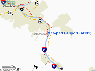
Location & QuickFacts
| FAA Information Effective: | 2008-09-25 |
| Airport Identifier: | 4PN2 |
| Airport Status: | Operational |
| Longitude/Latitude: | 081-33-56.0000W/38-17-40.0000N
-81.565556/38.294444 (Estimated) |
| Elevation: | 600 ft / 182.88 m () |
| Land: | 0 acres |
| From nearest city: | 0 nautical miles NW of Charleston, WV |
| Location: | Kanawha County, WV |
| Magnetic Variation: | 07W (2000) |
Owner & Manager
| Ownership: | Privately owned |
| Owner: | Massey Coal Services Inc |
| Address: | 315 70th Street
Charleston, WV 25304 |
| Phone number: | 304-345-3556 |
| Manager: | R. Freal Mize |
| Address: | 315 70th Street
Charleston, WV 25304 |
| Phone number: | 304-345-3556 |
Airport Operations and Facilities
| Airport Use: | Private |
| Segmented Circle: | No |
| Control Tower: | No |
| Sectional chart: | Cincinnati |
| Region: | AEA - Eastern |
| Boundary ARTCC: | ZID - Indianapolis |
| Tie-in FSS: | EKN - Elkins |
| FSS Toll Free: | 1-800-WX-BRIEF |
Runway Information
Helipad H1
| Dimension: | 20 x 20 ft / 6.1 x 6.1 m |
| Surface: | CONC, |
| |
Runway H1 |
Runway |
| Traffic Pattern: | Left | Left |
|
Radio Navigation Aids
| ID |
Type |
Name |
Ch |
Freq |
Var |
Dist |
| IJZ | NDB | Nicholas | | 272.00 | 05W | 31.3 nm |
| GTC | NDB | Guyandot | | 293.00 | 03W | 34.8 nm |
| GAS | NDB | Gallipolis | | 420.00 | 07W | 42.8 nm |
| JTM | NDB | Braxton | | 234.00 | 06W | 49.0 nm |
| RNL | VOR | Rainelle | | 116.60 | 04W | 40.7 nm |
| HVQ | VORTAC | Charleston | 121X | 117.40 | 03W | 10.2 nm |
| HNN | VORTAC | Henderson | 106X | 115.90 | 03W | 35.1 nm |
| BKW | VORTAC | Beckley | 124X | 117.70 | 06W | 37.3 nm |
| CRW | VOT | Charleston Kanawha | | 108.80 | | 4.9 nm |
Remarks
- AREA SECURED BY GUARDRAIL AND CHAIN LINK FENCE.
- SEE AIRSPACE LETTER DATED 11/29/2000.
Images and information placed above are from
http://www.airport-data.com/airport/4PN2/
We thank them for the data!
| General Info
|
| Country |
United States
|
| State |
WEST VIRGINIA
|
| FAA ID |
4PN2
|
| Latitude |
38-17-40.000N
|
| Longitude |
081-33-56.000W
|
| Elevation |
600 feet
|
| Near City |
CHARLESTON
|
We don't guarantee the information is fresh and accurate. The data may
be wrong or outdated.
For more up-to-date information please refer to other sources.
|
|


