 |
|
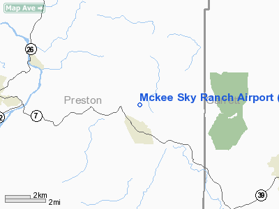
Location & QuickFacts
| FAA Information Effective: | 2008-09-25 |
| Airport Identifier: | WV57 |
| Airport Status: | Operational |
| Longitude/Latitude: | 079-32-33.1760W/39-27-47.3320N
-79.542549/39.463148 (Estimated) |
| Elevation: | 2757 ft / 840.33 m (Estimated) |
| Land: | 20 acres |
| From nearest city: | 1 nautical miles N of Terra Alta, WV |
| Location: | Preston County, WV |
| Magnetic Variation: | 07W (1985) |
Owner & Manager
| Ownership: | Privately owned |
| Owner: | Thomas E. Mckee |
| Address: | Rt 2
Terra Alta, WV 26764 |
| Phone number: | 304-789-2810 |
| Manager: | Thomas E. Mckee |
| Address: | Rt 2 Box 3b
Terra Alta, WV 26764 |
| Phone number: | 304-789-2810 |
Airport Operations and Facilities
| Airport Use: | Private |
| Wind indicator: | Yes |
| Segmented Circle: | No |
| Control Tower: | No |
| Landing fee charge: | No |
| Sectional chart: | Cincinnati |
| Region: | AEA - Eastern |
| Boundary ARTCC: | ZOB - Cleveland |
| Tie-in FSS: | EKN - Elkins |
| FSS Toll Free: | 1-800-WX-BRIEF |
Runway Information
Runway 01/19
| Dimension: | 1800 x 60 ft / 548.6 x 18.3 m |
| Surface: | TURF, |
| |
Runway 01 |
Runway 19 |
| Traffic Pattern: | Left | Left |
|
Radio Navigation Aids
| ID |
Type |
Name |
Ch |
Freq |
Var |
Dist |
| VV | NDB | Camor | | 299.00 | 08W | 26.9 nm |
| RQY | NDB | Randolph County | | 284.00 | 07W | 37.3 nm |
| CBE | NDB | Cumberland | | 317.00 | 07W | 38.5 nm |
| SYS | NDB | Stoystown | | 209.00 | 08W | 47.3 nm |
| PNU | NDB | Washington County | | 255.00 | 08W | 50.0 nm |
| GRV | VOR/DME | Grantsville | 070X | 112.30 | 06W | 25.0 nm |
| ESL | VOR/DME | Kessel | 045X | 110.80 | 06W | 29.4 nm |
| CKB | VOR/DME | Clarksburg | 073X | 112.60 | 04W | 36.0 nm |
| MGW | VORTAC | Morgantown | 053X | 111.60 | 05W | 15.8 nm |
| IHD | VORTAC | Indian Head | 019X | 108.20 | 06W | 31.9 nm |
| EKN | VORTAC | Elkins | 089X | 114.20 | 07W | 42.0 nm |
Remarks
- PROVIDED RWY 04 THRESHOLD DISPLACED TO PROVIDE CLEARANCE OVER ROAD; RESTRICTED TO SINGLE ENGINE AIRCRAFT.
Images and information placed above are from
http://www.airport-data.com/airport/WV57/
We thank them for the data!
| General Info
|
| Country |
United States
|
| State |
WEST VIRGINIA
|
| FAA ID |
WV57
|
| Latitude |
39-27-47.332N
|
| Longitude |
079-32-33.176W
|
| Elevation |
2757 feet
|
| Near City |
TERRA ALTA
|
We don't guarantee the information is fresh and accurate. The data may
be wrong or outdated.
For more up-to-date information please refer to other sources.
|
|


