 |
|
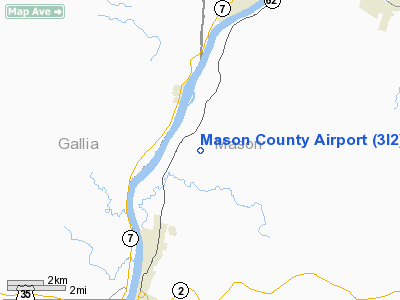
Location & QuickFacts
| FAA Information Effective: | 2008-09-25 |
| Airport Identifier: | 3I2 |
| Airport Status: | Operational |
| Longitude/Latitude: | 082-05-54.9000W/38-54-52.7000N
-82.098583/38.914639 (Estimated) |
| Elevation: | 643 ft / 195.99 m (Estimated) |
| Land: | 124 acres |
| From nearest city: | 4 nautical miles NE of Point Pleasant, WV |
| Location: | Mason County, WV |
| Magnetic Variation: | 07W (2000) |
Owner & Manager
| Ownership: | Publicly owned |
| Owner: | Mason Co Comission |
| Address: | Court House
Point Pleasant, WV 25550 |
| Phone number: | 304-675-1110 |
| Manager: | Benjamin Roush |
| Address: | Box 359, Rfd 1
Point Pleasant, WV 25550 |
| Phone number: | 304-675-7765 |
Airport Operations and Facilities
| Airport Use: | Open to public |
| Wind indicator: | Yes |
| Segmented Circle: | Yes |
| Control Tower: | No |
| Lighting Schedule: | DUSK-DAWN
ACTVT MIRL RY 07/25 & PAPI RY 25 - CTAF. |
| Beacon Color: | Clear-Green (lighted land airport) |
| Landing fee charge: | No |
| Sectional chart: | Cincinnati |
| Region: | AEA - Eastern |
| Boundary ARTCC: | ZID - Indianapolis |
| Tie-in FSS: | EKN - Elkins |
| FSS on Airport: | No |
| FSS Toll Free: | 1-800-WX-BRIEF |
| NOTAMs Facility: | EKN (NOTAM-d service avaliable) |
| Federal Agreements: | NGY |
Airport Communications
| CTAF: | 122.800 |
| Unicom: | 122.800 |
Airport Services
| Fuel available: | 100LL |
| Airframe Repair: | MINOR
AIRFRAME REPAIRS BY ARRANGEMENT ONLY. |
| Power Plant Repair: | MINOR |
| Bottled Oxygen: | NONE |
| Bulk Oxygen: | NONE |
Runway Information
Runway 07/25
| Dimension: | 4000 x 75 ft / 1219.2 x 22.9 m |
| Surface: | ASPH, Good Condition |
| Weight Limit: | Single wheel: 24000 lbs. |
| Edge Lights: | Medium |
| |
Runway 07 |
Runway 25 |
| Longitude: | 082-06-17.7935W | 082-05-31.9752W |
| Latitude: | 38-54-44.2916N | 38-55-01.0797N |
| Elevation: | 639.00 ft | 625.00 ft |
| Alignment: | 65 | 127 |
| Traffic Pattern: | Left | Left |
| Markings: | Non-precision instrument, Good Condition | Non-precision instrument, Good Condition |
| Crossing Height: | 0.00 ft | 40.00 ft |
| VASI: | | 2-light PAPI on left side |
| Visual Glide Angle: | 0.00° | 3.00° |
| Obstruction: | 20 ft trees, 1000.0 ft from runway, 150 ft right of centerline, 40:1 slope to clear
+5 FT BRUSH 100 FT FM THLD 85 FT R. | 70 ft trees, 400.0 ft from runway, 250 ft right of centerline, 3:1 slope to clear |
|
Radio Navigation Aids
| ID |
Type |
Name |
Ch |
Freq |
Var |
Dist |
| AJY | FAN MARKER | Ashland | | | 03W | 39.1 nm |
| PKB | FAN MARKER | Marietta Ohio | | | 03W | 42.6 nm |
| GAS | NDB | Gallipolis | | 420.00 | 07W | 5.7 nm |
| UGS | NDB | University | | 250.00 | 06W | 20.6 nm |
| PMH | NDB | Portsmouth | | 373.00 | 04W | 35.8 nm |
| EOP | NDB | Waverly | | 385.00 | 06W | 41.8 nm |
| HNN | VORTAC | Henderson | 106X | 115.90 | 03W | 10.2 nm |
| HVQ | VORTAC | Charleston | 121X | 117.40 | 03W | 37.3 nm |
| YRK | VORTAC | York | 075X | 112.80 | 05W | 44.3 nm |
| JPU | VORTAC | Parkersburg | 023X | 108.60 | 03W | 46.3 nm |
| CRW | VOT | Charleston Kanawha | | 108.80 | | 40.3 nm |
Remarks
- DEER ON & INVOF ARPT.
- ULTRALIGHT ACTIVITY ON AND INVOF ARPT.
- STEAM FROM COOLING TOWERS NW OCCASIONALLY OBSCURES OBSTN LGTS ON TOWER NORTH.
- RY 25 HAS 35 FT DROPOFF 100 FT FM THLD 0B.
- RY 07 HAS 3 FT DITCH 80 FT L & R OF CNTRLN FIRST 1000 FT.
- 6-8 FT BRUSH PARALLEL TO RY 25, 50 FT FM LIGHTS, FM THLD TO 1000 FT FM THLD.
- NO OBJECTION
Images and information placed above are from
http://www.airport-data.com/airport/3I2/
We thank them for the data!
| General Info
|
| Country |
United States
|
| State |
WEST VIRGINIA
|
| FAA ID |
3I2
|
| Latitude |
38-54-52.700N
|
| Longitude |
082-05-54.900W
|
| Elevation |
643 feet
|
| Near City |
POINT PLEASANT
|
We don't guarantee the information is fresh and accurate. The data may
be wrong or outdated.
For more up-to-date information please refer to other sources.
|
|


