 |
|
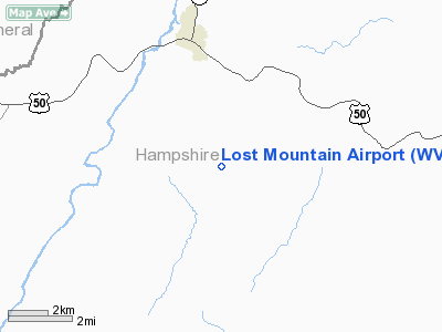
Location & QuickFacts
| FAA Information Effective: | 2008-09-25 |
| Airport Identifier: | WV06 |
| Airport Status: | Operational |
| Longitude/Latitude: | 078-44-18.0580W/39-17-06.3650N
-78.738349/39.285101 (Estimated) |
| Elevation: | 1960 ft / 597.41 m (Surveyed) |
| Land: | 0 acres |
| From nearest city: | 3 nautical miles S of Romney, WV |
| Location: | Hampshire County, WV |
| Magnetic Variation: | 08W (1985) |
Owner & Manager
| Ownership: | Privately owned |
| Owner: | Lost Mtn Prop Owners Assoc |
| Address: | Po Box 393
Romney, WV 26757 |
| Phone number: | 304-822-3237 |
| Manager: | James Andrews |
| Address: | 256 Garnet Ct
Warrenton, VA 20186 |
| Phone number: | 540-270-0737 |
Airport Operations and Facilities
| Airport Use: | Private |
| Wind indicator: | Yes |
| Segmented Circle: | No |
| Control Tower: | No |
| Landing fee charge: | No |
| Sectional chart: | Washington |
| Region: | AEA - Eastern |
| Boundary ARTCC: | ZDC - Washington |
| Tie-in FSS: | EKN - Elkins |
| FSS on Airport: | No |
| FSS Toll Free: | 1-800-WX-BRIEF |
Runway Information
Runway 02/20
| Dimension: | 2650 x 50 ft / 807.7 x 15.2 m |
| Surface: | TURF-GRVL, |
| |
Runway 02 |
Runway 20 |
| Traffic Pattern: | Left | Left |
| Obstruction: | 400 ft terrain | 150 ft tower |
|
Radio Navigation Aids
| ID |
Type |
Name |
Ch |
Freq |
Var |
Dist |
| CBE | NDB | Cumberland | | 317.00 | 07W | 21.8 nm |
| TZ | NDB | Cogan | | 364.00 | 10W | 33.4 nm |
| LUA | NDB | Caverns | | 245.00 | 09W | 37.3 nm |
| GDX | NDB | Goodwin Lake | | 227.00 | 08W | 46.8 nm |
| SYS | NDB | Stoystown | | 209.00 | 08W | 48.8 nm |
| HGR | VOR | Hagerstown | | 109.80 | 07W | 47.9 nm |
| ESL | VOR/DME | Kessel | 045X | 110.80 | 06W | 12.2 nm |
| GRV | VOR/DME | Grantsville | 070X | 112.30 | 06W | 25.5 nm |
| LDN | VORTAC | Linden | 090X | 114.30 | 06W | 35.9 nm |
| MRB | VORTAC | Martinsburg | 058X | 112.10 | 07W | 41.8 nm |
Remarks
Images and information placed above are from
http://www.airport-data.com/airport/WV06/
We thank them for the data!
| General Info
|
| Country |
United States
|
| State |
WEST VIRGINIA
|
| FAA ID |
WV06
|
| Latitude |
39-17-06.365N
|
| Longitude |
078-44-18.058W
|
| Elevation |
1960 feet
|
| Near City |
ROMNEY
|
We don't guarantee the information is fresh and accurate. The data may
be wrong or outdated.
For more up-to-date information please refer to other sources.
|
|


