 |
|
Coordinates: 37°51′20″N 081°54′57″W / 37.85556°N 81.91583°W / 37.85556; -81.91583
| Logan County Airport |
| IATA: none – ICAO: none – FAA LID: 6L4 |
| Summary |
| Airport type |
Public |
| Owner |
Logan County Airport Authority |
| Serves |
Logan, West Virginia |
| Elevation AMSL |
1,667 ft / 508 m |
| Runways |
| Direction |
Length |
Surface |
| ft |
m |
| 6/24 |
3,600 |
1,097 |
Asphalt |
| Statistics (2000) |
| Aircraft operations |
2,425 |
| Source: Federal Aviation Administration |
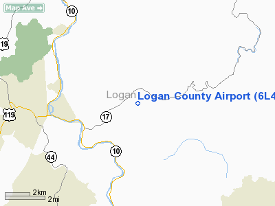
Logan County Airport (FAA LID: 6L4) is a public airport located four miles (6 km) east of the central business district of Logan, a city in Logan County, West Virginia, United States. It is owned by the Logan County Airport Authority.
Facilities and aircraft
Logan County Airport covers an area of 200 acres (81 ha) which contains one runway designated 6/24 with a 3,600 x 75 ft (1,097 x 23 m) asphalt surface. For the 12-month period ending February 17, 2000, the airport had 2,425 aircraft operations, of which 99% were general aviation and 1% was military.
The above content comes from Wikipedia and is published under free licenses – click here to read more.
Location & QuickFacts
| FAA Information Effective: | 2008-09-25 |
| Airport Identifier: | 6L4 |
| Airport Status: | Operational |
| Longitude/Latitude: | 081-54-57.2300W/37-51-20.4400N
-81.915897/37.855678 (Estimated) |
| Elevation: | 1667 ft / 508.10 m (Estimated) |
| Land: | 200 acres |
| From nearest city: | 4 nautical miles E of Logan, WV |
| Location: | Logan County, WV |
| Magnetic Variation: | 07W (2000) |
Owner & Manager
| Ownership: | Publicly owned |
| Owner: | Logan County Arpt Auth |
| Address: | Po Box 1973
Logan, WV 25601 |
| Phone number: | 304-752-0975 |
| Manager: | Rosco Atkins |
| Address: | 114 E Mcdonald Ave
Man, WV 25635 |
| Phone number: | 304-752-0975
OR 304-752-4600 |
Airport Operations and Facilities
| Airport Use: | Open to public |
| Wind indicator: | Yes |
| Segmented Circle: | Yes |
| Control Tower: | No |
| Lighting Schedule: | DUSK-DAWN
ACTVT MIRL RY 06/24 & PAPI RYS 06 & 24-CTAF. |
| Beacon Color: | Clear-Green (lighted land airport) |
| Sectional chart: | Cincinnati |
| Region: | AEA - Eastern |
| Boundary ARTCC: | ZID - Indianapolis |
| Tie-in FSS: | EKN - Elkins |
| FSS Toll Free: | 1-800-WX-BRIEF |
| NOTAMs Facility: | EKN (NOTAM-d service avaliable) |
| Federal Agreements: | N |
Airport Communications
Airport Services
| Fuel available: | 100LLA
FOR FUEL & SVCS AFTER HOURS CALL 304-752-4281. |
Runway Information
Runway 06/24
| Dimension: | 3600 x 75 ft / 1097.3 x 22.9 m |
| Surface: | ASPH, Good Condition |
| Edge Lights: | Medium |
| |
Runway 06 |
Runway 24 |
| Longitude: | 081-55-16.2600W | 081-54-38.2300W |
| Latitude: | 37-51-10.9800N | 37-51-29.8900N |
| Elevation: | 1656.00 ft | 1667.00 ft |
| Alignment: | 58 | 127 |
| Traffic Pattern: | Left | Left |
| Crossing Height: | 41.00 ft | 36.00 ft |
| VASI: | 2-light PAPI on left side | 2-light PAPI on left side |
| Visual Glide Angle: | 3.00° | 3.00° |
| Obstruction: | 129 ft gnd, 1928.0 ft from runway, 205 ft right of centerline, 13:1 slope to clear | 13 ft , 545.0 ft from runway, 13 ft right of centerline, 26:1 slope to clear |
|
Radio Navigation Aids
| ID |
Type |
Name |
Ch |
Freq |
Var |
Dist |
| GTC | NDB | Guyandot | | 293.00 | 03W | 4.4 nm |
| HVQ | VORTAC | Charleston | 121X | 117.40 | 03W | 30.5 nm |
| BKW | VORTAC | Beckley | 124X | 117.70 | 06W | 37.9 nm |
| BLF | VORTAC | Bluefield | 037X | 110.00 | 03W | 47.7 nm |
| CRW | VOT | Charleston Kanawha | | 108.80 | | 34.6 nm |
Remarks
- RY 06 30 FT HILL 800 FT FROM THLD LEFT & RIGHT.
- NO VEHICULAR ACCESS TO FIELD WITHOUT PRIOR ARRANGEMENT.
- PAEW WORKING ON ARPT.
- DEER ON & INVOF ARPT.
Images and information placed above are from
http://www.airport-data.com/airport/6L4/
We thank them for the data!
| General Info
|
| Country |
United States
|
| State |
WEST VIRGINIA
|
| FAA ID |
6L4
|
| Latitude |
37-51-20.440N
|
| Longitude |
081-54-57.230W
|
| Elevation |
1667 feet
|
| Near City |
LOGAN
|
We don't guarantee the information is fresh and accurate. The data may
be wrong or outdated.
For more up-to-date information please refer to other sources.
|
|


