 |
|
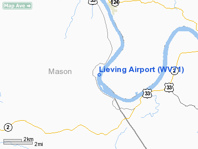
Location & QuickFacts
| FAA Information Effective: | 2008-09-25 |
| Airport Identifier: | WV71 |
| Airport Status: | Operational |
| Longitude/Latitude: | 081-55-47.0000W/38-53-57.0000N
-81.929722/38.899167 (Estimated) |
| Elevation: | 635 ft / 193.55 m (Estimated) |
| Land: | 5 acres |
| From nearest city: | 5 nautical miles NW of Letart, WV |
| Location: | Mason County, WV |
| Magnetic Variation: | 06W (1995) |
Owner & Manager
| Ownership: | Privately owned |
| Owner: | N.d. Lieving |
| Address: | 1008 Simpson Pl
Pt Pleasant, WV 25550 |
| Phone number: | 304-675-2902 |
| Manager: | N D Lieving |
| Address: | 1008 Simpson Pl
Pt Pleasant, WV 25550 |
| Phone number: | 304-675-2902 |
Airport Operations and Facilities
| Airport Use: | Private |
| Wind indicator: | Yes |
| Segmented Circle: | No |
| Control Tower: | No |
| Sectional chart: | Cincinnati |
| Region: | AEA - Eastern |
| Boundary ARTCC: | ZID - Indianapolis |
| Tie-in FSS: | EKN - Elkins |
| FSS Toll Free: | 1-800-WX-BRIEF |
Runway Information
Runway 06/24
| Dimension: | 1500 x 100 ft / 457.2 x 30.5 m |
| Surface: | TURF, Good Condition |
| |
Runway 06 |
Runway 24 |
| Traffic Pattern: | Left | Left |
| Obstruction: | 110 ft pline, 5000.0 ft from runway | 110 ft pline, 6500.0 ft from runway |
|
Radio Navigation Aids
| ID |
Type |
Name |
Ch |
Freq |
Var |
Dist |
| PKB | FAN MARKER | Marietta Ohio | | | 03W | 37.8 nm |
| AJY | FAN MARKER | Ashland | | | 03W | 45.5 nm |
| GAS | NDB | Gallipolis | | 420.00 | 07W | 11.5 nm |
| UGS | NDB | University | | 250.00 | 06W | 23.4 nm |
| PMH | NDB | Portsmouth | | 373.00 | 04W | 43.4 nm |
| EOP | NDB | Waverly | | 385.00 | 06W | 49.5 nm |
| HNN | VORTAC | Henderson | 106X | 115.90 | 03W | 9.8 nm |
| HVQ | VORTAC | Charleston | 121X | 117.40 | 03W | 33.9 nm |
| JPU | VORTAC | Parkersburg | 023X | 108.60 | 03W | 41.6 nm |
| CRW | VOT | Charleston Kanawha | | 108.80 | | 35.3 nm |
Remarks
- PRVDD DALGT VFR OPNS ONLY; CLEAR 20:1 APCH/DEP PATH FOR EACH RY END; OPERATE TO MINIMIZE NOISE.
Images and information placed above are from
http://www.airport-data.com/airport/WV71/
We thank them for the data!
| General Info
|
| Country |
United States
|
| State |
WEST VIRGINIA
|
| FAA ID |
WV71
|
| Latitude |
38-53-57.000N
|
| Longitude |
081-55-47.000W
|
| Elevation |
635 feet
|
| Near City |
LETART
|
We don't guarantee the information is fresh and accurate. The data may
be wrong or outdated.
For more up-to-date information please refer to other sources.
|
|


