 |
|
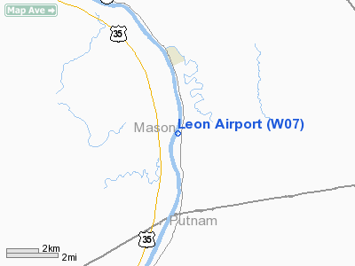
Location & QuickFacts
| FAA Information Effective: | 2008-09-25 |
| Airport Identifier: | W07 |
| Airport Status: | Operational |
| Longitude/Latitude: | 081-57-08.0900W/38-42-12.6700N
-81.952247/38.703519 (Estimated) |
| Elevation: | 563 ft / 171.60 m (Surveyed) |
| Land: | 10 acres |
| From nearest city: | 3 nautical miles S of Leon, WV |
| Location: | Mason County, WV |
| Magnetic Variation: | 05W (1985) |
Owner & Manager
| Ownership: | Privately owned |
| Owner: | Henry O. Upton |
| Address: | Po Box 70
Leon, WV 25123 |
| Phone number: | 304-458-1069 |
| Manager: | Henry Upton |
| Address: | Box 70
Leon, WV 25123 |
| Phone number: | 304-458-1069 |
Airport Operations and Facilities
| Airport Use: | Open to public |
| Wind indicator: | Yes |
| Segmented Circle: | No |
| Control Tower: | No |
| Landing fee charge: | No |
| Sectional chart: | Cincinnati |
| Region: | AEA - Eastern |
| Boundary ARTCC: | ZID - Indianapolis |
| Tie-in FSS: | EKN - Elkins |
| FSS on Airport: | No |
| FSS Toll Free: | 1-800-WX-BRIEF |
| NOTAMs Facility: | EKN (NOTAM-d service avaliable) |
Airport Communications
Airport Services
Runway Information
Runway 03/21
| Dimension: | 3100 x 45 ft / 944.9 x 13.7 m
RY 21 LDG AREA BOUNDED BY HIGH BRUSH & TREES FM THLD TO FIRST 800 FT OF RY. |
| Surface: | TURF, Good Condition |
| |
Runway 03 |
Runway 21 |
| Traffic Pattern: | Left | Right |
| Obstruction: | 15 ft brush, 33 ft left of centerline | 30 ft trees, 0.0 ft from runway, 20 ft left of centerline |
|
Radio Navigation Aids
| ID |
Type |
Name |
Ch |
Freq |
Var |
Dist |
| AJY | FAN MARKER | Ashland | | | 03W | 40.5 nm |
| PKB | FAN MARKER | Marietta Ohio | | | 03W | 48.1 nm |
| GAS | NDB | Gallipolis | | 420.00 | 07W | 12.5 nm |
| UGS | NDB | University | | 250.00 | 06W | 34.3 nm |
| PMH | NDB | Portsmouth | | 373.00 | 04W | 42.1 nm |
| HNN | VORTAC | Henderson | 106X | 115.90 | 03W | 4.6 nm |
| HVQ | VORTAC | Charleston | 121X | 117.40 | 03W | 22.9 nm |
| YRK | VORTAC | York | 075X | 112.80 | 05W | 48.3 nm |
| CRW | VOT | Charleston Kanawha | | 108.80 | | 26.1 nm |
Remarks
- ULTRALIGHT ACTIVITY ON & INVOF ARPT.
- TWY AT THR OF RY 03 ELEVATED 3 FT ABOVE RY ON RIGHT.
- UNRESTRICED VEHICLE ACCESS.
- DEER & BIRDS IN & INVOF ARPT.
Images and information placed above are from
http://www.airport-data.com/airport/W07/
We thank them for the data!
| General Info
|
| Country |
United States
|
| State |
WEST VIRGINIA
|
| FAA ID |
W07
|
| Latitude |
38-42-12.670N
|
| Longitude |
081-57-08.090W
|
| Elevation |
563 feet
|
| Near City |
LEON
|
We don't guarantee the information is fresh and accurate. The data may
be wrong or outdated.
For more up-to-date information please refer to other sources.
|
|


