 |
|
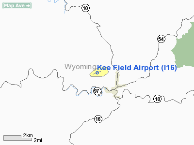
Location & QuickFacts
| FAA Information Effective: | 2008-09-25 |
| Airport Identifier: | I16 |
| Airport Status: | Operational |
| Longitude/Latitude: | 081-33-33.4000W/37-36-01.6000N
-81.559278/37.600444 (Estimated) |
| Elevation: | 1783 ft / 543.46 m (Surveyed) |
| Land: | 232 acres |
| From nearest city: | 2 nautical miles NW of Pineville, WV |
| Location: | Wyoming County, WV |
| Magnetic Variation: | 05W (1985) |
Owner & Manager
| Ownership: | Publicly owned |
| Owner: | Wyoming Co Comm. |
| Address: | Courthouse
Pineville, WV 24874 |
| Phone number: | 304-732-8000 |
| Manager: | Billy Joe Cooper |
| Address: | Po Box 309
Pineville, WV 24874 |
| Phone number: | 304-732-9160 |
Airport Operations and Facilities
| Airport Use: | Open to public |
| Wind indicator: | Yes |
| Segmented Circle: | Yes |
| Control Tower: | No |
| Lighting Schedule: | DUSK-DAWN
ACTVT MIRL RY 08/26, REIL RYS 08/26 - CTAF. |
| Beacon Color: | Clear-Green (lighted land airport)
ARPT BCN LCTD 3000' NE ARPT. |
| Landing fee charge: | No |
| Sectional chart: | Cincinnati |
| Region: | AEA - Eastern |
| Boundary ARTCC: | ZID - Indianapolis |
| Tie-in FSS: | EKN - Elkins |
| FSS on Airport: | No |
| FSS Toll Free: | 1-800-WX-BRIEF |
| NOTAMs Facility: | EKN (NOTAM-d service avaliable) |
| Federal Agreements: | NGY |
Airport Communications
| CTAF: | 122.800 |
| Unicom: | 122.800 |
Airport Services
Runway Information
Runway 08/26
| Dimension: | 3701 x 60 ft / 1128.1 x 18.3 m |
| Surface: | ASPH, Good Condition |
| Weight Limit: | Single wheel: 13000 lbs. |
| Edge Lights: | Medium |
| |
Runway 08 |
Runway 26 |
| Longitude: | 081-33-54.9000W | 081-33-11.8220W |
| Latitude: | 37-35-55.2450N | 37-36-08.0390N |
| Elevation: | 1724.00 ft | 1783.00 ft |
| Alignment: | 69 | 127 |
| Traffic Pattern: | Left | Left |
| Markings: | Non-precision instrument, Poor Condition
RY 08 & RY 26 MKGS FADED. TXY A AND B MKGS AND HOLD LINES FADED. | Non-precision instrument, Poor Condition |
| Displaced threshold: | 0.00 ft | 590.00 ft |
| Runway End Identifier: | Yes | Yes |
| Obstruction: | 35 ft trees, 201.0 ft from runway, 75 ft left of centerline
RY 08 HAS +25 FT GND 0-200 FT OUT; 120 FT L; +20 FT TREES AND BRUSH 55 FT L 75 FT FM THLD. | 15 ft trees, 201.0 ft from runway, 65 ft left of centerline
RY 26 APCH SLOPE 6:1 AT DSPLCD THLD; +65 FT TREES 405 FT FM THLD 85 FT R; 275 FT TREES 1887 FT FM THLD 300 FT RT.
RY 26 RISING GND 0 FT-+4FT 75-200 FT OUT; ACROSS THLD; +8-10 FT TREES AND BRUSH 0-200 FT OUT 60-65 FT R. |
|
Radio Navigation Aids
| ID |
Type |
Name |
Ch |
Freq |
Var |
Dist |
| GTC | NDB | Guyandot | | 293.00 | 03W | 19.9 nm |
| MK | NDB | Suzze | | 335.00 | 06W | 43.6 nm |
| IJZ | NDB | Nicholas | | 272.00 | 05W | 46.0 nm |
| RNL | VOR | Rainelle | | 116.60 | 04W | 42.3 nm |
| BKW | VORTAC | Beckley | 124X | 117.70 | 06W | 23.4 nm |
| BLF | VORTAC | Bluefield | 037X | 110.00 | 03W | 24.8 nm |
| HVQ | VORTAC | Charleston | 121X | 117.40 | 03W | 46.1 nm |
| CRW | VOT | Charleston Kanawha | | 108.80 | | 46.5 nm |
Remarks
- WILDLIFE ON AND INVOF ARPT.
- BIRDS INVOF MIDPOINT OF RY.
Images and information placed above are from
http://www.airport-data.com/airport/I16/
We thank them for the data!
| General Info
|
| Country |
United States
|
| State |
WEST VIRGINIA
|
| FAA ID |
I16
|
| Latitude |
37-36-01.600N
|
| Longitude |
081-33-33.400W
|
| Elevation |
1783 feet
|
| Near City |
PINEVILLE
|
We don't guarantee the information is fresh and accurate. The data may
be wrong or outdated.
For more up-to-date information please refer to other sources.
|
|


