 |
|
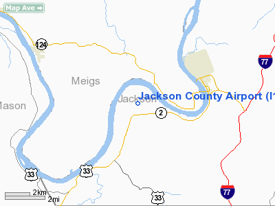
Location & QuickFacts
| FAA Information Effective: | 2008-09-25 |
| Airport Identifier: | I18 |
| Airport Status: | Operational |
| Longitude/Latitude: | 081-49-10.1000W/38-55-47.2000N
-81.819472/38.929778 (Estimated) |
| Elevation: | 758 ft / 231.04 m (Estimated) |
| Land: | 217 acres |
| From nearest city: | 6 nautical miles SW of Ravenswood, WV |
| Location: | Jackson County, WV |
| Magnetic Variation: | 07W (2000) |
Owner & Manager
| Ownership: | Publicly owned |
| Owner: | Jackson County Cmsn |
| Address: | Court House
Ripley, WV 25271 |
| Phone number: | 304-373-2253 |
| Manager: | Ralph Dennis |
| Address: | Rt 1, Box 84
Millwood, WV 25262 |
| Phone number: | 304-273-8114 |
Airport Operations and Facilities
| Airport Use: | Open to public |
| Wind indicator: | Yes |
| Segmented Circle: | Yes |
| Control Tower: | No |
| Lighting Schedule: | DUSK-DAWN
ACTVT MIRL RY 04/22, REIL RYS 04 & 22, PAPI RYS 04 & 22, & WINDSOCK LGT - CTAF. |
| Beacon Color: | Clear-Green (lighted land airport)
ROTG BCN OBSCURED TO THE EAST. |
| Landing fee charge: | No |
| Sectional chart: | Cincinnati |
| Region: | AEA - Eastern |
| Traffic Pattern Alt: | 1000 ft |
| Boundary ARTCC: | ZID - Indianapolis |
| Tie-in FSS: | EKN - Elkins |
| FSS on Airport: | No |
| FSS Toll Free: | 1-800-WX-BRIEF |
| NOTAMs Facility: | EKN (NOTAM-d service avaliable) |
| Federal Agreements: | NGY |
Airport Communications
| CTAF: | 122.800 |
| Unicom: | 122.800 |
Airport Services
| Fuel available: | 100LL |
| Airframe Repair: | MINOR |
| Power Plant Repair: | MINOR |
| Bottled Oxygen: | NONE |
| Bulk Oxygen: | NONE |
Runway Information
Runway 04/22
| Dimension: | 4001 x 75 ft / 1219.5 x 22.9 m |
| Surface: | ASPH, Good Condition |
| Weight Limit: | Single wheel: 12500 lbs. |
| Edge Lights: | Medium |
| |
Runway 04 |
Runway 22 |
| Longitude: | 081-49-22.6353W | 081-48-57.6379W |
| Latitude: | 38-55-29.9690N | 38-56-04.3575N |
| Elevation: | 738.00 ft | 758.00 ft |
| Alignment: | 30 | 127 |
| Traffic Pattern: | Left | Left |
| Markings: | Non-precision instrument, Good Condition | Non-precision instrument, Good Condition |
| Crossing Height: | 44.00 ft | 46.00 ft |
| VASI: | 2-light PAPI on left side | 2-light PAPI on left side |
| Visual Glide Angle: | 3.00° | 4.00° |
| Runway End Identifier: | Yes | Yes |
| Obstruction: | 65 ft trees, 1200.0 ft from runway, 15:1 slope to clear
INTERMITTENT CLUMPS OF 4'-6' BRUSH 70'L AND 80'R FROM THRESHOLD TO 200' DISTANT | 20 ft trees, 200.0 ft from runway, 108 ft left of centerline
TREES 60' HIGH, 199' FM THRLD,230'R TREES 20' HIGH, 199' FM THRLD,108'L TO 100' FM THRLD 250L. |
|
Radio Navigation Aids
| ID |
Type |
Name |
Ch |
Freq |
Var |
Dist |
| PKB | FAN MARKER | Marietta Ohio | | | 03W | 33.3 nm |
| GAS | NDB | Gallipolis | | 420.00 | 07W | 17.0 nm |
| UGS | NDB | University | | 250.00 | 06W | 24.3 nm |
| PMH | NDB | Portsmouth | | 373.00 | 04W | 48.8 nm |
| HNN | VORTAC | Henderson | 106X | 115.90 | 03W | 14.3 nm |
| HVQ | VORTAC | Charleston | 121X | 117.40 | 03W | 34.9 nm |
| JPU | VORTAC | Parkersburg | 023X | 108.60 | 03W | 37.1 nm |
| CRW | VOT | Charleston Kanawha | | 108.80 | | 35.1 nm |
Remarks
- 12 FT TREES PARALLEL TO RY 04 15 FT L OF EDGE LGTS FM THLD TO +1000 FT.
- DEER AND BIRDS ON & INVOF ARPT.
- +481' STACK 1/2 MILE NW OF ARPT.
- RY SAFETY AREA HAS SFC VARIATIONS.
- RY 04 HAS OVER 50 FT DROPOFF 200 FT FM THLD 0B.
- 12 FT TREES PARALLEL TO RY 04, 20 FT L OF EDGE LIGHTS, 700 FT TO 2500 FT FRM THLD.
- 12 FT TREES PARALLEL TO RY 04, 25 FT R OF EDGE LIGHTS, 400 FT TO 600 FT FM THLD.
Images and information placed above are from
http://www.airport-data.com/airport/I18/
We thank them for the data!
| General Info
|
| Country |
United States
|
| State |
WEST VIRGINIA
|
| FAA ID |
I18
|
| Latitude |
38-55-47.200N
|
| Longitude |
081-49-10.100W
|
| Elevation |
758 feet
|
| Near City |
RAVENSWOOD
|
We don't guarantee the information is fresh and accurate. The data may
be wrong or outdated.
For more up-to-date information please refer to other sources.
|
|


