 |
|
Location & QuickFacts
| FAA Information Effective: | 2008-09-25 |
| Airport Identifier: | WV77 |
| Airport Status: | Operational |
| Longitude/Latitude: | 080-42-37.2890W/37-40-46.4340N
-80.710358/37.679565 (Estimated) |
| Elevation: | 1520 ft / 463.30 m (Surveyed) |
| Land: | 47 acres |
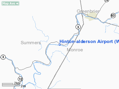
| From nearest city: | 1 nautical miles E of Pence Springs, WV |
| Location: | Summers County, WV |
| Magnetic Variation: | 06W (1985) |
Owner & Manager
| Ownership: | Privately owned |
| Owner: | Ruth Tolley Gwinn |
| Address: | 308 Longview A
Lenisburg, WV 24901 |
| Phone number: | 304-645-2444 |
| Manager: | Ruth Tolley Gwinn |
| Address: | Box 305
Pence Springs, WV 24962 |
| Phone number: | 304-445-7802 |
Airport Operations and Facilities
| Airport Use: | Private |
| Wind indicator: | Yes |
| Segmented Circle: | No |
| Control Tower: | No |
| Landing fee charge: | No |
| Sectional chart: | Cincinnati |
| Region: | AEA - Eastern |
| Boundary ARTCC: | ZDC - Washington |
| Tie-in FSS: | EKN - Elkins |
| FSS on Airport: | No |
| FSS Toll Free: | 1-800-WX-BRIEF |
Airport Services
| Bottled Oxygen: | NONE |
| Bulk Oxygen: | NONE |
Runway Information
Runway 10/28
| Dimension: | 2700 x 25 ft / 823.0 x 7.6 m |
| Surface: | TURF, Good Condition |
| |
Runway 10 |
Runway 28 |
| Traffic Pattern: | Left | Left |
| Obstruction: | 35 ft trees, 40.0 ft from runway, 125 ft right of centerline, 1:1 slope to clear | 55 ft trees, 0.0 ft from runway, 100 ft left of centerline |
|
Radio Navigation Aids
| ID |
Type |
Name |
Ch |
Freq |
Var |
Dist |
| LW | NDB | Bushi | | 346.00 | 06W | 13.1 nm |
| IJZ | NDB | Nicholas | | 272.00 | 05W | 31.4 nm |
| TEC | NDB | Tech | | 368.00 | 06W | 31.9 nm |
| CNQ | NDB | Callahan | | 379.00 | 05W | 36.4 nm |
| VIT | NDB | Vinton | | 277.00 | 06W | 48.8 nm |
| RNL | VOR | Rainelle | | 116.60 | 04W | 18.4 nm |
| ODR | VOR | Woodrum | | 114.90 | 06W | 40.9 nm |
| LWB | VOR/DME | Greenbrier | 107Y | 116.05 | 08W | 18.7 nm |
| BKW | VORTAC | Beckley | 124X | 117.70 | 06W | 20.6 nm |
| BLF | VORTAC | Bluefield | 037X | 110.00 | 03W | 32.2 nm |
| PSK | VORTAC | Pulaski | 115X | 116.80 | 06W | 35.6 nm |
| ROA | VORTAC | Roanoke | 031X | 109.40 | 04W | 36.6 nm |
Remarks
- RY 28 25 FT POLE WIRES 170 FT FROM THLD 120 FT RIGHT.
- PRIOR TO 1959.
Images and information placed above are from
http://www.airport-data.com/airport/WV77/
We thank them for the data!
| General Info
|
| Country |
United States
|
| State |
WEST VIRGINIA
|
| FAA ID |
WV77
|
| Latitude |
37-40-46.434N
|
| Longitude |
080-42-37.289W
|
| Elevation |
1520 feet
|
| Near City |
PENCE SPRINGS
|
We don't guarantee the information is fresh and accurate. The data may
be wrong or outdated.
For more up-to-date information please refer to other sources.
|
|


