 |
|
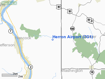
Location & QuickFacts
| FAA Information Effective: | 2008-09-25 |
| Airport Identifier: | 7G1 |
| Airport Status: | Operational |
| Longitude/Latitude: | 080-32-24.2490W/40-32-00.2370N
-80.540069/40.533399 (Estimated) |
| Elevation: | 1226 ft / 373.68 m (Surveyed) |
| Land: | 40 acres |
| From nearest city: | 3 nautical miles NE of New Cumberland, WV |
| Location: | Hancock County, WV |
| Magnetic Variation: | 07W (1985) |
Owner & Manager
| Ownership: | Privately owned |
| Owner: | Herron Airport, Inc. |
| Address: | 529 Herron Rd
New Cumberland, WV 26047 |
| Phone number: | 304-387-0191 |
| Manager: | Steven T. Roman |
| Address: | 529 Herron Rd
New Cumberland, WV 26047 |
| Phone number: | 304-387-0191
ON ARPT PHONE 304-387-0191. |
Airport Operations and Facilities
| Airport Use: | Open to public |
| Wind indicator: | Yes |
| Segmented Circle: | No |
| Control Tower: | No |
| Lighting Schedule: | DUSK-DAWN
ACTVT LIRL RY 04/22 5 TIMES ON/5 TIMES OFF - 123.0. |
| Beacon Color: | Clear-Green (lighted land airport) |
| Landing fee charge: | No |
| Sectional chart: | Detroit |
| Region: | AEA - Eastern |
| Traffic Pattern Alt: | 775 ft |
| Boundary ARTCC: | ZOB - Cleveland |
| Tie-in FSS: | EKN - Elkins |
| FSS on Airport: | No |
| FSS Toll Free: | 1-800-WX-BRIEF |
| NOTAMs Facility: | EKN (NOTAM-d service avaliable) |
Airport Communications
Airport Services
| Fuel available: | 100LL80 |
| Airframe Repair: | MINOR
REPAIRS BY PRIOR ARRANGEMENT. ATTENDANT NOT ON DUTY. |
| Power Plant Repair: | MINOR |
| Bottled Oxygen: | NONE |
| Bulk Oxygen: | NONE |
Runway Information
Runway 01/19
| Dimension: | 1200 x 24 ft / 365.8 x 7.3 m |
| Surface: | TURF, Good Condition
RY 04/22 HAS EXTENSIVE CRACKING, GRASSING GROWING FULL LENGTH, ASPH UNEVEN. |
| |
Runway 01 |
Runway 19 |
| Traffic Pattern: | Left | Left |
| Obstruction: | 12 ft tree, 60.0 ft from runway, 42 ft left of centerline, 5:1 slope to clear | 50 ft tree, 0.0 ft from runway, 90 ft right of centerline |
|
Runway 04/22
| Dimension: | 2030 x 20 ft / 618.7 x 6.1 m |
| Surface: | ASPH, Poor Condition
RY 04/22 HAS EXTENSIVE CRACKING, GRASSING GROWING FULL LENGTH, ASPH UNEVEN. |
| Edge Lights: | Non-standard lighting system
RY 04/22 HAS LGTS ON SE SIDE ONLY. |
| |
Runway 04 |
Runway 22 |
| Traffic Pattern: | Left | Left |
| Markings: | Nonstandard, Poor Condition
MARKINGS FADED | Nonstandard, Poor Condition
MARKINGS FADED. |
| Obstruction: | 40 ft trees, 200.0 ft from runway
RY 04 HAS +30 FT TREE AT THLD 48 FT LEFT. | 40 ft trees, 200.0 ft from runway, 90 ft right of centerline
RY 22 HAS +40 FT TREES 15 FT FM THLD 90 FT RIGHT; 4 FT FENCE LINE 0 FT FM THLD 100-125 FT LEFT. |
|
Radio Navigation Aids
| ID |
Type |
Name |
Ch |
Freq |
Var |
Dist |
| TSO | NDB | Tolson | | 395.00 | 07W | 24.6 nm |
| CFX | NDB | Cadiz | | 239.00 | 07W | 28.1 nm |
| PNU | NDB | Washington County | | 255.00 | 08W | 29.1 nm |
| UCP | NDB | Castle | | 272.00 | 09W | 30.0 nm |
| MKP | NDB | Mc Keesport | | 287.00 | 07W | 36.3 nm |
| HBD | NDB | Hubbard | | 408.00 | 08W | 37.2 nm |
| HLG | VOR/DME | Wheeling | 059X | 112.20 | 07W | 16.5 nm |
| AGC | VOR/DME | Allegheny | 037X | 110.00 | 09W | 27.5 nm |
| AIR | VOR/DME | Bellaire | 118X | 117.10 | 07W | 33.5 nm |
| BSV | VOR/DME | Briggs | 071X | 112.40 | 04W | 42.6 nm |
| ACO | VOR/DME | Akron | 091X | 114.40 | 04W | 45.8 nm |
| CTW | VOR/DME | Newcomerstown | 055X | 111.80 | 07W | 46.6 nm |
| MMJ | VORTAC | Montour | 057X | 112.00 | 08W | 16.1 nm |
| EWC | VORTAC | Ellwood City | 105X | 115.80 | 08W | 23.1 nm |
| YNG | VORTAC | Youngstown | 027X | 109.00 | 05W | 48.3 nm |
| CAK | VOT | Akron/canton Regional | | 110.60 | | 47.1 nm |
Remarks
- PUBLIC ROAD CROSSES CENTER OF AIRFIELD; DO NOT TAXI ON ROAD, WING WILL NOT CLEAR STOP SIGN ON RD.
- FORMER RY 14/32 CLSD EXCP TAXIING & PARKING.
- RY 04 & 22 ENDS NOT VISIBLE FM EACH END. TRAFFIC ON RD. CROSSING RY NOT VISIBLE FM RY 4 END.
- RY 04/22 SLOPES UP FM E TO W, APRX 30 FT.
- DEER ON AND INVOF ARPT.
- ULTRALIGHT ACTIVITY.
- 30 FT DROP OFF AT EACH RY END.
- ESTABLISHED PRIOR TO 1959.
Images and information placed above are from
http://www.airport-data.com/airport/7G1/
We thank them for the data!
| General Info
|
| Country |
United States
|
| State |
WEST VIRGINIA
|
| FAA ID |
7G1
|
| Latitude |
40-32-00.237N
|
| Longitude |
080-32-24.249W
|
| Elevation |
1226 feet
|
| Near City |
NEW CUMBERLAND
|
We don't guarantee the information is fresh and accurate. The data may
be wrong or outdated.
For more up-to-date information please refer to other sources.
|
|


