 |
|
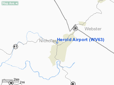
Location & QuickFacts
| FAA Information Effective: | 2008-09-25 |
| Airport Identifier: | WV63 |
| Airport Status: | Operational |
| Longitude/Latitude: | 080-39-11.3300W/38-20-04.3960N
-80.653147/38.334554 (Estimated) |
| Elevation: | 2346 ft / 715.06 m (Surveyed) |
| Land: | 15 acres |
| From nearest city: | 1 nautical miles N of Craigsville, WV |
| Location: | Nicholas County, WV |
| Magnetic Variation: | 06W (1985) |
Owner & Manager
| Ownership: | Privately owned |
| Owner: | Mark D. & Michelle D. Herold |
| Address: | Box 233, 52 Decatur Street
Craigsville, WV 26205 |
| Manager: | Mark D. & Michelle D. Herold |
| Address: | Box 233, 52 Decatur Street
Craigsville, WV 26205 |
| Phone number: | 304-742-5220 |
Airport Operations and Facilities
| Airport Use: | Private |
| Wind indicator: | Yes
WINDKSOCK OTS INDEFLY. |
| Segmented Circle: | No |
| Control Tower: | No |
| Landing fee charge: | No |
| Sectional chart: | Cincinnati |
| Region: | AEA - Eastern |
| Boundary ARTCC: | ZDC - Washington |
| Tie-in FSS: | EKN - Elkins |
| FSS on Airport: | No |
| FSS Toll Free: | 1-800-WX-BRIEF |
Airport Services
| Airframe Repair: | NONE |
| Power Plant Repair: | NONE |
Runway Information
Runway NE/SW
| Dimension: | 1450 x 100 ft / 442.0 x 30.5 m |
| Surface: | TURF, Good Condition |
| |
Runway NE |
Runway SW |
| Traffic Pattern: | Left | Left |
| Runway End Identifier: | No | |
| Touchdown Lights: | No | |
| Obstruction: | | 52 ft trees, 0.0 ft from runway, 90 ft left of centerline, 1:1 slope to clear |
|
Radio Navigation Aids
| ID |
Type |
Name |
Ch |
Freq |
Var |
Dist |
| IJZ | NDB | Nicholas | | 272.00 | 05W | 15.8 nm |
| JTM | NDB | Braxton | | 234.00 | 06W | 21.1 nm |
| LW | NDB | Bushi | | 346.00 | 06W | 34.3 nm |
| RNL | VOR | Rainelle | | 116.60 | 04W | 22.8 nm |
| LWB | VOR/DME | Greenbrier | 107Y | 116.05 | 08W | 30.9 nm |
| BKW | VORTAC | Beckley | 124X | 117.70 | 06W | 40.1 nm |
| EKN | VORTAC | Elkins | 089X | 114.20 | 07W | 43.5 nm |
| CRW | VOT | Charleston Kanawha | | 108.80 | | 44.4 nm |
Remarks
- PLINE-M SOUTH END OF RWY UNLGTD.
- LDG SFC MARKED WITH REFLECTORS MOUNTED ON 2' STAKES.
Images and information placed above are from
http://www.airport-data.com/airport/WV63/
We thank them for the data!
| General Info
|
| Country |
United States
|
| State |
WEST VIRGINIA
|
| FAA ID |
WV63
|
| Latitude |
38-20-04.396N
|
| Longitude |
080-39-11.330W
|
| Elevation |
2346 feet
|
| Near City |
CRAIGSVILLE
|
We don't guarantee the information is fresh and accurate. The data may
be wrong or outdated.
For more up-to-date information please refer to other sources.
|
|


