 |
|
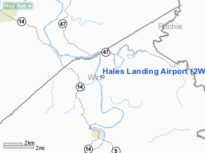
Location & QuickFacts
| FAA Information Effective: | 2008-09-25 |
| Airport Identifier: | 2WV3 |
| Airport Status: | Operational |
| Longitude/Latitude: | 081-23-30.0000W/39-07-02.0440N
-81.391667/39.117234 (Estimated) |
| Elevation: | 650 ft / 198.12 m (Estimated) |
| Land: | 5 acres |
| From nearest city: | 4 nautical miles N of Elizabeth, WV |
| Location: | Wirt County, WV |
| Magnetic Variation: | () |
Owner & Manager
| Ownership: | Privately owned |
| Owner: | Hales Landing Homeowners Assoc |
| Address: | Po Box 81
Davisville, WV 26142 |
| Phone number: | 304-275-2090 |
| Manager: | Hales Landing Homeowners Assoc
JOHN PROPST -RR3 BOX 24A ELIZABETH WV 304-588-3690 |
| Address: | Po Box 81
Davisville, WV 26142 |
| Phone number: | 304-275-2090 |
Airport Operations and Facilities
| Airport Use: | Private |
| Wind indicator: | Yes |
| Control Tower: | No |
| Sectional chart: | Cincinnati |
| Region: | AEA - Eastern |
| Boundary ARTCC: | ZID - Indianapolis |
| Tie-in FSS: | EKN - Elkins |
| FSS Toll Free: | 1-800-WX-BRIEF |
Runway Information
Runway 07/25
| Dimension: | 2600 x 75 ft / 792.5 x 22.9 m |
| Surface: | TURF, |
| |
Runway 07 |
Runway 25 |
| Traffic Pattern: | Left | Left |
|
Radio Navigation Aids
| ID |
Type |
Name |
Ch |
Freq |
Var |
Dist |
| PKB | FAN MARKER | Marietta Ohio | | | 03W | 16.1 nm |
| UGS | NDB | University | | 250.00 | 06W | 35.2 nm |
| GAS | NDB | Gallipolis | | 420.00 | 07W | 39.8 nm |
| JTM | NDB | Braxton | | 234.00 | 06W | 43.3 nm |
| JPU | VORTAC | Parkersburg | 023X | 108.60 | 03W | 19.5 nm |
| HNN | VORTAC | Henderson | 106X | 115.90 | 03W | 36.8 nm |
| HVQ | VORTAC | Charleston | 121X | 117.40 | 03W | 49.4 nm |
| CRW | VOT | Charleston Kanawha | | 108.80 | | 45.7 nm |
Images and information placed above are from
http://www.airport-data.com/airport/2WV3/
We thank them for the data!
|
|


