 |
|
Greenbrier Valley Airport |
| Greenbrier Valley Airport |
| IATA: LWB – ICAO: KLWB – FAA LID: LWB |
| Summary |
| Airport type |
Public |
| Owner |
Greenbrier County Airport Authority |
| Serves |
Lewisburg, West Virginia |
| Location |
Greenbrier County, near Lewisburg, West Virginia |
| Elevation AMSL |
2,302 ft / 702 m |
| Coordinates |
37°51′30″N 080°23′58″W / 37.85833°N 80.39944°W / 37.85833; -80.39944 |
| Website |
www.gvairport.com |
| Runways |
| Direction |
Length |
Surface |
| ft |
m |
| 4/22 |
7,004 |
2,135 |
Asphalt |
| Statistics (2008) |
| Aircraft operations |
25,240 |
| Based aircraft |
30 |
| Source: Federal Aviation Administration |
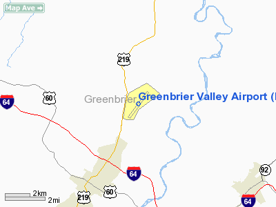
Greenbrier Valley Airport (IATA: LWB, ICAO: KLWB, FAA LID: LWB) is a public use airport located three nautical miles (6 km) north of the central business district of Lewisburg, a city in Greenbrier County, West Virginia, United States. It is owned by the Greenbrier County Airport Authority.
The airport has one runway, marketed as "The Longest Runway in West Virginia." It is mostly used for general aviation. Scheduled service to Cleveland is operated by Gulfstream International Airlines and subsidized by the Essential Air Service program. History
During World War II the airfield was used by the United States Army Air Force.
Airlines and destinations
| Airlines |
Destinations |
| Continental Connection operated by Gulfstream International Airlines |
Cleveland |
| Delta Connection operated by Atlantic Southeast Airlines |
Atlanta |
| Delta Connection operated by Pinnacle Airlines |
New York-LaGuardia |
Airport Information
Greenbrier Valley Airport covers an area of 472 acres (191 ha) at an elevation of 2,302 feet (702 m) above mean sea level. It has one runway designated 4/22 with an asphalt surface measuring 7,004 by 150 feet (2,135 x 46 m).
For the 12-month period ending September 30, 2008, the airport had 25,240 aircraft operations, an average of 69 per day: 79% general aviation, 14% air taxi and 4% military and 3% scheduled commercial. At that time there were 30 aircraft based at this airport: 80% single-engine, 13% multi-engine, 3% jet and 3% helicopter.
Remarks:
- Fueling fee waived if purchasing for Multi-engine aircraft only.
- Permission required 24 hours in advance for unscheduled air carrier operations with more than 30 passenger seats. To schedule, call the airport manager at 304-645-3961.
- Activate HIRL runway 04/22, MALSR runway 04, VASI runway 22 & taxiway lights - CTAF.
- Birds & deer on and in the vicinity of airport.
- Hot air balloon activity in the vicinity of airport.
- This airport has been surveyed by the National Geodetic Survey.
The above content comes from Wikipedia and is published under free licenses – click here to read more.
Location & QuickFacts
| FAA Information Effective: | 2008-09-25 |
| Airport Identifier: | LWB |
| Airport Status: | Operational |
| Longitude/Latitude: | 080-23-58.1000W/37-51-29.9000N
-80.399472/37.858306 (Estimated) |
| Elevation: | 2302 ft / 701.65 m (Surveyed) |
| Land: | 472 acres |
| From nearest city: | 3 nautical miles N of Lewisburg, WV |
| Location: | Greenbrier County, WV |
| Magnetic Variation: | 08W (2000) |
Owner & Manager
| Ownership: | Publicly owned |
| Owner: | Greenbrier Co Arpt Auth |
| Address: | 219 N. Lewisburg Rd.
Lewisburg, WV 24901 |
| Phone number: | 304-645-3961 |
| Manager: | Col Jerry O'sullivan |
| Address: | 219 N. Lewisburg Rd
Lewisburg, WV 24901 |
| Phone number: | 304-645-3961 |
Airport Operations and Facilities
| Airport Use: | Open to public |
| Wind indicator: | Yes |
| Control Tower: | Yes |
| Lighting Schedule: | DUSK-DAWN
ACTVT HIRL RY 04/22, MALSR RY 04, VASI RY 22 & TWY LGTS - CTAF. |
| Beacon Color: | Clear-Green (lighted land airport) |
| Landing fee charge: | Yes
MULTI ENG ONLY, FEE WAIVED IF PURCHASE FUEL. |
| Sectional chart: | Cincinnati |
| Region: | AEA - Eastern |
| Boundary ARTCC: | ZDC - Washington |
| Tie-in FSS: | EKN - Elkins |
| FSS on Airport: | No |
| FSS Toll Free: | 1-800-WX-BRIEF |
| NOTAMs Facility: | LWB (NOTAM-d service avaliable) |
| Certification type/date: | I B S 05/1973
PPR24 HRS FOR UNSKED ACR OPNS WITH MORE THAN 30 PSGR SEATS CALL AMGR 304-645-3961. |
| Federal Agreements: | NGYH |
Airport Communications
| CTAF: | 118.900 |
| Unicom: | 122.950 |
Airport Services
| Fuel available: | 100LLA |
| Airframe Repair: | MINOR |
| Power Plant Repair: | MINOR |
| Bottled Oxygen: | NONE |
| Bulk Oxygen: | NONE |
Runway Information
Runway 04/22
| Dimension: | 7004 x 150 ft / 2134.8 x 45.7 m |
| Surface: | ASPH, Good Condition |
| Surface Treatment: | Saw-cut or plastic Grooved |
| Weight Limit: | Single wheel: 90000 lbs.
Dual wheel: 120000 lbs.
Dual tandem wheel: 160000 lbs. |
| Edge Lights: | High |
| |
Runway 04 |
Runway 22 |
| Longitude: | 080-24-23.3640W | 080-23-32.9050W |
| Latitude: | 37-51-01.6550N | 37-51-58.1530N |
| Elevation: | 2288.00 ft | 2293.00 ft |
| Alignment: | 35 | 127 |
| ILS Type: | ILS
| |
| Traffic Pattern: | Left | Left |
| Markings: | Precision instrument, Good Condition | Non-precision instrument, Good Condition |
| Crossing Height: | 0.00 ft | 59.00 ft |
| VASI: | | 4-box on left side |
| Visual Glide Angle: | 0.00° | 3.00° |
| Approach lights: | MALSR | |
| Runway End Identifier: | | Yes |
| Obstruction: | 32 ft tree, 700.0 ft from runway, 500 ft right of centerline, 15:1 slope to clear | 81 ft tree, 1600.0 ft from runway, 525 ft left of centerline, 17:1 slope to clear |
|
Radio Navigation Aids
| ID |
Type |
Name |
Ch |
Freq |
Var |
Dist |
| LW | NDB | Bushi | | 346.00 | 06W | 5.6 nm |
| IJZ | NDB | Nicholas | | 272.00 | 05W | 31.1 nm |
| CNQ | NDB | Callahan | | 379.00 | 05W | 37.7 nm |
| TEC | NDB | Tech | | 368.00 | 06W | 39.1 nm |
| VIT | NDB | Vinton | | 277.00 | 06W | 46.4 nm |
| RNL | VOR | Rainelle | | 116.60 | 04W | 20.5 nm |
| ODR | VOR | Woodrum | | 114.90 | 06W | 37.8 nm |
| LWB | VOR/DME | Greenbrier | 107Y | 116.05 | 08W | 0.5 nm |
| ROA | VORTAC | Roanoke | 031X | 109.40 | 04W | 34.7 nm |
| BKW | VORTAC | Beckley | 124X | 117.70 | 06W | 34.7 nm |
| PSK | VORTAC | Pulaski | 115X | 116.80 | 06W | 48.7 nm |
Remarks
- BIRDS & DEER ON & INVOF ARPT.
- HOT AIR BALLON ACTIVITY INVOF ARPT.
Images and information placed above are from
http://www.airport-data.com/airport/LWB/
We thank them for the data!
| General Info
|
| Country |
United States
|
| State |
WEST VIRGINIA
|
| FAA ID |
LWB
|
| Latitude |
37-51-29.900N
|
| Longitude |
080-23-58.100W
|
| Elevation |
2302 feet
|
| Near City |
LEWISBURG
|
We don't guarantee the information is fresh and accurate. The data may
be wrong or outdated.
For more up-to-date information please refer to other sources.
|
|


