 |
|
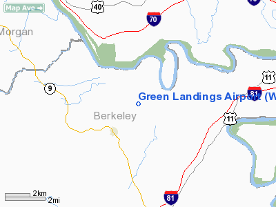
Location & QuickFacts
| FAA Information Effective: | 2008-09-25 |
| Airport Identifier: | WV22 |
| Airport Status: | Operational |
| Longitude/Latitude: | 077-58-17.4600W/39-34-29.0000N
-77.971517/39.574722 (Estimated) |
| Elevation: | 510 ft / 155.45 m (Estimated) |
| Land: | 12 acres |
| From nearest city: | 3 nautical miles NE of Hedgesville, WV |
| Location: | Berkeley County, WV |
| Magnetic Variation: | 10W (1995) |
Owner & Manager
| Ownership: | Privately owned |
| Owner: | Kevin Green |
| Address: | 309 Take Off Drive
Hedgesville, WV 25427 |
| Phone number: | 304-754-6556 |
| Manager: | Kevin Green |
| Address: | 309 Take Off Drive
Hedgesville, WV 25427 |
| Phone number: | 304-754-6556 |
Airport Operations and Facilities
| Airport Use: | Private |
| Wind indicator: | Yes |
| Segmented Circle: | No |
| Control Tower: | No |
| Sectional chart: | Washington |
| Region: | AEA - Eastern |
| Boundary ARTCC: | ZDC - Washington |
| Tie-in FSS: | EKN - Elkins |
| FSS Toll Free: | 1-800-WX-BRIEF |
Runway Information
Runway 03/21
| Dimension: | 1700 x 100 ft / 518.2 x 30.5 m |
| Surface: | TURF, Good Condition |
| |
Runway 03 |
Runway 21 |
| Traffic Pattern: | Left | Left |
| Displaced threshold: | 0.00 ft | 300.00 ft |
| Obstruction: | | 4 ft road, 20.0 ft from runway |
|
Radio Navigation Aids
| ID |
Type |
Name |
Ch |
Freq |
Var |
Dist |
| TZ | NDB | Cogan | | 364.00 | 10W | 29.7 nm |
| CBE | NDB | Cumberland | | 317.00 | 07W | 36.2 nm |
| GDX | NDB | Goodwin Lake | | 227.00 | 08W | 37.9 nm |
| GAI | NDB | Gaithersburg | | 385.00 | 09W | 44.7 nm |
| HGR | VOR | Hagerstown | | 109.80 | 07W | 9.1 nm |
| FDK | VOR | Frederick | | 109.00 | 08W | 29.3 nm |
| AOO | VOR | Altoona | | 108.80 | 07W | 47.6 nm |
| MRB | VORTAC | Martinsburg | 058X | 112.10 | 07W | 12.7 nm |
| THS | VORTAC | St Thomas | 097X | 115.00 | 07W | 21.6 nm |
| LDN | VORTAC | Linden | 090X | 114.30 | 06W | 44.6 nm |
| AML | VORTAC | Armel | 082X | 113.50 | 08W | 45.1 nm |
| EMI | VORTAC | Westminster | 126X | 117.90 | 08W | 46.3 nm |
Remarks
- PRVDD VFR ONLY, CLEAR 20:1 APCH/DEP PATH FOR EACH RY, & FAA FORM 7460-1 FILED FOR ALL CONSTRUCTION IN VICINITY OF ARPT.
Images and information placed above are from
http://www.airport-data.com/airport/WV22/
We thank them for the data!
| General Info
|
| Country |
United States
|
| State |
WEST VIRGINIA
|
| FAA ID |
WV22
|
| Latitude |
39-34-29.000N
|
| Longitude |
077-58-17.460W
|
| Elevation |
510 feet
|
| Near City |
HEDGESVILLE
|
We don't guarantee the information is fresh and accurate. The data may
be wrong or outdated.
For more up-to-date information please refer to other sources.
|
|


