 |
|
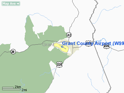
Location & QuickFacts
| FAA Information Effective: | 2008-09-25 |
| Airport Identifier: | W99 |
| Airport Status: | Operational |
| Longitude/Latitude: | 079-08-45.1100W/38-59-41.7800N
-79.145864/38.994939 (Estimated) |
| Elevation: | 963 ft / 293.52 m (Surveyed) |
| Land: | 188 acres |
| From nearest city: | 1 nautical miles SW of Petersburg, WV |
| Location: | Grant County, WV |
| Magnetic Variation: | 08W (1990) |
Owner & Manager
| Ownership: | Publicly owned |
| Owner: | Grant County Airport Auth |
| Address: | 5 Highland Ave
Petersburg, WV 26847 |
| Phone number: | 304-257-4435 |
| Manager: | Larry Stahl |
| Address: | Hc 33 Box 55
Petersburg, WV 26802 |
| Phone number: | 304-257-4435
AFTER HRS 304-257-9116/8282. |
Airport Operations and Facilities
| Airport Use: | Open to public |
| Wind indicator: | Yes |
| Segmented Circle: | Yes |
| Control Tower: | No |
| Lighting Schedule: | DUSK-DAWN
ACTVT MIRL RY 13/31; REIL RY 31 & PAPI RY 31 - CTAF. |
| Beacon Color: | Clear-Green (lighted land airport) |
| Landing fee charge: | No |
| Sectional chart: | Cincinnati |
| Region: | AEA - Eastern |
| Boundary ARTCC: | ZDC - Washington |
| Tie-in FSS: | EKN - Elkins |
| FSS on Airport: | No |
| FSS Toll Free: | 1-800-WX-BRIEF |
| NOTAMs Facility: | EKN (NOTAM-d service avaliable) |
| Federal Agreements: | NGY |
Airport Communications
| CTAF: | 122.800 |
| Unicom: | 122.800 |
Airport Services
| Fuel available: | 100LLA
SELF SERVICE FUEL AVBL 24 HRS A DAY WITH CREDIT CARD;JET A BY REQUEST AFTER HOURS. |
| Airframe Repair: | MAJOR |
| Power Plant Repair: | MINOR |
| Bottled Oxygen: | LOW |
| Bulk Oxygen: | NONE |
Runway Information
Runway 13/31
| Dimension: | 5000 x 75 ft / 1524.0 x 22.9 m |
| Surface: | ASPH, Good Condition |
| Weight Limit: | Single wheel: 12500 lbs. |
| Edge Lights: | Medium |
| |
Runway 13 |
Runway 31 |
| Longitude: | 079-09-11.8900W | 079-08-18.3382W |
| Latitude: | 38-59-54.9700N | 38-59-28.5847N |
| Elevation: | 948.00 ft | 948.00 ft |
| Alignment: | 122 | 127 |
| ILS Type: | | LDA/DME
|
| Traffic Pattern: | Left | Right |
| Markings: | Basic, Good Condition | Non-precision instrument, Good Condition |
| VASI: | | 4-light PAPI on left side |
| Visual Glide Angle: | 0.00° | 6.00° |
| Runway End Identifier: | | Yes |
| Obstruction: | 36 ft trees, 632.0 ft from runway, 135 ft left of centerline, 12:1 slope to clear | 52 ft trees, 824.0 ft from runway, 250 ft right of centerline, 12:1 slope to clear |
|
Radio Navigation Aids
| ID |
Type |
Name |
Ch |
Freq |
Var |
Dist |
| RQY | NDB | Randolph County | | 284.00 | 07W | 33.9 nm |
| LUA | NDB | Caverns | | 245.00 | 09W | 36.2 nm |
| VBW | NDB | Bridgewater | | 241.00 | 07W | 38.8 nm |
| CBE | NDB | Cumberland | | 317.00 | 07W | 43.4 nm |
| ESL | VOR/DME | Kessel | 045X | 110.80 | 06W | 15.7 nm |
| GRV | VOR/DME | Grantsville | 070X | 112.30 | 06W | 38.7 nm |
| LDN | VORTAC | Linden | 090X | 114.30 | 06W | 44.8 nm |
| EKN | VORTAC | Elkins | 089X | 114.20 | 07W | 44.8 nm |
| MGW | VORTAC | Morgantown | 053X | 111.60 | 05W | 47.4 nm |
Remarks
- BIRDS ON & INVOF ARPT.
- FLY-IN CAMPGROUND ON ARPT.
- EXISTED PRIOR TO 1959.
Images and information placed above are from
http://www.airport-data.com/airport/W99/
We thank them for the data!
| General Info
|
| Country |
United States
|
| State |
WEST VIRGINIA
|
| FAA ID |
W99
|
| Latitude |
38-59-39.100N
|
| Longitude |
079-08-39.800W
|
| Elevation |
960 feet
|
| Near City |
PETERSBURG
|
We don't guarantee the information is fresh and accurate. The data may
be wrong or outdated.
For more up-to-date information please refer to other sources.
|
|


