 |
|
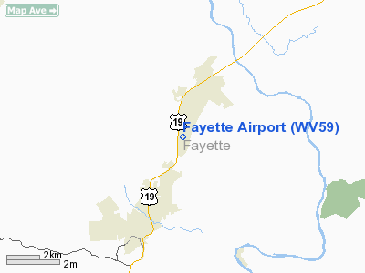
Location & QuickFacts
| FAA Information Effective: | 2008-09-25 |
| Airport Identifier: | WV59 |
| Airport Status: | Operational |
| Longitude/Latitude: | 081-07-11.3680W/38-01-36.3990N
-81.119824/38.026778 (Estimated) |
| Elevation: | 1960 ft / 597.41 m (Estimated) |
| Land: | 30 acres |
| From nearest city: | 2 nautical miles SW of Fayetteville, WV |
| Location: | Fayette County, WV |
| Magnetic Variation: | 06W (1985) |
Owner & Manager
| Ownership: | Privately owned |
| Owner: | Frank K. Thomas |
| Address: | Route 2, Box 480b
Fayetteville, WV 25840 |
| Phone number: | 304-574-1035 |
| Manager: | Ray Salmon & Tim Kearns |
| Address: | 380 Airport Cir.
Beaver, WV 25813 |
| Phone number: | 304-255-2717 |
Airport Operations and Facilities
| Airport Use: | Private |
| Wind indicator: | Yes
WINDSOCK POOR CONDITION. |
| Segmented Circle: | No |
| Control Tower: | No |
| Lighting Schedule: | PHONE REQ
FOR ROTG BCN CALL 304-574-1035. |
| Beacon Color: | Clear-Green (lighted land airport)
ROTG BCN OTS INDEFLY. |
| Landing fee charge: | No |
| Sectional chart: | Cincinnati |
| Region: | AEA - Eastern |
| Boundary ARTCC: | ZID - Indianapolis |
| Tie-in FSS: | EKN - Elkins |
| FSS on Airport: | No |
| FSS Toll Free: | 1-800-WX-BRIEF |
Airport Communications
| Unicom: | 122.800
OTS INDEFLY. |
Airport Services
| Airframe Repair: | NONE |
| Power Plant Repair: | NONE |
| Bottled Oxygen: | NONE |
| Bulk Oxygen: | NONE |
Runway Information
Runway 03/21
| Dimension: | 2010 x 20 ft / 612.6 x 6.1 m |
| Surface: | ASPH, Good Condition |
| Edge Lights: | Non-standard lighting system
NSTD LIRL 35 FT FROM EDGE OF PAVEMENT. LIRL OTS INDEFLY. |
| |
Runway 03 |
Runway 21 |
| Traffic Pattern: | Right | Left |
| Markings: | Nonstandard, Good Condition
RY 03/21 MKD BY SMALL NUMBERS. NO CL OR THLD BAR. RY 03 HAS TWY TRANSITIONING INTO RY. RY 21 HAS TURN AROUND AT THLD. NUMBERS FOR RY 21 INCORRECTLY LOCATED IN TURN-AROUND AREA. NO THLD MKGS ON RY. | Nonstandard, Good Condition |
| Displaced threshold: | 97.00 ft
RY 03/21 DSPLCD THLDS DALGT ONLY. MKD BY SINGLE ORANGE CONE RIGHT SIDE PARTIALLY OBSCURED BY GRASS. | 62.00 ft |
| Runway End Identifier: | No | Yes
SINGLE REIL RIGHT SIDE. |
| Centerline Lights: | No | No |
| Touchdown Lights: | No | No |
| Obstruction: | 28 ft trees, 650.0 ft from runway, 100 ft right of centerline, 16:1 slope to clear
APCH RATIO 26:1 TO DSPLCD THLD.
RY 03 +10 FT TREES 50 FT FM THLD 75 FT RIGHT. | 55 ft trees, 650.0 ft from runway, 8:1 slope to clear
APCH RATIO 12:1 TO DSPLCD THLD.
RY 21 +8 FT BRUSH 0-125 FT FM THLD 45 FT LEFT. |
|
Radio Navigation Aids
| ID |
Type |
Name |
Ch |
Freq |
Var |
Dist |
| IJZ | NDB | Nicholas | | 272.00 | 05W | 13.0 nm |
| LW | NDB | Bushi | | 346.00 | 06W | 34.2 nm |
| GTC | NDB | Guyandot | | 293.00 | 03W | 40.2 nm |
| JTM | NDB | Braxton | | 234.00 | 06W | 45.3 nm |
| RNL | VOR | Rainelle | | 116.60 | 04W | 15.2 nm |
| LWB | VOR/DME | Greenbrier | 107Y | 116.05 | 08W | 35.9 nm |
| BKW | VORTAC | Beckley | 124X | 117.70 | 06W | 14.8 nm |
| HVQ | VORTAC | Charleston | 121X | 117.40 | 03W | 36.3 nm |
| BLF | VORTAC | Bluefield | 037X | 110.00 | 03W | 43.4 nm |
| CRW | VOT | Charleston Kanawha | | 108.80 | | 30.6 nm |
Remarks
- NO LINE OF SIGHT BETWEEN RY ENDS.
- NIGHT LDG NOT RECOMMENDED WITHOUT PRIOR ARRANGEMENT.
- PRIOR TO 1959.
Images and information placed above are from
http://www.airport-data.com/airport/WV59/
We thank them for the data!
|
|


