 |
|
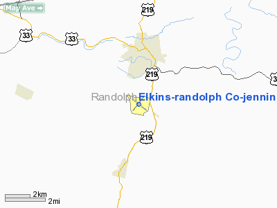
Elkins-randolph Co-jennings Randolph Fld Airport |
Location & QuickFacts
| FAA Information Effective: | 2008-09-25 |
| Airport Identifier: | EKN |
| Airport Status: | Operational |
| Longitude/Latitude: | 079-51-25.7000W/38-53-22.0000N
-79.857139/38.889444 (Estimated) |
| Elevation: | 1987 ft / 605.64 m (Surveyed) |
| Land: | 227 acres |
| From nearest city: | 2 nautical miles S of Elkins, WV |
| Location: | Randolph County, WV |
| Magnetic Variation: | 07W (1985) |
Owner & Manager
| Ownership: | Publicly owned |
| Owner: | Elkins-randolph Co Arpt Auth |
| Address: | Rt 4, Box 271-1
Elkins, WV 26241 |
| Phone number: | 304-636-2726 |
| Manager: | Dick Chaney |
| Address: | Rt 4, Box 271-1
Elkins, WV 26241 |
| Phone number: | 304-636-2726 |
Airport Operations and Facilities
| Airport Use: | Open to public |
| Wind indicator: | Yes |
| Segmented Circle: | No |
| Control Tower: | No |
| Lighting Schedule: | DUSK-DAWN
ACTVT MIRL RY 05/23 & REIL RY 23 - 122.9. |
| Beacon Color: | Clear-Green (lighted land airport) |
| Landing fee charge: | No |
| Sectional chart: | Cincinnati |
| Region: | AEA - Eastern |
| Traffic Pattern Alt: | 1013 ft |
| Boundary ARTCC: | ZDC - Washington |
| Responsible ARTCC: | ZOB - Cleveland |
| Tie-in FSS: | EKN - Elkins
CTC ELKINS RADIO FOR AIRPORT ADVISORY SERVICE ON 123.6. |
| FSS on Airport: | No |
| FSS Toll Free: | 1-800-WX-BRIEF |
| NOTAMs Facility: | EKN (NOTAM-d service avaliable) |
| Federal Agreements: | NGY |
Airport Communications
Airport Services
| Fuel available: | 100LLA
24HR SELF SERVICE JET A |
| Bottled Oxygen: | NONE |
| Bulk Oxygen: | NONE |
Runway Information
Runway 00X
| Dimension: | 0 x 0 ft / 0.0 x 0.0 m |
| Surface: | , |
| |
Runway 00X |
Runway |
| ILS Type: | LDA/DME
| |
| Traffic Pattern: | Left | Left |
|
Runway 05/23
| Dimension: | 4501 x 140 ft / 1371.9 x 42.7 m |
| Surface: | ASPH, Good Condition |
| Weight Limit: | Single wheel: 28000 lbs.
Dual wheel: 35000 lbs.
Dual tandem wheel: 56000 lbs. |
| Edge Lights: | Medium |
| |
Runway 05 |
Runway 23 |
| Longitude: | 079-51-46.0021W | 079-51-10.3485W |
| Latitude: | 38-53-05.9775N | 38-53-40.6507N |
| Elevation: | 1973.00 ft | 1946.00 ft |
| Alignment: | 39 | 127 |
| Traffic Pattern: | Left | Left |
| Markings: | Basic, Fair Condition | Basic, Fair Condition |
| Crossing Height: | 0.00 ft | 45.00 ft |
| VASI: | | 2-light PAPI on left side
PAPI RY 23 NON-STD VGSI. |
| Visual Glide Angle: | 0.00° | 5.00° |
| Runway End Identifier: | No | Yes
REIL RY 23 NSTD OMNI-DIRECTIONAL. |
| Obstruction: | 54 ft trees, 362.0 ft from runway, 250 ft left of centerline, 3:1 slope to clear
RY O5 +20-25 FT LIGHTED OBSTRUCTION POLES; 200 FT FM RY END; 250' RT. | 98 ft trees, 1572.0 ft from runway, 125L/ ft right of centerline, 14:1 slope to clear |
|
Runway 14/32
| Dimension: | 4543 x 140 ft / 1384.7 x 42.7 m |
| Surface: | ASPH, Good Condition |
| Weight Limit: | Single wheel: 10000 lbs. |
| |
Runway 14 |
Runway 32 |
| Longitude: | 079-51-45.5278W | 079-51-00.7511W |
| Latitude: | 38-53-34.8360N | 38-53-06.7055N |
| Elevation: | 1940.00 ft | 1987.00 ft |
| Alignment: | 127 | 127 |
| Traffic Pattern: | Left | Left |
| Markings: | Basic, Fair Condition | Basic, Fair Condition |
| Displaced threshold: | 0.00 ft | 1390.00 ft |
| Runway End Identifier: | No | No |
| Obstruction: | 112 ft trees, 1465.0 ft from runway, 250 ft left of centerline, 11:1 slope to clear | 60 ft trees, 220.0 ft from runway, 125 ft right of centerline
RY 32 +70 FT TREES, DIST 850 FT, 0B, 14:1 BASED ON DSPLCD THLD.
+5 FT GND AT THLD 110 FT L. |
|
Radio Navigation Aids
| ID |
Type |
Name |
Ch |
Freq |
Var |
Dist |
| RQY | NDB | Randolph County | | 284.00 | 07W | 0.3 nm |
| JTM | NDB | Braxton | | 234.00 | 06W | 39.2 nm |
| CKB | VOR/DME | Clarksburg | 073X | 112.60 | 04W | 29.1 nm |
| ESL | VOR/DME | Kessel | 045X | 110.80 | 06W | 45.3 nm |
| EKN | VORTAC | Elkins | 089X | 114.20 | 07W | 11.4 nm |
| MGW | VORTAC | Morgantown | 053X | 111.60 | 05W | 40.1 nm |
Remarks
- UNCONTROLLED VEHICULAR TFC CROSSES THR RY 32.
- CTC ELKINS RADIO FOR ARPT ADVSY SERVICE ON 123.6.
- DEER ON & INVOF ARPT.
- DEPRESSED DRAINAGE INLETS ON RYS 10 FT INBOARD FROM EDGES 2-12 INCHES DEEP RYS 05/23 & 14/32.
- TOWER 100 FT AGL 500 FT SW RY 32.
- PRVDD DAYLGT VFR ONLY.
Images and information placed above are from
http://www.airport-data.com/airport/EKN/
We thank them for the data!
| General Info
|
| Country |
United States
|
| State |
WEST VIRGINIA
|
| FAA ID |
EKN
|
| Latitude |
38-53-22.000N
|
| Longitude |
079-51-25.700W
|
| Elevation |
1987 feet
|
| Near City |
ELKINS
|
We don't guarantee the information is fresh and accurate. The data may
be wrong or outdated.
For more up-to-date information please refer to other sources.
|
|


