 |
|
Location & QuickFacts
| FAA Information Effective: | 2008-09-25 |
| Airport Identifier: | WV67 |
| Airport Status: | Operational |
| Longitude/Latitude: | 078-40-46.0000W/39-23-41.0000N
-78.679444/39.394722 (Estimated) |
| Elevation: | 1590 ft / 484.63 m (Estimated) |
| Land: | 15 acres |
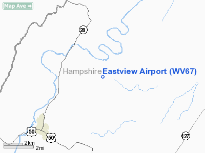
| From nearest city: | 5 nautical miles NE of Romney, WV |
| Location: | Hampshire County, WV |
| Magnetic Variation: | 09W (1990) |
Owner & Manager
| Ownership: | Privately owned |
| Owner: | Loudoun L Thompson |
| Address: | Box 884
Romney, WV 26757 |
| Phone number: | 304-822-3322 |
| Manager: | Loudoun L Thompson |
| Address: | Box884
Romney, WV 26757 |
| Phone number: | 304-822-3322 |
Airport Operations and Facilities
| Airport Use: | Private |
| Segmented Circle: | No |
| Control Tower: | No |
| Sectional chart: | Washington |
| Region: | AEA - Eastern |
| Boundary ARTCC: | ZDC - Washington |
| Tie-in FSS: | EKN - Elkins |
| FSS on Airport: | No |
| FSS Toll Free: | 1-800-WX-BRIEF |
Runway Information
Runway 04/22
| Dimension: | 1800 x 18 ft / 548.6 x 5.5 m |
| Surface: | TURF, |
| |
Runway 04 |
Runway 22 |
| Traffic Pattern: | Left | Left |
| Obstruction: | 50 ft trees, 500.0 ft from runway | 30 ft trees, 500.0 ft from runway |
|
Radio Navigation Aids
| ID |
Type |
Name |
Ch |
Freq |
Var |
Dist |
| CBE | NDB | Cumberland | | 317.00 | 07W | 15.6 nm |
| TZ | NDB | Cogan | | 364.00 | 10W | 33.9 nm |
| LUA | NDB | Caverns | | 245.00 | 09W | 42.9 nm |
| SYS | NDB | Stoystown | | 209.00 | 08W | 43.0 nm |
| GDX | NDB | Goodwin Lake | | 227.00 | 08W | 47.6 nm |
| HGR | VOR | Hagerstown | | 109.80 | 07W | 42.3 nm |
| ESL | VOR/DME | Kessel | 045X | 110.80 | 06W | 17.6 nm |
| GRV | VOR/DME | Grantsville | 070X | 112.30 | 06W | 22.5 nm |
| MRB | VORTAC | Martinsburg | 058X | 112.10 | 07W | 38.6 nm |
| LDN | VORTAC | Linden | 090X | 114.30 | 06W | 39.3 nm |
| THS | VORTAC | St Thomas | 097X | 115.00 | 07W | 46.7 nm |
| IHD | VORTAC | Indian Head | 019X | 108.20 | 06W | 46.9 nm |
Remarks
- OBSTRUCTIONS REMOVED OR RY THLD DSPLCD TO PROVIDE 20:1 APCH SLOPE.
Images and information placed above are from
http://www.airport-data.com/airport/WV67/
We thank them for the data!
| General Info
|
| Country |
United States
|
| State |
WEST VIRGINIA
|
| FAA ID |
WV67
|
| Latitude |
39-23-41.000N
|
| Longitude |
078-40-46.000W
|
| Elevation |
1590 feet
|
| Near City |
ROMNEY
|
We don't guarantee the information is fresh and accurate. The data may
be wrong or outdated.
For more up-to-date information please refer to other sources.
|
|


