|
|
Eastern Wv Rgnl/shepherd Fld Airport |
Eastern WV Regional Airport
Shepherd Field |
| IATA: MRB – ICAO: KMRB – FAA LID: MRB |
| Summary |
| Airport type |
Eastern WV Regional Airport Authority |
| Operator |
Martinsburg, West Virginia |
| Location |
Berkeley County, near Martinsburg, West Virginia |
| Elevation AMSL |
169.8 ft / m |
| Coordinates |
39°24′07″N 77°59′04″W / 39.40194°N 77.98444°W / 39.40194; -77.98444Coordinates: 39°24′07″N 77°59′04″W / 39.40194°N 77.98444°W / 39.40194; -77.98444 |
| Runways |
| Direction |
Length |
Surface |
| ft |
m |
| 8/26 |
7,000 |
2,134 |
Asphalt/Grooved |
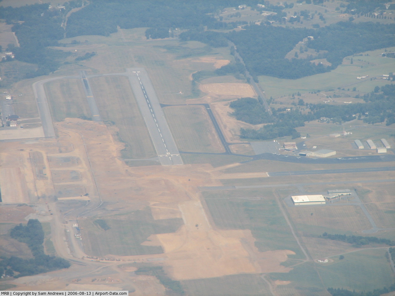
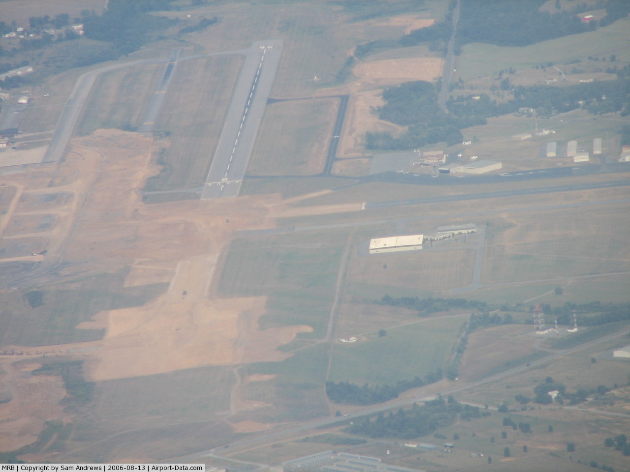
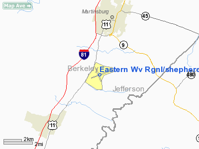
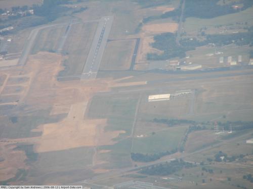
Eastern WV Regional Airport (IATA: MRB, ICAO: KMRB, FAA LID: MRB), also known as Shepherd Field, is a joint civil-military public airport located four miles (6 km) south of the central business district (CBD) of Martinsburg, a city in Berkeley County, West Virginia, USA.
The airport covers 1,015 acres (411 ha) and has one runway. It is mostly used for general aviation, but also serves as a base for the Air National Guard's 167th Airlift Wing (167 AW), an Air Mobility Command (AMC)-gained unit of the West Virginia Air National Guard. The 167 AW operates the C-5 Galaxy and the airport is currently lengthening and strengthening the airport's 7,000 foot runway to better support this aircraft.
In 2007, the airport underwent a renovation which included the removal of the secondary runway, expansion of the main runway, and the renovation of the parking pads for the C-5's. The renovation added hangers for the C-5, as the C-130 hangers were grossly inadequate for the size of the newer plane.
The above content comes from Wikipedia and is published under free licenses – click here to read more.
 |
(Click on the photo to enlarge) |
 |
(Click on the photo to enlarge) |
Location & QuickFacts
| FAA Information Effective: | 2008-09-25 |
| Airport Identifier: | MRB |
| Airport Status: | Operational |
| Longitude/Latitude: | 077-59-04.8070W/39-24-06.8510N
-77.984669/39.401903 (Estimated) |
| Elevation: | 557 ft / 169.77 m (Surveyed) |
| Land: | 1015 acres |
| From nearest city: | 4 nautical miles S of Martinsburg, WV |
| Location: | Berkeley County, WV |
| Magnetic Variation: | 08W (1980) |
Owner & Manager
| Ownership: | Publicly owned |
| Owner: | Eastern Wva Reg Arpt Auth |
| Address: | 170 Aviation Way Rm 105
Martinsburg, WV 25405 |
| Phone number: | 304-263-2106 |
| Manager: | William E. Walkup |
| Address: | 170 Aviation Way Rm 105
Martinsburg, WV 25405 |
| Phone number: | 304-263-2106 |
Airport Operations and Facilities
| Airport Use: | Open to public |
| Wind indicator: | Yes |
| Segmented Circle: | No |
| Control Tower: | Yes |
| Lighting Schedule: | DUSK-DAWN
WHEN ATCT CLSD ACTVT MALSR RY 26; HIRL RY 08/26; TAXIWAY LGTS - CTAF. |
| Beacon Color: | Clear-Green (lighted land airport) |
| Landing fee charge: | Yes
FEE FOR ACFT GREATER THAN 6500 LBS GROSS WEIGHT. |
| Sectional chart: | Washington |
| Region: | AEA - Eastern |
| Boundary ARTCC: | ZDC - Washington |
| Tie-in FSS: | EKN - Elkins |
| FSS on Airport: | No |
| FSS Toll Free: | 1-800-WX-BRIEF |
| NOTAMs Facility: | MRB (NOTAM-d service avaliable) |
| Federal Agreements: | NGY |
Airport Communications
| CTAF: | 124.300 |
| Unicom: | 122.950 |
Airport Services
| Fuel available: | 100LLA
FOR FUEL AFTER HRS CALL 304-262-2507. |
| Airframe Repair: | MAJOR |
| Power Plant Repair: | MAJOR |
| Bottled Oxygen: | NONE |
| Bulk Oxygen: | NONE |
Runway Information
Runway 08/26
| Dimension: | 7815 x 150 ft / 2382.0 x 45.7 m |
| Surface: | ASPH, Good Condition |
| Surface Treatment: | Saw-cut or plastic Grooved |
| Weight Limit: | Single wheel: 75000 lbs.
Dual wheel: 135000 lbs.
Dual tandem wheel: 300000 lbs.
Dual dual tandem wheel: 650000 lbs. |
| Edge Lights: | High |
| |
Runway 08 |
Runway 26 |
| Longitude: | 077-59-51.7730W | 077-58-17.8410W |
| Latitude: | 39-23-54.0480N | 39-24-19.6540N |
| Elevation: | 565.00 ft | 548.00 ft |
| Alignment: | 71 | 127 |
| ILS Type: | | ILS
|
| Traffic Pattern: | Left | Left |
| Markings: | Precision instrument, Good Condition | Precision instrument, Good Condition |
| Crossing Height: | 0.00 ft | 53.00 ft |
| VASI: | | 4-box on left side |
| Visual Glide Angle: | 0.00° | 3.00° |
| Approach lights: | | MALSR |
| Runway End Identifier: | No | |
| Centerline Lights: | No | No |
| Touchdown Lights: | No | No |
| Obstruction: | 10 ft gnd, 200.0 ft from runway, 320 ft right of centerline | 22 ft trees, 640.0 ft from runway, 450 ft left of centerline, 20:1 slope to clear |
|
Radio Navigation Aids
| ID |
Type |
Name |
Ch |
Freq |
Var |
Dist |
| TZ | NDB | Cogan | | 364.00 | 10W | 19.4 nm |
| GDX | NDB | Goodwin Lake | | 227.00 | 08W | 27.9 nm |
| CBE | NDB | Cumberland | | 317.00 | 07W | 38.3 nm |
| GAI | NDB | Gaithersburg | | 385.00 | 09W | 40.6 nm |
| LUA | NDB | Caverns | | 245.00 | 09W | 47.9 nm |
| GTN | NDB | Georgetown | | 323.00 | 09W | 49.1 nm |
| HGR | VOR | Hagerstown | | 109.80 | 07W | 18.8 nm |
| FDK | VOR | Frederick | | 109.00 | 08W | 28.3 nm |
| ESL | VOR/DME | Kessel | 045X | 110.80 | 06W | 47.9 nm |
| MRB | VORTAC | Martinsburg | 058X | 112.10 | 07W | 6.4 nm |
| THS | VORTAC | St Thomas | 097X | 115.00 | 07W | 32.0 nm |
| LDN | VORTAC | Linden | 090X | 114.30 | 06W | 34.5 nm |
| AML | VORTAC | Armel | 082X | 113.50 | 08W | 37.0 nm |
| CSN | VORTAC | Casanova | 110X | 116.30 | 06W | 46.1 nm |
| EMI | VORTAC | Westminster | 126X | 117.90 | 08W | 47.0 nm |
Remarks
- FUEL: J4(MIL) (NC-100LL, A).
- FLUID: PRESAIR-AVBL 2200-0200Z++ OR 30 MIN PN AND PRIOR ARNG ON HOL.
- OIL: O-156(MIL).
- SEE FLIP AP/1 SUPPLEMENTARY ARPT RMK.
- CAUTION: FUEL TRUCKS ON SE PORTION OF CIV RAMPS.
- MISC: PPR FOR SVC AND PRK DSN 242-5256, BASE OPS DSN 242-5250 & C304-616-5250 OPR 1200 - 2100 Z++.
- ANG: PN 167 AW/DOO RQR DSN 242-9045/9250.
- FUEL TRUCKS ON SOUTHEAST PORTION OF CIVILIAN RAMPS.
- RY 08/26 CURRENTLY UNDER RECONSTRUCTION; 2300 FT X 150 FT OPEN UNTIL CONSTRUCTION COMPLETION ON/NEAR NOV 1, 2007.
- ANG: LTD PRK AVBL 1030-2030Z++ MON-FRI, TRANS ACFT ANG RAMP, NO PRIORITY BASIS. PPR FOR SVC AND PRK DSN 242-5256 C304-616-5256, BASE OPS DSN 242-5250 C304-616-5250 OPR 1100-2030Z++. TRANS ALERT SVC 1030-2030Z++ MON-FRI CONTINGENT ON ANG OPR. CRASH FAC AVBL 1000-0400Z++.
- NO GRASS LANDINGS. MOWING IN PROGRESS SPRING THROUGH AUTUMN YEARLY.
- DEER & BIRDS ON & INVOF ARPT.
- JASU: (MD-3) 1(MA-1A).
Images and information placed above are from
http://www.airport-data.com/airport/MRB/
We thank them for the data!
| General Info
|
| Country |
United States
|
| State |
WEST VIRGINIA
|
| FAA ID |
MRB
|
| Latitude |
39-24-06.958N
|
| Longitude |
077-59-04.493W
|
| Elevation |
557 feet
|
| Near City |
MARTINSBURG
|
We don't guarantee the information is fresh and accurate. The data may
be wrong or outdated.
For more up-to-date information please refer to other sources.
|
|