 |
|
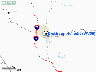
Location & QuickFacts
| FAA Information Effective: | 2008-09-25 |
| Airport Identifier: | WV50 |
| Airport Status: | Operational |
| Longitude/Latitude: | 081-41-46.4640W/38-48-44.3050N
-81.696240/38.812307 (Estimated) |
| Elevation: | 790 ft / 240.79 m (Estimated) |
| Land: | 0 acres |
| From nearest city: | 1 nautical miles NW of Fairplain, WV |
| Location: | Jackson County, WV |
| Magnetic Variation: | 06W (1985) |
Owner & Manager
| Ownership: | Privately owned |
| Owner: | Dickirson Corporation |
| Address: | Po Box 750
Ripley, WV 25271 |
| Phone number: | 304-372-9111 |
| Manager: | Debbie Mccauley |
| Address: | Po Box 750
Ripley, WV 25271 |
| Phone number: | 304-372-9111
EXT. 852 |
Airport Operations and Facilities
| Airport Use: | Private |
| Wind indicator: | No |
| Segmented Circle: | No |
| Control Tower: | No |
| Lighting Schedule: | NONE |
| Landing fee charge: | No |
| Sectional chart: | Cincinnati |
| Region: | AEA - Eastern |
| Boundary ARTCC: | ZID - Indianapolis |
| Tie-in FSS: | EKN - Elkins |
| FSS on Airport: | No |
| FSS Toll Free: | 1-800-WX-BRIEF |
Runway Information
Helipad H1
| Dimension: | 45 x 45 ft / 13.7 x 13.7 m |
| Surface: | CONC, |
| |
Runway H1 |
Runway |
| Traffic Pattern: | Left | Left |
|
Radio Navigation Aids
| ID |
Type |
Name |
Ch |
Freq |
Var |
Dist |
| PKB | FAN MARKER | Marietta Ohio | | | 03W | 36.9 nm |
| GAS | NDB | Gallipolis | | 420.00 | 07W | 21.8 nm |
| UGS | NDB | University | | 250.00 | 06W | 33.4 nm |
| JTM | NDB | Braxton | | 234.00 | 06W | 49.6 nm |
| HNN | VORTAC | Henderson | 106X | 115.90 | 03W | 15.8 nm |
| HVQ | VORTAC | Charleston | 121X | 117.40 | 03W | 28.0 nm |
| JPU | VORTAC | Parkersburg | 023X | 108.60 | 03W | 40.7 nm |
| CRW | VOT | Charleston Kanawha | | 108.80 | | 26.8 nm |
Remarks
- PROVIDED PLINES RUNNING E/W & N/S ARE MARKED.
Images and information placed above are from
http://www.airport-data.com/airport/WV50/
We thank them for the data!
| General Info
|
| Country |
United States
|
| State |
WEST VIRGINIA
|
| FAA ID |
WV50
|
| Latitude |
38-48-44.305N
|
| Longitude |
081-41-46.464W
|
| Elevation |
790 feet
|
| Near City |
FAIRPLAIN
|
We don't guarantee the information is fresh and accurate. The data may
be wrong or outdated.
For more up-to-date information please refer to other sources.
|
|


