 |
|
Location & QuickFacts
| FAA Information Effective: | 2008-09-25 |
| Airport Identifier: | WV00 |
| Airport Status: | Operational |
| Longitude/Latitude: | 079-48-02.0000W/38-28-15.0000N
-79.800556/38.470833 (Estimated) |
| Elevation: | 2650 ft / 807.72 m (Estimated) |
| Land: | 6 acres |
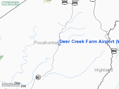
| From nearest city: | 2 nautical miles N of Arbovale, WV |
| Location: | Pocahontas County, WV |
| Magnetic Variation: | 08W (1995) |
Owner & Manager
| Ownership: | Privately owned |
| Owner: | Stephen P Coonts |
| Address: | Po Box 91
Arbovale, WV 24915 |
| Phone number: | 304-456-3047 |
| Manager: | Stephen P Coonts |
| Address: | Po Box 91
Arbovale, WV 24915 |
| Phone number: | 304-456-3047 |
Airport Operations and Facilities
| Airport Use: | Private |
| Wind indicator: | Yes |
| Segmented Circle: | No |
| Control Tower: | No |
| Sectional chart: | Cincinnati |
| Region: | AEA - Eastern |
| Boundary ARTCC: | ZDC - Washington |
| Tie-in FSS: | EKN - Elkins |
| FSS Toll Free: | 1-800-WX-BRIEF |
Runway Information
Runway 04/22
| Dimension: | 2500 x 60 ft / 762.0 x 18.3 m |
| Surface: | TURF, Good Condition |
| |
Runway 04 |
Runway 22 |
| Traffic Pattern: | Left | Right |
| Obstruction: | 200 ft gnd, 2500.0 ft from runway | 200 ft gnd, 2500.0 ft from runway |
|
Radio Navigation Aids
| ID |
Type |
Name |
Ch |
Freq |
Var |
Dist |
| RQY | NDB | Randolph County | | 284.00 | 07W | 25.6 nm |
| VBW | NDB | Bridgewater | | 241.00 | 07W | 40.0 nm |
| JTM | NDB | Braxton | | 234.00 | 06W | 42.0 nm |
| LWB | VOR/DME | Greenbrier | 107Y | 116.05 | 08W | 46.0 nm |
| MOL | VOR/DME | Montebello | 100X | 115.30 | 05W | 47.4 nm |
| EKN | VORTAC | Elkins | 089X | 114.20 | 07W | 30.1 nm |
Remarks
- PRVDD VFR ONLY, PILOTS BE MADE AWARE OF EVERS MOA, OPERATORS/OWNERS OF MILITARY & PVT-USE ARPTS BE MADE AWARE OF OPNS PRIOR TO START OF AIR OPNS, & CLEAR 20:1 APCH/DEP PATH EACH RY.
Images and information placed above are from
http://www.airport-data.com/airport/WV00/
We thank them for the data!
| General Info
|
| Country |
United States
|
| State |
WEST VIRGINIA
|
| FAA ID |
WV00
|
| Latitude |
38-28-15.000N
|
| Longitude |
079-48-02.000W
|
| Elevation |
2650 feet
|
| Near City |
ARBOVALE
|
We don't guarantee the information is fresh and accurate. The data may
be wrong or outdated.
For more up-to-date information please refer to other sources.
|
|


