 |
|
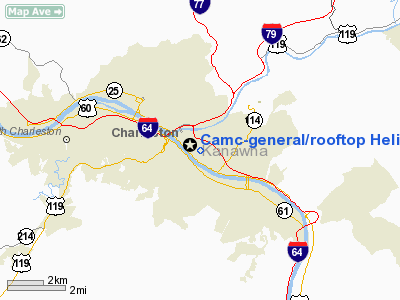
Camc-general/rooftop Heliport |
Location & QuickFacts
| FAA Information Effective: | 2008-09-25 |
| Airport Identifier: | WV56 |
| Airport Status: | Operational |
| Longitude/Latitude: | 081-37-39.4440W/38-20-51.3500N
-81.627623/38.347597 (Estimated) |
| Elevation: | 695 ft / 211.84 m (Estimated) |
| Land: | 0 acres |
| From nearest city: | 0 nautical miles N of Charleston, WV |
| Location: | Kanawha County, WV |
| Magnetic Variation: | 05W (1985) |
Owner & Manager
| Ownership: | Privately owned |
| Owner: | Charleston Area Med Ctr Inc |
| Address: | Po Box 1393
Charleston, WV 25325 |
| Phone number: | 304-388-6002 |
| Manager: | Rebecca M. Oakley
DOUG DOUGLAS 304-388-6592 |
| Address: | 501 Morris Street
Charleston, WV 25301 |
| Phone number: | 304-388-6002 |
Airport Operations and Facilities
| Airport Use: | Private
MEDICAL USE. |
| Wind indicator: | Yes |
| Segmented Circle: | No |
| Control Tower: | No |
| Landing fee charge: | No |
| Sectional chart: | Cincinnati |
| Region: | AEA - Eastern |
| Boundary ARTCC: | ZID - Indianapolis |
| Tie-in FSS: | EKN - Elkins |
| FSS on Airport: | No |
| FSS Toll Free: | 1-800-WX-BRIEF |
Runway Information
Helipad H1
| Dimension: | 78 x 78 ft / 23.8 x 23.8 m |
| Surface: | CONC, |
| |
Runway H1 |
Runway |
| Traffic Pattern: | Left | Left |
|
Radio Navigation Aids
| ID |
Type |
Name |
Ch |
Freq |
Var |
Dist |
| IJZ | NDB | Nicholas | | 272.00 | 05W | 35.0 nm |
| GTC | NDB | Guyandot | | 293.00 | 03W | 36.5 nm |
| GAS | NDB | Gallipolis | | 420.00 | 07W | 38.5 nm |
| RNL | VOR | Rainelle | | 116.60 | 04W | 44.8 nm |
| HVQ | VORTAC | Charleston | 121X | 117.40 | 03W | 6.7 nm |
| HNN | VORTAC | Henderson | 106X | 115.90 | 03W | 30.8 nm |
| BKW | VORTAC | Beckley | 124X | 117.70 | 06W | 41.6 nm |
| CRW | VOT | Charleston Kanawha | | 108.80 | | 2.2 nm |
Images and information placed above are from
http://www.airport-data.com/airport/WV56/
We thank them for the data!
| General Info
|
| Country |
United States
|
| State |
WEST VIRGINIA
|
| FAA ID |
WV56
|
| Latitude |
38-20-51.350N
|
| Longitude |
081-37-39.444W
|
| Elevation |
695 feet
|
| Near City |
CHARLESTON
|
We don't guarantee the information is fresh and accurate. The data may
be wrong or outdated.
For more up-to-date information please refer to other sources.
|
|


