 |
|
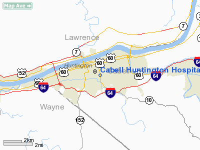
Cabell Huntington Hospital Heliport |
Location & QuickFacts
| FAA Information Effective: | 2008-09-25 |
| Airport Identifier: | WV27 |
| Airport Status: | Operational |
| Longitude/Latitude: | 082-25-42.0000W/38-24-37.0000N
-82.428333/38.410278 (Estimated) |
| Elevation: | 591 ft / 180.14 m (Estimated) |
| Land: | 0 acres |
| From nearest city: | 3 nautical miles SE of Huntington, WV |
| Location: | Cabell County, WV |
| Magnetic Variation: | 05W (1985) |
Owner & Manager
| Ownership: | Privately owned |
| Owner: | Cabell Hunting Hospital |
| Address: | 1340 Hal Greer Blvd.
Huntington, WV 25701 |
| Phone number: | 304-526-2309 |
| Manager: | C Keith Biddle |
| Address: | 1340 Hal Greer Blvd.
Huntington, WV 25701 |
| Phone number: | 304-526-2309 |
Airport Operations and Facilities
| Airport Use: | Private
MEDICAL USE. |
| Wind indicator: | Yes |
| Segmented Circle: | No |
| Control Tower: | No |
| Lighting Schedule: | PHONE REQ
FOR PERIMETER LGTS CALL 304-526-2309. |
| Landing fee charge: | No |
| Sectional chart: | Atlanta |
| Region: | AEA - Eastern |
| Boundary ARTCC: | ZID - Indianapolis |
| Tie-in FSS: | EKN - Elkins |
| FSS on Airport: | No |
| FSS Toll Free: | 1-800-WX-BRIEF |
Runway Information
Helipad H1
| Dimension: | 40 x 40 ft / 12.2 x 12.2 m |
| Surface: | CONC, |
| |
Runway H1 |
Runway |
| Traffic Pattern: | Left | Left |
| Markings: | Basic, | , |
|
Radio Navigation Aids
| ID |
Type |
Name |
Ch |
Freq |
Var |
Dist |
| AJY | FAN MARKER | Ashland | | | 03W | 19.4 nm |
| GAS | NDB | Gallipolis | | 420.00 | 07W | 28.4 nm |
| PMH | NDB | Portsmouth | | 373.00 | 04W | 29.7 nm |
| GTC | NDB | Guyandot | | 293.00 | 03W | 45.1 nm |
| ECB | VORTAC | Newcombe | 041X | 110.40 | 02W | 27.3 nm |
| HNN | VORTAC | Henderson | 106X | 115.90 | 03W | 28.0 nm |
| YRK | VORTAC | York | 075X | 112.80 | 05W | 29.4 nm |
| HVQ | VORTAC | Charleston | 121X | 117.40 | 03W | 31.2 nm |
| CRW | VOT | Charleston Kanawha | | 108.80 | | 39.4 nm |
Remarks
- PRVDD VFR ONLY, CLEAR 8:1 INGRESS/EGRESS, PROVISIONS FOR PERSONS & PROPERTY ON GND, APPROPRIATE INGRESS/EGRESS MKGS PLACED ON PAD.
Images and information placed above are from
http://www.airport-data.com/airport/WV27/
We thank them for the data!
| General Info
|
| Country |
United States
|
| State |
WEST VIRGINIA
|
| FAA ID |
WV27
|
| Latitude |
38-24-37.000N
|
| Longitude |
082-25-42.000W
|
| Elevation |
591 feet
|
| Near City |
HUNTINGTON
|
We don't guarantee the information is fresh and accurate. The data may
be wrong or outdated.
For more up-to-date information please refer to other sources.
|
|


