 |
|
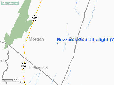
Buzzards Gap Ultralight Airport |
Location & QuickFacts
| FAA Information Effective: | 2008-09-25 |
| Airport Identifier: | WV61 |
| Airport Status: | Operational |
| Longitude/Latitude: | 078-14-08.0190W/39-28-10.3490N
-78.235561/39.469541 (Estimated) |
| Elevation: | 960 ft / 292.61 m (Estimated) |
| Land: | 0 acres |
| From nearest city: | 10 nautical miles S of Berkeley Springs, WV |
| Location: | Morgan County, WV |
| Magnetic Variation: | 09W (1990) |
Owner & Manager
| Ownership: | Privately owned |
| Owner: | James H Critchfield Jr |
| Address: | Rt 3 Box 164-a
Berkeley Springs, WV 25411 |
| Phone number: | 304-258-3607 |
| Address: |
|
Airport Operations and Facilities
| Airport Use: | Private
PERSONAL USE. |
| Segmented Circle: | No |
| Control Tower: | No |
| Sectional chart: | Washington |
| Region: | AEA - Eastern |
| Boundary ARTCC: | ZDC - Washington |
| Tie-in FSS: | EKN - Elkins |
| FSS Toll Free: | 1-800-WX-BRIEF |
Runway Information
Runway 03/21
| Dimension: | 1000 x 50 ft / 304.8 x 15.2 m |
| Surface: | TURF, |
| |
Runway 03 |
Runway 21 |
| Traffic Pattern: | Left | Left |
|
Radio Navigation Aids
| ID |
Type |
Name |
Ch |
Freq |
Var |
Dist |
| TZ | NDB | Cogan | | 364.00 | 10W | 24.3 nm |
| CBE | NDB | Cumberland | | 317.00 | 07W | 26.0 nm |
| GDX | NDB | Goodwin Lake | | 227.00 | 08W | 36.3 nm |
| LUA | NDB | Caverns | | 245.00 | 09W | 47.6 nm |
| SYS | NDB | Stoystown | | 209.00 | 08W | 48.6 nm |
| HGR | VOR | Hagerstown | | 109.80 | 07W | 22.3 nm |
| FDK | VOR | Frederick | | 109.00 | 08W | 40.1 nm |
| ESL | VOR/DME | Kessel | 045X | 110.80 | 06W | 38.0 nm |
| GRV | VOR/DME | Grantsville | 070X | 112.30 | 06W | 39.1 nm |
| MRB | VORTAC | Martinsburg | 058X | 112.10 | 07W | 18.7 nm |
| THS | VORTAC | St Thomas | 097X | 115.00 | 07W | 30.8 nm |
| LDN | VORTAC | Linden | 090X | 114.30 | 06W | 37.0 nm |
| AML | VORTAC | Armel | 082X | 113.50 | 08W | 48.1 nm |
Remarks
- PRVDD ARPT BE USED BY ULTRALIGHT ACFT OR OTHER ACFT OF SIMILAR PERFORMANCE ONLY & THE TREES BE REMOVED OR LOWERED TO ENSURE PROPER CLEARANCE.
Images and information placed above are from
http://www.airport-data.com/airport/WV61/
We thank them for the data!
| General Info
|
| Country |
United States
|
| State |
WEST VIRGINIA
|
| FAA ID |
WV61
|
| Latitude |
39-28-10.349N
|
| Longitude |
078-14-08.019W
|
| Elevation |
960 feet
|
| Near City |
BERKELEY SPRINGS
|
We don't guarantee the information is fresh and accurate. The data may
be wrong or outdated.
For more up-to-date information please refer to other sources.
|
|


