 |
|
Location & QuickFacts
| FAA Information Effective: | 2008-09-25 |
| Airport Identifier: | 48I |
| Airport Status: | Operational |
| Longitude/Latitude: | 080-39-07.5000W/38-41-13.6000N
-80.652083/38.687111 (Estimated) |
| Elevation: | 1276 ft / 388.92 m (Estimated) |
| Land: | 76 acres |
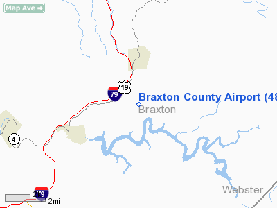
| From nearest city: | 3 nautical miles E of Sutton, WV |
| Location: | Braxton County, WV |
| Magnetic Variation: | 06W (1985) |
Owner & Manager
| Ownership: | Publicly owned |
| Owner: | Co Cmsn Of Braxton |
| Address: | Box 486
Sutton, WV 26601 |
| Phone number: | 304-765-2835 |
| Manager: | Carl Blake |
| Address: | Box 86
Burnsville, WV 26335 |
| Phone number: | 304-853-2538
ALTERNATE NUMBER 304-765-7061. |
Airport Operations and Facilities
| Airport Use: | Open to public |
| Wind indicator: | Yes |
| Segmented Circle: | Yes |
| Control Tower: | No |
| Lighting Schedule: | DUSK-DAWN
AFTER 2300 ACTVT MIRL RY 01/19 - CTAF. |
| Beacon Color: | Clear-Green (lighted land airport)
BEACON LOCATED 1/4 MILE NW OF AIRPORT. |
| Landing fee charge: | No |
| Sectional chart: | Cincinnati |
| Region: | AEA - Eastern |
| Boundary ARTCC: | ZID - Indianapolis |
| Responsible ARTCC: | ZOB - Cleveland |
| Tie-in FSS: | EKN - Elkins |
| FSS on Airport: | No |
| FSS Toll Free: | 1-800-WX-BRIEF |
| NOTAMs Facility: | EKN (NOTAM-d service avaliable) |
| Federal Agreements: | NGY |
Airport Communications
Airport Services
| Fuel available: | 100LLA |
| Airframe Repair: | NONE |
| Power Plant Repair: | NONE |
| Bottled Oxygen: | NONE |
| Bulk Oxygen: | NONE |
Runway Information
Runway 01/19
| Dimension: | 3995 x 60 ft / 1217.7 x 18.3 m |
| Surface: | ASPH, Good Condition |
| Surface Treatment: | Aggregate Friction Seal Coat |
| Weight Limit: | Single wheel: 12000 lbs. |
| Edge Lights: | Medium |
| |
Runway 01 |
Runway 19 |
| Longitude: | 080-39-10.8770W | 080-39-04.1270W |
| Latitude: | 38-40-53.9806N | 38-41-33.1186N |
| Elevation: | 1253.00 ft | 1276.00 ft |
| Alignment: | 8 | 127 |
| Traffic Pattern: | Left | Left |
| Markings: | Nonstandard, Good Condition
CENTERLINE AND NUMBERS PAINTED, DISPLACED THRESHOLD BAR AND ARROWS MISSING. | Nonstandard, Good Condition |
| Displaced threshold: | 409.00 ft | 0.00 ft |
| VASI: | | 2-box on left side
VASI OTS INDEFLY. |
| Obstruction: | 30 ft trees, 220.0 ft from runway, 170 ft left of centerline
APCH RATIO 0:1 TO DSPLCD THLD.
8 FT TREES 120 FT FM THLD 01. | 20 ft trees, 370.0 ft from runway, 10 ft left of centerline, 8:1 slope to clear |
|
Radio Navigation Aids
| ID |
Type |
Name |
Ch |
Freq |
Var |
Dist |
| JTM | NDB | Braxton | | 234.00 | 06W | 0.1 nm |
| IJZ | NDB | Nicholas | | 272.00 | 05W | 33.3 nm |
| RQY | NDB | Randolph County | | 284.00 | 07W | 39.2 nm |
| RNL | VOR | Rainelle | | 116.60 | 04W | 43.4 nm |
| CKB | VOR/DME | Clarksburg | 073X | 112.60 | 04W | 38.5 nm |
| EKN | VORTAC | Elkins | 089X | 114.20 | 07W | 29.3 nm |
| CRW | VOT | Charleston Kanawha | | 108.80 | | 48.1 nm |
Remarks
- 6' DITCH CROSSES AER 01 0-116' FROM THR.
- DEER ON & INVOF RY.
- RY 01/19 HAS 2 INCH PAVEMENT LIP AND SOFT SHOULDER.
- OBTAIN GATE ACCESS CARD AT DAYS INN: 304-765-5055.
Images and information placed above are from
http://www.airport-data.com/airport/48I/
We thank them for the data!
| General Info
|
| Country |
United States
|
| State |
WEST VIRGINIA
|
| FAA ID |
48I
|
| Latitude |
38-41-13.360N
|
| Longitude |
080-39-06.339W
|
| Elevation |
1270 feet
|
| Near City |
SUTTON
|
We don't guarantee the information is fresh and accurate. The data may
be wrong or outdated.
For more up-to-date information please refer to other sources.
|
|


