 |
|
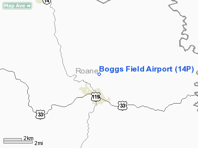
Location & QuickFacts
| FAA Information Effective: | 2008-09-25 |
| Airport Identifier: | 14P |
| Airport Status: | Operational |
| Longitude/Latitude: | 081-20-58.0000W/38-49-26.0000N
-81.349444/38.823889 (Estimated) |
| Elevation: | 927 ft / 282.55 m (Estimated) |
| Land: | 177 acres |
| From nearest city: | 1 nautical miles N of Spencer, WV |
| Location: | Roane County, WV |
| Magnetic Variation: | 06W (1985) |
Owner & Manager
| Ownership: | Privately owned |
| Owner: | Boggs Aviation, Llc |
| Address: | 217 Airfield Road
Spencer, WV 25276 |
| Phone number: | 304-927-4045 |
| Manager: | Harry C. Boggs |
| Address: | 217 Airfield Road
Spencer, WV 25276 |
| Phone number: | 304-927-4045 |
Airport Operations and Facilities
| Airport Use: | Open to public |
| Wind indicator: | Yes |
| Segmented Circle: | No |
| Control Tower: | No |
| Lighting Schedule: | RDO-CTL
ACTVT ROTG BCN - CTAF. |
| Beacon Color: | Clear-Green (lighted land airport) |
| Sectional chart: | Cincinnati |
| Region: | AEA - Eastern |
| Boundary ARTCC: | ZID - Indianapolis |
| Tie-in FSS: | EKN - Elkins |
| FSS Toll Free: | 1-800-WX-BRIEF |
| NOTAMs Facility: | EKN (NOTAM-d service avaliable) |
Airport Communications
| CTAF: | 122.800 |
| Unicom: | 122.800 |
Airport Services
| Fuel available: | 100LL80 A
24 HR SELF SERVICE CREDIT CARD FUEL . |
Runway Information
Runway 09/27
| Dimension: | 4553 x 80 ft / 1387.8 x 24.4 m |
| Surface: | ASPH, |
| Edge Lights: | Medium |
| |
Runway 09 |
Runway 27 |
| Traffic Pattern: | Left | Left |
| Markings: | Non-precision instrument, Good Condition | Non-precision instrument, Good Condition |
| Runway End Identifier: | Yes | Yes |
| Obstruction: | 48 ft gnd, 100.0 ft from runway | 50 ft pline, 140.0 ft from runway |
|
Radio Navigation Aids
| ID |
Type |
Name |
Ch |
Freq |
Var |
Dist |
| PKB | FAN MARKER | Marietta Ohio | | | 03W | 33.9 nm |
| JTM | NDB | Braxton | | 234.00 | 06W | 33.8 nm |
| GAS | NDB | Gallipolis | | 420.00 | 07W | 38.0 nm |
| IJZ | NDB | Nicholas | | 272.00 | 05W | 43.9 nm |
| UGS | NDB | University | | 250.00 | 06W | 44.6 nm |
| HNN | VORTAC | Henderson | 106X | 115.90 | 03W | 32.0 nm |
| HVQ | VORTAC | Charleston | 121X | 117.40 | 03W | 34.7 nm |
| JPU | VORTAC | Parkersburg | 023X | 108.60 | 03W | 37.1 nm |
| CRW | VOT | Charleston Kanawha | | 108.80 | | 29.4 nm |
Remarks
- WILDLIFE & DEER ON & INVOF RY.
- SEE AIRSPACE LTR DTD 11/6/98 FOR CONDITIONS.
Images and information placed above are from
http://www.airport-data.com/airport/14P/
We thank them for the data!
| General Info
|
| Country |
United States
|
| State |
WEST VIRGINIA
|
| FAA ID |
14P
|
| Latitude |
38-49-26.000N
|
| Longitude |
081-20-58.000W
|
| Elevation |
927 feet
|
| Near City |
SPENCER
|
We don't guarantee the information is fresh and accurate. The data may
be wrong or outdated.
For more up-to-date information please refer to other sources.
|
|


