 |
|
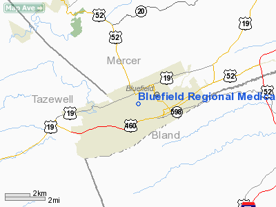
Bluefield Rgnl Medical Center Heliport |
Location & QuickFacts
| FAA Information Effective: | 2008-09-25 |
| Airport Identifier: | WV69 |
| Airport Status: | Operational |
| Longitude/Latitude: | 081-14-10.0000W/37-15-20.0000N
-81.236111/37.255556 (Estimated) |
| Elevation: | 2555 ft / 778.76 m (Estimated) |
| Land: | 0 acres |
| From nearest city: | 0 nautical miles N of Bluefield, WV |
| Location: | Mercer County, WV |
| Magnetic Variation: | 06W (1995) |
Owner & Manager
| Ownership: | Privately owned |
| Owner: | Bluefield |
| Address: | 500 Cherry St
Bluefield, WV 24701 |
| Phone number: | 304-327-1115 |
| Manager: | Roscoe Warner |
| Address: | 500 Cherry St
Bluefield, WV 24701 |
| Phone number: | 304-327-1115 |
Airport Operations and Facilities
| Airport Use: | Private
MEDICAL USE. |
| Wind indicator: | Yes |
| Segmented Circle: | No |
| Control Tower: | No |
| Lighting Schedule: | DUSK-DAWN |
| Sectional chart: | Cincinnati |
| Region: | AEA - Eastern |
| Boundary ARTCC: | ZID - Indianapolis |
| Tie-in FSS: | EKN - Elkins |
| FSS Toll Free: | 1-800-WX-BRIEF |
Runway Information
Helipad H1
| Dimension: | 20 x 20 ft / 6.1 x 6.1 m |
| Surface: | CONC, |
| |
Runway H1 |
Runway |
| Traffic Pattern: | Left | Left |
|
Radio Navigation Aids
| ID |
Type |
Name |
Ch |
Freq |
Var |
Dist |
| MK | NDB | Suzze | | 335.00 | 06W | 20.2 nm |
| HLX | NDB | Hillsville | | 269.00 | 06W | 35.7 nm |
| TEC | NDB | Tech | | 368.00 | 06W | 39.9 nm |
| GTC | NDB | Guyandot | | 293.00 | 03W | 45.1 nm |
| VJ | NDB | Whine | | 236.00 | 05W | 46.4 nm |
| LW | NDB | Bushi | | 346.00 | 06W | 48.4 nm |
| JU | NDB | Ashee | | 410.00 | 07W | 49.6 nm |
| RNL | VOR | Rainelle | | 116.60 | 04W | 47.9 nm |
| GZG | VOR/DME | Glade Spring | 039X | 110.20 | 02W | 48.0 nm |
| BLF | VORTAC | Bluefield | 037X | 110.00 | 03W | 3.7 nm |
| PSK | VORTAC | Pulaski | 115X | 116.80 | 06W | 27.0 nm |
| BKW | VORTAC | Beckley | 124X | 117.70 | 06W | 32.0 nm |
Remarks
- PRVDD NO IFR OPNS; CLEAR 8:1 INGRESS/EGRESS; PROVISION MADE FOR PERSONS & PROPERTY ON GND; APPROPRIATE INGRESS/EGRESS MARKINGS ON PAD.
Images and information placed above are from
http://www.airport-data.com/airport/WV69/
We thank them for the data!
| General Info
|
| Country |
United States
|
| State |
WEST VIRGINIA
|
| FAA ID |
WV34
|
| Latitude |
37-15-16.422N
|
| Longitude |
081-14-01.352W
|
| Elevation |
2500 feet
|
| Near City |
BLUEFIELD
|
We don't guarantee the information is fresh and accurate. The data may
be wrong or outdated.
For more up-to-date information please refer to other sources.
|
|


