 |
|
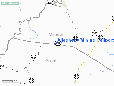
Allegheny Mining Heliport |
Location & QuickFacts
| FAA Information Effective: | 2008-09-25 |
| Airport Identifier: | WV24 |
| Airport Status: | Operational |
| Longitude/Latitude: | 079-10-18.1280W/39-19-09.3650N
-79.171702/39.319268 (Estimated) |
| Elevation: | 2650 ft / 807.72 m (Estimated) |
| Land: | 0 acres |
| From nearest city: | 2 nautical miles SW of Hartmansville, WV |
| Location: | Mineral County, WV |
| Magnetic Variation: | 08W (1985) |
Owner & Manager
| Ownership: | Privately owned |
| Owner: | Thomas F. Streets |
| Address: | Rt 1
Elk Garden, WV 26717 |
| Manager: | Marston B. Hose |
| Address: | Po Box 232
Mount Storm, WV 26739 |
| Phone number: | 304-693-7621 |
Airport Operations and Facilities
| Airport Use: | Private |
| Wind indicator: | Yes |
| Segmented Circle: | No |
| Control Tower: | No |
| Lighting Schedule: | PHONE REQ
FOR RTG BCN, PHONE 304-693-7621 |
| Beacon Color: | Clear-Green (lighted land airport) |
| Landing fee charge: | No |
| Sectional chart: | Cincinnati |
| Region: | AEA - Eastern |
| Boundary ARTCC: | ZDC - Washington |
| Tie-in FSS: | EKN - Elkins |
| FSS on Airport: | No |
| FSS Toll Free: | 1-800-WX-BRIEF |
Runway Information
Helipad H1
| Dimension: | 600 x 600 ft / 182.9 x 182.9 m |
| Surface: | TURF, |
| |
Runway H1 |
Runway |
| Traffic Pattern: | Left | Left |
|
Radio Navigation Aids
| ID |
Type |
Name |
Ch |
Freq |
Var |
Dist |
| CBE | NDB | Cumberland | | 317.00 | 07W | 27.9 nm |
| RQY | NDB | Randolph County | | 284.00 | 07W | 41.0 nm |
| VV | NDB | Camor | | 299.00 | 08W | 43.0 nm |
| SYS | NDB | Stoystown | | 209.00 | 08W | 47.6 nm |
| LUA | NDB | Caverns | | 245.00 | 09W | 49.6 nm |
| ESL | VOR/DME | Kessel | 045X | 110.80 | 06W | 10.2 nm |
| GRV | VOR/DME | Grantsville | 070X | 112.30 | 06W | 19.8 nm |
| MGW | VORTAC | Morgantown | 053X | 111.60 | 05W | 35.0 nm |
| IHD | VORTAC | Indian Head | 019X | 108.20 | 06W | 40.3 nm |
| EKN | VORTAC | Elkins | 089X | 114.20 | 07W | 49.6 nm |
Images and information placed above are from
http://www.airport-data.com/airport/WV24/
We thank them for the data!
| General Info
|
| Country |
United States
|
| State |
WEST VIRGINIA
|
| FAA ID |
WV24
|
| Latitude |
39-19-09.365N
|
| Longitude |
079-10-18.128W
|
| Elevation |
2650 feet
|
| Near City |
HARTMANSVILLE
|
We don't guarantee the information is fresh and accurate. The data may
be wrong or outdated.
For more up-to-date information please refer to other sources.
|
|


