 |
|
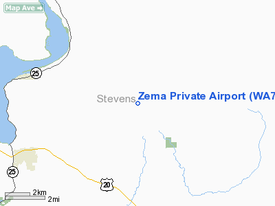
Location & QuickFacts
| FAA Information Effective: | 2008-09-25 |
| Airport Identifier: | WA72 |
| Airport Status: | Operational |
| Longitude/Latitude: | 117-56-17.5400W/48-38-40.8400N
-117.938206/48.644678 (Estimated) |
| Elevation: | 1854 ft / 565.10 m () |
| Land: | 9 acres |
| From nearest city: | 6 nautical miles NW of Colville, WA |
| Location: | Adams County, WA |
| Magnetic Variation: | 18E (2000) |
Owner & Manager
| Ownership: | Privately owned |
| Owner: | Monte L. Zema |
| Address: | 769a Williams Lk Rd
Colville, WA 99114 |
| Phone number: | 509-684-2601 |
| Manager: | Monte L. Zema |
| Address: | 769a Williams Lk Rd
Colville, WA 99114 |
| Phone number: | 509-684-2601 |
Airport Operations and Facilities
| Airport Use: | Private |
| Wind indicator: | Yes |
| Segmented Circle: | No |
| Control Tower: | No |
| Sectional chart: | Seattle |
| Region: | ANM - Northwest Mountain |
| Boundary ARTCC: | ZSE - Seattle |
| Tie-in FSS: | SEA - Seattle |
| FSS Toll Free: | 1-800-WX-BRIEF |
Runway Information
Runway 07/25
| Dimension: | 2600 x 75 ft / 792.5 x 22.9 m |
| Surface: | TURF-DIRT, Fair Condition |
| |
Runway 07 |
Runway 25 |
| Traffic Pattern: | Left | Left |
| Obstruction: | 4 ft fence | 50 ft pline, 10.0 ft from runway |
|
Radio Navigation Aids
| ID |
Type |
Name |
Ch |
Freq |
Var |
Dist |
| ION | NDB | Ione | | 379.00 | 21E | 21.2 nm |
| EF | NDB | Champion | | 206.00 | 20E | 38.7 nm |
| YK | NDB | Brilliant | | 269.00 | 20E | 42.6 nm |
| DPY | NDB | Deer Park | | 216.00 | 19E | 45.5 nm |
Remarks
Images and information placed above are from
http://www.airport-data.com/airport/WA72/
We thank them for the data!
|
|


