 |
|
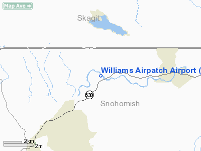
Williams Airpatch Airport |
Location & QuickFacts
| FAA Information Effective: | 2008-09-25 |
| Airport Identifier: | 89WA |
| Airport Status: | Operational |
| Longitude/Latitude: | 122-01-09.5040W/48-16-14.3720N
-122.019307/48.270659 (Estimated) |
| Elevation: | 130 ft / 39.62 m (Estimated) |
| Land: | 5 acres |
| From nearest city: | 6 nautical miles NE of Arlington, WA |
| Location: | Snohomish County, WA |
| Magnetic Variation: | 21E (1985) |
Owner & Manager
| Ownership: | Privately owned |
| Owner: | John W. Williams |
| Address: | 15529 300th St Ne
Arlington, WA 98223 |
| Phone number: | 206-435-9877 |
| Manager: | John W. Williams |
| Address: | 15529 300th St Ne
Arlington, WA 98223 |
| Phone number: | 206-435-9877 |
Airport Operations and Facilities
| Airport Use: | Private |
| Wind indicator: | Yes |
| Segmented Circle: | No |
| Control Tower: | No |
| Landing fee charge: | No |
| Sectional chart: | Seattle |
| Region: | ANM - Northwest Mountain |
| Boundary ARTCC: | ZSE - Seattle |
| Tie-in FSS: | SEA - Seattle |
| FSS on Airport: | No |
| FSS Toll Free: | 1-800-WX-BRIEF |
Runway Information
Runway 18/36
| Dimension: | 1400 x 70 ft / 426.7 x 21.3 m |
| Surface: | TURF, |
| |
Runway 18 |
Runway 36 |
| Traffic Pattern: | Left | Left |
|
Radio Navigation Aids
| ID |
Type |
Name |
Ch |
Freq |
Var |
Dist |
| BVS | NDB | Skagit/bay View | | 240.00 | 21E | 19.9 nm |
| OPZ | NDB | Lopez Island | | 356.00 | 21E | 38.1 nm |
| FHR | NDB | Friday Harbor | | 284.00 | 20E | 43.1 nm |
| LU | NDB | Cultus | | 214.00 | 22E | 45.1 nm |
| RNT | NDB | Renton | | 353.00 | 20E | 47.3 nm |
| XX | NDB | Abbotsford | | 344.00 | 21E | 48.5 nm |
| NUW | TACAN | Whidbey Island | 085X | | 21E | 26.2 nm |
| PAE | VOR/DME | Paine | 043X | 110.60 | 20E | 23.5 nm |
| CVV | VOR/DME | Penn Cove | 119X | 117.20 | 19E | 28.3 nm |
| HUH | VORTAC | Whatcom | 077X | 113.00 | 20E | 46.3 nm |
| BFI | VOT | Boeing Field | | 108.60 | | 46.1 nm |
Images and information placed above are from
http://www.airport-data.com/airport/89WA/
We thank them for the data!
| General Info
|
| Country |
United States
|
| State |
WASHINGTON
|
| FAA ID |
89WA
|
| Latitude |
48-16-14.372N
|
| Longitude |
122-01-09.504W
|
| Elevation |
130 feet
|
| Near City |
ARLINGTON
|
We don't guarantee the information is fresh and accurate. The data may
be wrong or outdated.
For more up-to-date information please refer to other sources.
|
|


