 |
|
Location & QuickFacts
| FAA Information Effective: | 2008-09-25 |
| Airport Identifier: | 01WA |
| Airport Status: | Operational |
| Longitude/Latitude: | 123-48-43.5820W/46-39-47.3570N
-123.812106/46.663155 (Estimated) |
| Elevation: | 154 ft / 46.94 m (Estimated) |
| Land: | 0 acres |
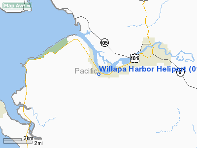
| From nearest city: | 0 nautical miles N of South Bend, WA |
| Location: | Pacific County, WA |
| Magnetic Variation: | 20E (1985) |
Owner & Manager
| Ownership: | Publicly owned |
| Owner: | Willapa Harbor Hospital |
| Address: | Alder & Cedar Streets
South Bend, WA 98586 |
| Phone number: | 206-875-5526 |
| Manager: | Victor Vanderdoes |
| Address: | Alder & Cedar St., Po/box 438
South Bend, WA 98586 |
| Phone number: | 206-875-5526 |
Airport Operations and Facilities
| Airport Use: | Private
MEDICAL USE. |
| Wind indicator: | Yes |
| Segmented Circle: | No |
| Control Tower: | No |
| Landing fee charge: | No |
| Sectional chart: | Seattle |
| Region: | ANM - Northwest Mountain |
| Boundary ARTCC: | ZSE - Seattle |
| Tie-in FSS: | SEA - Seattle |
| FSS on Airport: | No |
| FSS Toll Free: | 1-800-WX-BRIEF |
Runway Information
Helipad H1
| Dimension: | 36 x 36 ft / 11.0 x 11.0 m |
| Surface: | CONC, |
| |
Runway H1 |
Runway |
| Traffic Pattern: | Left | Left |
|
Radio Navigation Aids
| ID |
Type |
Name |
Ch |
Freq |
Var |
Dist |
| AST | FAN MARKER | Fort Stevens | | | 22E | 28.1 nm |
| PEN | NDB | Karpen | | 201.00 | 20E | 32.8 nm |
| TDO | NDB | Toledo | | 219.00 | 20E | 42.6 nm |
| MNC | NDB | Mason County | | 348.00 | 19E | 46.1 nm |
| LSO | NDB | Kelso | | 256.00 | 21E | 48.2 nm |
| AST | VOR/DME | Astoria | 087X | 114.00 | 19E | 30.3 nm |
| HQM | VORTAC | Hoquiam | 124X | 117.70 | 19E | 22.0 nm |
| OLM | VORTAC | Olympia | 081X | 113.40 | 19E | 41.8 nm |
Remarks
Images and information placed above are from
http://www.airport-data.com/airport/01WA/
We thank them for the data!
| General Info
|
| Country |
United States
|
| State |
WASHINGTON
|
| FAA ID |
01WA
|
| Latitude |
46-39-47.357N
|
| Longitude |
123-48-43.582W
|
| Elevation |
154 feet
|
| Near City |
SOUTH BEND
|
We don't guarantee the information is fresh and accurate. The data may
be wrong or outdated.
For more up-to-date information please refer to other sources.
|
|


