 |
|
Location & QuickFacts
| FAA Information Effective: | 2008-09-25 |
| Airport Identifier: | 55WA |
| Airport Status: | Operational |
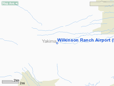
| Longitude/Latitude: | 120-45-41.0000W/46-31-41.0000N
-120.761389/46.528056 (Estimated) |
| Elevation: | 1670 ft / 509.02 m (Estimated) |
| Land: | 4 acres |
| From nearest city: | 11 nautical miles E of Yakima, WA |
| Location: | Yakima County, WA |
| Magnetic Variation: | 19E (1995) |
Owner & Manager
| Ownership: | Privately owned |
| Owner: | Russell Wilkinson |
| Address: | 710 Lynch Lane
Yakima, WA 98903 |
| Phone number: | 509-965-4240 |
| Manager: | Russell Wilkinson |
| Address: | 710 Lynch Lane
Yakima, WA 98903 |
| Phone number: | 509-966-8525 |
Airport Operations and Facilities
| Airport Use: | Private |
| Segmented Circle: | No |
| Control Tower: | No |
| Sectional chart: | Seattle |
| Region: | ANM - Northwest Mountain |
| Boundary ARTCC: | ZSE - Seattle |
| Tie-in FSS: | SEA - Seattle |
| FSS on Airport: | No |
| FSS Toll Free: | 1-800-WX-BRIEF |
Runway Information
Runway 11/29
| Dimension: | 2050 x 30 ft / 624.8 x 9.1 m |
| Surface: | TURF,
SFC IS SOFT & ROUGH AT TIMES. |
| |
Runway 11 |
Runway 29 |
| Traffic Pattern: | Left | Left |
|
Radio Navigation Aids
| ID |
Type |
Name |
Ch |
Freq |
Var |
Dist |
| YKM | VORTAC | Yakima | 107X | 116.00 | 21E | 13.3 nm |
| ELN | VORTAC | Ellensburg | 126X | 117.90 | 21E | 32.3 nm |
Images and information placed above are from
http://www.airport-data.com/airport/55WA/
We thank them for the data!
| General Info
|
| Country |
United States
|
| State |
WASHINGTON
|
| FAA ID |
55WA
|
| Latitude |
46-31-41.000N
|
| Longitude |
120-45-41.000W
|
| Elevation |
1670 feet
|
| Near City |
YAKIMA
|
We don't guarantee the information is fresh and accurate. The data may
be wrong or outdated.
For more up-to-date information please refer to other sources.
|
|


