 |
|
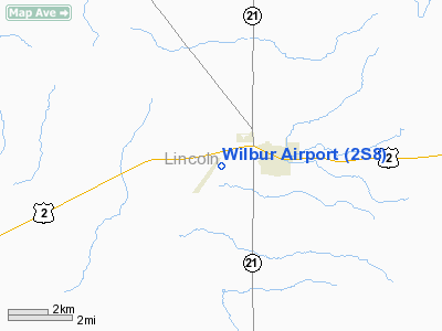
Location & QuickFacts
| FAA Information Effective: | 2008-09-25 |
| Airport Identifier: | 2S8 |
| Airport Status: | Operational |
| Longitude/Latitude: | 118-44-35.0570W/47-45-15.1900N
-118.743071/47.754219 (Estimated) |
| Elevation: | 2182 ft / 665.07 m (Estimated) |
| Land: | 42 acres |
| From nearest city: | 2 nautical miles SW of Wilbur, WA |
| Location: | Lincoln County, WA |
| Magnetic Variation: | 20E (1985) |
Owner & Manager
| Ownership: | Publicly owned |
| Owner: | City Of Wilbur |
| Address: | Po Box 214
Wilbur, WA 99185 |
| Phone number: | 509-647-5821 |
| Manager: | Greg Leyva |
| Address: | Po Box 87
Wilbur, WA 99185 |
| Phone number: | 509-647-2441 |
Airport Operations and Facilities
| Airport Use: | Open to public |
| Wind indicator: | Yes |
| Segmented Circle: | No |
| Control Tower: | No |
| Lighting Schedule: | RDO-CTL
ACTVT ROTG BCN - CTAF. |
| Beacon Color: | Clear-Green (lighted land airport) |
| Landing fee charge: | No |
| Sectional chart: | Seattle |
| Region: | ANM - Northwest Mountain |
| Boundary ARTCC: | ZSE - Seattle |
| Tie-in FSS: | SEA - Seattle |
| FSS on Airport: | No |
| FSS Toll Free: | 1-800-WX-BRIEF |
| NOTAMs Facility: | SEA (NOTAM-d service avaliable) |
| Federal Agreements: | N |
Airport Communications
Airport Services
| Fuel available: | 100LLA |
| Airframe Repair: | NONE |
| Power Plant Repair: | NONE |
| Bottled Oxygen: | NONE |
| Bulk Oxygen: | NONE |
Runway Information
Runway 02/20
| Dimension: | 3119 x 35 ft / 950.7 x 10.7 m |
| Surface: | ASPH, Good Condition |
| Edge Lights: | Medium |
| |
Runway 02 |
Runway 20 |
| Longitude: | 118-44-48.5802W | 118-44-21.5320W |
| Latitude: | 47-45-02.7910N | 47-45-27.5881N |
| Traffic Pattern: | Left | Left |
| Markings: | Basic, Good Condition | Basic, Fair Condition |
|
Radio Navigation Aids
| ID |
Type |
Name |
Ch |
Freq |
Var |
Dist |
| MW | NDB | Pelly | | 408.00 | 18E | 44.0 nm |
| SKA | TACAN | Fairchild | 051X | | 19E | 44.6 nm |
| MWH | VOR/DME | Moses Lake | 097X | 115.00 | 18E | 40.1 nm |
| EPH | VORTAC | Ephrata | 073X | 112.60 | 21E | 35.7 nm |
| GEG | VORTAC | Spokane | 102X | 115.50 | 21E | 46.6 nm |
| GEG | VOT | Spokane Intl | | 109.60 | | 49.3 nm |
Remarks
- HGR IN TRANSITION SFC.
- GRVL TWY NOT USEABLE.
- ACFT ON AGRICULTURAL RAMP, NE SIDE OF ARPT PARKED IN PRIMARY SURFACE.
- ESTABD PRIOR TO 15 MAY 1959.
Images and information placed above are from
http://www.airport-data.com/airport/2S8/
We thank them for the data!
| General Info
|
| Country |
United States
|
| State |
WASHINGTON
|
| FAA ID |
2S8
|
| Latitude |
47-45-11.543N
|
| Longitude |
118-44-38.017W
|
| Elevation |
2178 feet
|
| Near City |
WILBUR
|
We don't guarantee the information is fresh and accurate. The data may
be wrong or outdated.
For more up-to-date information please refer to other sources.
|
|


