 |
|
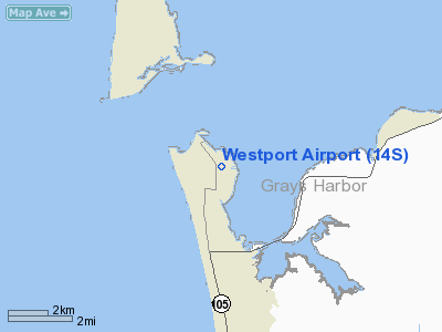
Location & QuickFacts
| FAA Information Effective: | 2008-09-25 |
| Airport Identifier: | 14S |
| Airport Status: | Operational |
| Longitude/Latitude: | 124-06-02.6830W/46-53-49.0230N
-124.100745/46.896951 (Estimated) |
| Elevation: | 14 ft / 4.27 m (Estimated) |
| Land: | 30 acres |
| From nearest city: | 1 nautical miles N of Westport, WA |
| Location: | Grays Harbor County, WA |
| Magnetic Variation: | 20E (1985) |
Owner & Manager
| Ownership: | Publicly owned |
| Owner: | City Of Westport |
| Address: | 740 North Montesano Street, Po Box 505
Westport, WA 98595 |
| Phone number: | 360-268-0131 |
| Manager: | Randy Lewis, City Administrator
RANDY LEWIS IS THE CITY ADMINISTRATOR. |
| Address: | 740 North Montesano Street, Po Box 505
Westport, WA 98595 |
| Phone number: | 360-268-0131
OR 360-268-0835. |
Airport Operations and Facilities
| Airport Use: | Open to public |
| Wind indicator: | Yes |
| Segmented Circle: | Yes |
| Control Tower: | No |
| Lighting Schedule: | DUSK-DAWN |
| Landing fee charge: | No |
| Sectional chart: | Seattle |
| Region: | ANM - Northwest Mountain |
| Boundary ARTCC: | ZSE - Seattle |
| Tie-in FSS: | SEA - Seattle |
| FSS on Airport: | No |
| FSS Toll Free: | 1-800-WX-BRIEF |
| NOTAMs Facility: | SEA (NOTAM-d service avaliable) |
Airport Communications
Airport Services
| Airframe Repair: | NONE |
| Power Plant Repair: | NONE |
| Bottled Oxygen: | NONE |
| Bulk Oxygen: | NONE |
Runway Information
Runway 12/30
| Dimension: | 2318 x 50 ft / 706.5 x 15.2 m |
| Surface: | ASPH, Good Condition
SOFT SHOULDERS. |
| Edge Lights: | Medium |
| |
Runway 12 |
Runway 30 |
| Longitude: | 124-06-14.1250W | 124-05-51.2420W |
| Latitude: | 46-53-57.3480N | 46-53-40.6970N |
| Elevation: | 6.00 ft | 8.00 ft |
| Alignment: | 127 | 127 |
| Traffic Pattern: | Left | Right |
| Markings: | Basic, Fair Condition | Basic, Fair Condition |
| VASI: | 2-box on left side | 2-box on left side |
|
Radio Navigation Aids
| ID |
Type |
Name |
Ch |
Freq |
Var |
Dist |
| AST | FAN MARKER | Fort Stevens | | | 22E | 41.8 nm |
| MNC | NDB | Mason County | | 348.00 | 19E | 46.6 nm |
| AST | VOR/DME | Astoria | 087X | 114.00 | 19E | 45.1 nm |
| HQM | VORTAC | Hoquiam | 124X | 117.70 | 19E | 3.6 nm |
| OLM | VORTAC | Olympia | 081X | 113.40 | 19E | 49.4 nm |
Remarks
- LARGE BIRD NESTING AREA ADJ TO RY 12/30.
- ESTABD PRIOR TO MAY 15 1959.
Images and information placed above are from
http://www.airport-data.com/airport/14S/
We thank them for the data!
| General Info
|
| Country |
United States
|
| State |
WASHINGTON
|
| FAA ID |
14S
|
| Latitude |
46-53-50.324N
|
| Longitude |
124-06-02.619W
|
| Elevation |
6 feet
|
| Near City |
WESTPORT
|
We don't guarantee the information is fresh and accurate. The data may
be wrong or outdated.
For more up-to-date information please refer to other sources.
|
|


