 |
|
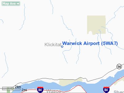
Location & QuickFacts
| FAA Information Effective: | 2008-09-25 |
| Airport Identifier: | 5WA7 |
| Airport Status: | Operational |
| Longitude/Latitude: | 120-59-04.2440W/45-42-59.4410N
-120.984512/45.716511 (Estimated) |
| Elevation: | 1620 ft / 493.78 m (Estimated) |
| Land: | 80 acres |
| From nearest city: | 4 nautical miles SW of Centerville, WA |
| Location: | Klickitat County, WA |
| Magnetic Variation: | 18E (1995) |
Owner & Manager
| Ownership: | Privately owned |
| Owner: | Eugene A & Patricia A Huse |
| Address: | 2203 Se 105th Court
Vancouverwa 98664-5331 |
| Phone number: | 360-693-1182 |
| Manager: | Eugene A Huse |
| Address: | 2203 Se 105th Court
Vancouver, WA 98664-5331 |
| Phone number: | 360-693-1182 |
Airport Operations and Facilities
| Airport Use: | Private |
| Wind indicator: | Yes |
| Segmented Circle: | No |
| Control Tower: | No |
| Sectional chart: | Seattle |
| Region: | ANM - Northwest Mountain |
| Boundary ARTCC: | ZSE - Seattle |
| Tie-in FSS: | SEA - Seattle |
| FSS on Airport: | No |
| FSS Toll Free: | 1-800-WX-BRIEF |
Runway Information
Runway 07/25
| Dimension: | 2300 x 80 ft / 701.0 x 24.4 m |
| Surface: | TURF, |
| |
Runway 07 |
Runway 25 |
| Traffic Pattern: | Left | Left |
| Obstruction: | 30 ft pline, 30.0 ft from runway | 60 ft fence, 400.0 ft from runway |
|
Radio Navigation Aids
| ID |
Type |
Name |
Ch |
Freq |
Var |
Dist |
| LTJ | VOR/DME | Klickitat | 070X | 112.30 | 21E | 4.9 nm |
Remarks
- RY 07/25 SOFT AFTER HEAVY RAIN OR THAWING.
Images and information placed above are from
http://www.airport-data.com/airport/5WA7/
We thank them for the data!
| General Info
|
| Country |
United States
|
| State |
WASHINGTON
|
| FAA ID |
5WA7
|
| Latitude |
45-42-59.441N
|
| Longitude |
120-59-04.244W
|
| Elevation |
1620 feet
|
| Near City |
CENTERVILLE
|
We don't guarantee the information is fresh and accurate. The data may
be wrong or outdated.
For more up-to-date information please refer to other sources.
|
|


