 |
|
Location & QuickFacts
| FAA Information Effective: | 2008-09-25 |
| Airport Identifier: | 0WA5 |
| Airport Status: | Operational |
| Longitude/Latitude: | 122-17-18.5600W/48-22-45.4400N
-122.288489/48.379289 (Estimated) |
| Elevation: | 750 ft / 228.60 m (Estimated) |
| Land: | 1 acres |
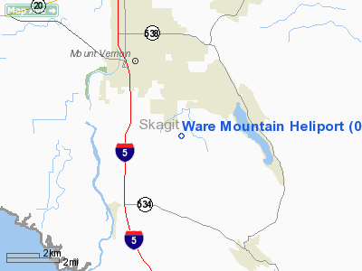
| From nearest city: | 0 nautical miles of Mount Vernon, WA |
| Location: | Skagit County, WA |
| Magnetic Variation: | () |
Owner & Manager
| Ownership: | Privately owned |
| Owner: | G.p. Ware |
| Address: | 18340 Osprey Ct.
Mr. Vernon, WA 98274 |
| Phone number: | 360-424-4422 |
| Manager: | Kevin E. Ware |
| Address: | 18419 Peregrine Lane
Mt. Vernon, WA 98274 |
| Phone number: | 360-848-1551 |
Airport Operations and Facilities
| Airport Use: | Private |
| Control Tower: | No |
| Sectional chart: | Seattle |
| Region: | ANM - Northwest Mountain |
| Boundary ARTCC: | ZSE - Seattle |
| Tie-in FSS: | SEA - Seattle |
| FSS Toll Free: | 1-800-WX-BRIEF |
Runway Information
Helipad H1
| Dimension: | 24 x 12 ft / 7.3 x 3.7 m |
| Surface: | CONC, |
| |
Runway H1 |
Runway |
| Traffic Pattern: | Left | Left |
|
Helipad H2
| Dimension: | 24 x 12 ft / 7.3 x 3.7 m |
| Surface: | TURF, |
| |
Runway H2 |
Runway |
| Traffic Pattern: | Left | Left |
|
Radio Navigation Aids
| ID |
Type |
Name |
Ch |
Freq |
Var |
Dist |
| BVS | NDB | Skagit/bay View | | 240.00 | 21E | 7.5 nm |
| OPZ | NDB | Lopez Island | | 356.00 | 21E | 25.9 nm |
| FHR | NDB | Friday Harbor | | 284.00 | 20E | 30.8 nm |
| XX | NDB | Abbotsford | | 344.00 | 21E | 39.0 nm |
| LU | NDB | Cultus | | 214.00 | 22E | 39.7 nm |
| WC | NDB | White Rock | | 332.00 | 21E | 41.5 nm |
| YJ | NDB | Victoria | | 200.00 | 21E | 47.0 nm |
| AP | NDB | Active Pass | | 378.00 | 21E | 49.7 nm |
| NUW | TACAN | Whidbey Island | 085X | | 21E | 15.0 nm |
| CVV | VOR/DME | Penn Cove | 119X | 117.20 | 19E | 19.2 nm |
| PAE | VOR/DME | Paine | 043X | 110.60 | 20E | 27.6 nm |
| HUH | VORTAC | Whatcom | 077X | 113.00 | 20E | 35.9 nm |
Remarks
Images and information placed above are from
http://www.airport-data.com/airport/0WA5/
We thank them for the data!
| General Info
|
| Country |
United States
|
| State |
WASHINGTON
|
| FAA ID |
0WA5
|
| Latitude |
46-53-30.367N
|
| Longitude |
122-22-50.418W
|
| Elevation |
750 feet
|
| Near City |
EATONVILLE
|
We don't guarantee the information is fresh and accurate. The data may
be wrong or outdated.
For more up-to-date information please refer to other sources.
|
|


