 |
|
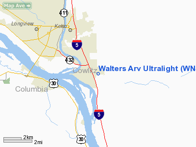
Walters Arv Ultralight Airport |
Location & QuickFacts
| FAA Information Effective: | 2008-09-25 |
| Airport Identifier: | WN80 |
| Airport Status: | Operational |
| Longitude/Latitude: | 122-51-55.3930W/46-05-52.4070N
-122.865387/46.097891 (Estimated) |
| Elevation: | 475 ft / 144.78 m (Estimated) |
| Land: | 0 acres |
| From nearest city: | 5 nautical miles SE of Kelso, WA |
| Location: | Cowlitz County, WA |
| Magnetic Variation: | 20E (1985) |
Owner & Manager
| Ownership: | Privately owned |
| Owner: | Leonard W. Walters |
| Address: | 285 Pare Road
Kelso, WA 98626 |
| Phone number: | 206-636-2483 |
| Address: |
|
Airport Operations and Facilities
| Airport Use: | Private |
| Segmented Circle: | No |
| Control Tower: | No |
| Landing fee charge: | No |
| Sectional chart: | Seattle |
| Region: | ANM - Northwest Mountain |
| Boundary ARTCC: | ZSE - Seattle |
| Tie-in FSS: | SEA - Seattle |
| FSS on Airport: | No |
| FSS Toll Free: | 1-800-WX-BRIEF |
Runway Information
Runway E/W
| Dimension: | 500 x 100 ft / 152.4 x 30.5 m |
| Surface: | TURF, |
| |
Runway E |
Runway W |
| Traffic Pattern: | Left | Left |
| Obstruction: | 20 ft trees, 200.0 ft from runway | |
|
Radio Navigation Aids
| ID |
Type |
Name |
Ch |
Freq |
Var |
Dist |
| AST | FAN MARKER | Fort Stevens | | | 22E | 46.3 nm |
| LSO | NDB | Kelso | | 256.00 | 21E | 4.0 nm |
| TDO | NDB | Toledo | | 219.00 | 20E | 22.8 nm |
| PND | NDB | Banks | | 356.00 | 21E | 29.1 nm |
| PEN | NDB | Karpen | | 201.00 | 20E | 30.2 nm |
| LBH | NDB | Laker | | 332.00 | 20E | 37.5 nm |
| CBU | TACAN | Columbia | 029X | | 20E | 32.4 nm |
| PDX | VOR/DME | Portland | 055X | 111.80 | 20E | 32.2 nm |
| AST | VOR/DME | Astoria | 087X | 114.00 | 19E | 42.5 nm |
| UBG | VOR/DME | Newberg | 121X | 117.40 | 21E | 45.0 nm |
| BTG | VORTAC | Battle Ground | 113X | 116.60 | 21E | 24.0 nm |
| PDX | VOT | Portland Intl | | 111.00 | | 32.0 nm |
| HIO | VOT | Portland-hillsboro | | 115.20 | | 33.7 nm |
Remarks
- ALL OPERATIONS REMAIN TO THE SOUTH OF THE RY.
Images and information placed above are from
http://www.airport-data.com/airport/WN80/
We thank them for the data!
| General Info
|
| Country |
United States
|
| State |
WASHINGTON
|
| FAA ID |
WN80
|
| Latitude |
46-05-52.407N
|
| Longitude |
122-51-55.393W
|
| Elevation |
475 feet
|
| Near City |
KELSO
|
We don't guarantee the information is fresh and accurate. The data may
be wrong or outdated.
For more up-to-date information please refer to other sources.
|
|


