 |
|
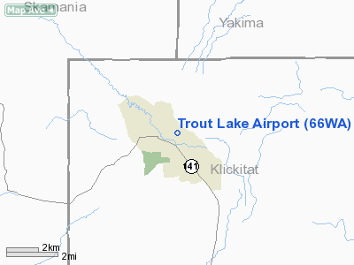
Location & QuickFacts
| FAA Information Effective: | 2008-09-25 |
| Airport Identifier: | 66WA |
| Airport Status: | Operational |
| Longitude/Latitude: | 121-31-24.2920W/46-00-08.4340N
-121.523414/46.002343 (Estimated) |
| Elevation: | 1914 ft / 583.39 m (Surveyed) |
| Land: | 0 acres |
| From nearest city: | 1 nautical miles NE of Trout Lake, WA |
| Location: | Klickitat County, WA |
| Magnetic Variation: | 19E (1985) |
Owner & Manager
| Ownership: | Privately owned |
| Owner: | Mt. Adams Lumber Co., Inc. |
| Address: | Po Box 40
Trout Lake, WA 98650 |
| Phone number: | 509-395-2122 |
| Manager: | George E Woodruff |
| Address: | Po Box 40
Trout Lake, WA 98650 |
| Phone number: | 509-395-2122 |
Airport Operations and Facilities
| Airport Use: | Private |
| Wind indicator: | Yes |
| Segmented Circle: | No |
| Control Tower: | No |
| Landing fee charge: | No |
| Sectional chart: | Seattle |
| Region: | ANM - Northwest Mountain |
| Boundary ARTCC: | ZSE - Seattle |
| Tie-in FSS: | SEA - Seattle |
| FSS on Airport: | No |
| FSS Toll Free: | 1-800-WX-BRIEF |
Runway Information
Runway 07/25
| Dimension: | 1800 x 60 ft / 548.6 x 18.3 m |
| Surface: | TURF, |
| |
Runway 07 |
Runway 25 |
| Traffic Pattern: | Left | Left |
|
Radio Navigation Aids
| ID |
Type |
Name |
Ch |
Freq |
Var |
Dist |
| LBH | NDB | Laker | | 332.00 | 20E | 48.1 nm |
| LTJ | VOR/DME | Klickitat | 070X | 112.30 | 21E | 24.8 nm |
| BTG | VORTAC | Battle Ground | 113X | 116.60 | 21E | 47.2 nm |
Remarks
- RWY 07/25 SLOPES UP TOWARD WEST 20 FEET.
- ROUGH SPOTS IN RWY 07/25.
Images and information placed above are from
http://www.airport-data.com/airport/66WA/
We thank them for the data!
| General Info
|
| Country |
United States
|
| State |
WASHINGTON
|
| FAA ID |
66WA
|
| Latitude |
46-00-08.434N
|
| Longitude |
121-31-24.292W
|
| Elevation |
1914 feet
|
| Near City |
TROUT LAKE
|
We don't guarantee the information is fresh and accurate. The data may
be wrong or outdated.
For more up-to-date information please refer to other sources.
|
|


