 |
|
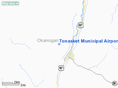
Location & QuickFacts
| FAA Information Effective: | 2008-09-25 |
| Airport Identifier: | W01 |
| Airport Status: | Operational |
| Longitude/Latitude: | 119-27-56.2850W/48-43-29.5260N
-119.465635/48.724868 (Estimated) |
| Elevation: | 1311 ft / 399.59 m (Estimated) |
| Land: | 100 acres |
| From nearest city: | 2 nautical miles NW of Tonasket, WA |
| Location: | Okanogan County, WA |
| Magnetic Variation: | 20E (1985) |
Owner & Manager
| Ownership: | Publicly owned |
| Owner: | Town Of Tonasket |
| Address: | Po Box 487
Tonasket, WA 98855 |
| Phone number: | 509-486-2132 |
| Manager: | Bill Pilkinton |
| Address: | Po Box 487
Tonasket, WA 98855 |
| Phone number: | 509-486-2617 |
Airport Operations and Facilities
| Airport Use: | Open to public |
| Wind indicator: | Yes |
| Segmented Circle: | Yes |
| Control Tower: | No |
| Lighting Schedule: | RDO-CTL
ACTIVATE MIRL RY 15/33 - CTAF. |
| Beacon Color: | Clear-Green (lighted land airport) |
| Sectional chart: | Seattle |
| Region: | ANM - Northwest Mountain |
| Boundary ARTCC: | ZSE - Seattle |
| Tie-in FSS: | SEA - Seattle |
| FSS on Airport: | No |
| FSS Toll Free: | 1-800-WX-BRIEF |
| NOTAMs Facility: | SEA (NOTAM-d service avaliable) |
Airport Communications
Airport Services
Runway Information
Runway 15/33
| Dimension: | 3053 x 50 ft / 930.6 x 15.2 m |
| Surface: | ASPH, Good Condition
SETTLING & RAVELLING AT ENDS & ALONG SIDES. |
| Edge Lights: | Medium |
| |
Runway 15 |
Runway 33 |
| Longitude: | 119-28-03.1600W | 119-27-49.4120W |
| Latitude: | 48-43-43.8860N | 48-43-15.1660N |
| Traffic Pattern: | Right | Left |
| Markings: | Basic, Fair Condition | Basic, Fair Condition |
| Crossing Height: | 37.00 ft | 31.00 ft |
| VASI: | 2-light PAPI on left side | 2-light PAPI on left side |
| Visual Glide Angle: | 5.00° | 4.50° |
| Obstruction: | 17 ft gnd, 562.0 ft from runway, 21:1 slope to clear | 5 ft fence, 369.0 ft from runway, 118 ft left of centerline, 33:1 slope to clear |
|
Radio Navigation Aids
| ID |
Type |
Name |
Ch |
Freq |
Var |
Dist |
| OMK | NDB | Omak | | 219.00 | 19E | 16.4 nm |
| ON | NDB | Okanagan | | 356.00 | 20E | 37.4 nm |
| YYF | NDB | Penticton | | 290.00 | 21E | 46.2 nm |
Remarks
- MOUNTAINS SURROUND AIRPORT.
- DISTANCE TO GO MARKERS SOUTH SIDE AIRPORT.
- FOR NIGHT OPNS & WIND PERMITTING LAND RY 33 & DEPART RY 15.
Images and information placed above are from
http://www.airport-data.com/airport/W01/
We thank them for the data!
| General Info
|
| Country |
United States
|
| State |
WASHINGTON
|
| FAA ID |
W01
|
| Latitude |
48-43-27.547N
|
| Longitude |
119-27-55.223W
|
| Elevation |
1340 feet
|
| Near City |
TONASKET
|
We don't guarantee the information is fresh and accurate. The data may
be wrong or outdated.
For more up-to-date information please refer to other sources.
|
|


