 |
|
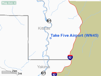
Location & QuickFacts
| FAA Information Effective: | 2008-09-25 |
| Airport Identifier: | WN45 |
| Airport Status: | Operational |
| Longitude/Latitude: | 120-26-39.2300W/46-46-50.4600N
-120.444231/46.780683 (Estimated) |
| Elevation: | 1543 ft / 470.31 m (Surveyed) |
| Land: | 30 acres |
| From nearest city: | 12 nautical miles N of Yakima, WA |
| Location: | Kittitas County, WA |
| Magnetic Variation: | () |
Owner & Manager
| Ownership: | Privately owned |
| Owner: | Otto Sieber |
| Address: | 470 Rosa View Dr
Yakima, WA 98901 |
| Phone number: | 509-457-0652 |
| Manager: | Otto Sieber |
| Address: | 470 Rosa View Dr
Yakima, WA 98901 |
| Phone number: | 509-457-0652 |
Airport Operations and Facilities
| Airport Use: | Private |
| Wind indicator: | Yes |
| Control Tower: | No |
| Sectional chart: | Seattle |
| Region: | ANM - Northwest Mountain |
| Boundary ARTCC: | ZSE - Seattle |
| Tie-in FSS: | SEA - Seattle |
| FSS Toll Free: | 1-800-WX-BRIEF |
Runway Information
Runway 06/24
| Dimension: | 2000 x 30 ft / 609.6 x 9.1 m |
| Surface: | ASPH, Good Condition |
| |
Runway 06 |
Runway 24 |
| Traffic Pattern: | Left | Left |
|
Radio Navigation Aids
| ID |
Type |
Name |
Ch |
Freq |
Var |
Dist |
| EAT | FAN MARKER | Malaga | | | 21E | 37.1 nm |
| EAT | VOR/DME | Wenatchee | 047X | 111.00 | 19E | 38.4 nm |
| YKM | VORTAC | Yakima | 107X | 116.00 | 21E | 12.6 nm |
| ELN | VORTAC | Ellensburg | 126X | 117.90 | 21E | 14.7 nm |
Images and information placed above are from
http://www.airport-data.com/airport/WN45/
We thank them for the data!
| General Info
|
| Country |
United States
|
| State |
WASHINGTON
|
| FAA ID |
WN45
|
| Latitude |
46-34-55.528N
|
| Longitude |
118-01-53.816W
|
| Elevation |
645 feet
|
| Near City |
STARBUCK
|
We don't guarantee the information is fresh and accurate. The data may
be wrong or outdated.
For more up-to-date information please refer to other sources.
|
|


