 |
|
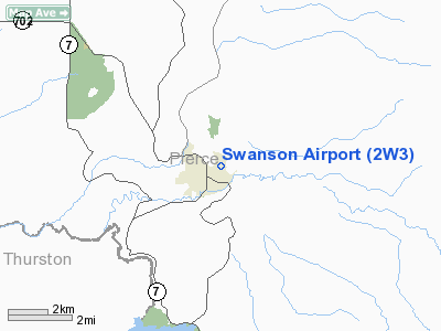
Location & QuickFacts
| FAA Information Effective: | 2008-09-25 |
| Airport Identifier: | 2W3 |
| Airport Status: | Operational |
| Longitude/Latitude: | 122-15-25.9740W/46-52-17.9210N
-122.257215/46.871645 (Estimated) |
| Elevation: | 843 ft / 256.95 m (Estimated) |
| Land: | 10 acres |
| From nearest city: | 1 nautical miles NE of Eatonville, WA |
| Location: | Pierce County, WA |
| Magnetic Variation: | 20E (1985) |
Owner & Manager
| Ownership: | Publicly owned |
| Owner: | Town Of Eatonville |
| Address: | Po Box 820
Eatonville, WA 98328 |
| Phone number: | 360-832-6215 |
| Manager: | H W Burlingame |
| Address: | Po Box 820
Eatonville, WA 98328 |
| Phone number: | 360-832-6215 |
Airport Operations and Facilities
| Airport Use: | Open to public |
| Wind indicator: | Yes |
| Segmented Circle: | No |
| Control Tower: | No |
| Lighting Schedule: | DUSK-0000
AFTER 0000, ACTVT MIRL RY 16/34 - CTAF. |
| Landing fee charge: | No |
| Sectional chart: | Seattle |
| Region: | ANM - Northwest Mountain |
| Traffic Pattern Alt: | 800 ft |
| Boundary ARTCC: | ZSE - Seattle |
| Tie-in FSS: | SEA - Seattle |
| FSS on Airport: | No |
| FSS Toll Free: | 1-800-WX-BRIEF |
| NOTAMs Facility: | SEA (NOTAM-d service avaliable) |
Airport Communications
Airport Services
| Airframe Repair: | NONE |
| Power Plant Repair: | NONE |
| Bottled Oxygen: | NONE |
| Bulk Oxygen: | NONE |
Runway Information
Runway 16/34
| Dimension: | 2990 x 36 ft / 911.4 x 11.0 m |
| Surface: | ASPH, Good Condition |
| Edge Lights: | Medium |
| |
Runway 16 |
Runway 34 |
| Traffic Pattern: | Right | Left |
| Markings: | Basic, Fair Condition
APRT NAME PAINTED IN CENTER OF RY. | Basic, Fair Condition |
| Obstruction: | 120 ft trees, 696.0 ft from runway, 4:1 slope to clear | 28 ft gnd, 330.0 ft from runway, 4:1 slope to clear
TREES +14 FT TO 70 FT FM 60 FT TO 200 FT FM THLD. |
|
Radio Navigation Aids
| ID |
Type |
Name |
Ch |
Freq |
Var |
Dist |
| LAC | NDB | Lacomas | | 328.00 | 18E | 14.8 nm |
| GR | NDB | Graye | | 216.00 | 18E | 22.0 nm |
| ODD | NDB | Dondo | | 224.00 | 19E | 29.7 nm |
| TDO | NDB | Toledo | | 219.00 | 20E | 33.1 nm |
| RNT | NDB | Renton | | 353.00 | 20E | 37.5 nm |
| CAN | NDB | Carney | | 274.00 | 20E | 40.2 nm |
| MNC | NDB | Mason County | | 348.00 | 19E | 40.8 nm |
| PWT | NDB | Kitsap | | 206.00 | 20E | 42.5 nm |
| TCM | VORTAC | Mcchord | 033X | 109.60 | 22E | 18.8 nm |
| OLM | VORTAC | Olympia | 081X | 113.40 | 19E | 27.1 nm |
| SEA | VORTAC | Seattle | 115X | 116.80 | 19E | 34.0 nm |
| SEA | VOT | Seattle-tacoma | | 117.50 | | 34.4 nm |
| BFI | VOT | Boeing Field | | 108.60 | | 39.5 nm |
Remarks
- TREES IN APCH & TRANSITIONAL SFCS BOTH SIDES OF RWY.
- CAUTION:DEER ON AND IN VCNTY OF ARPT.
- BLDGS ARE IN CLOSE PROXIMITY TO RY.
- ESTABD PRIOR TO MAY 1959.
Images and information placed above are from
http://www.airport-data.com/airport/2W3/
We thank them for the data!
|
|


