 |
|
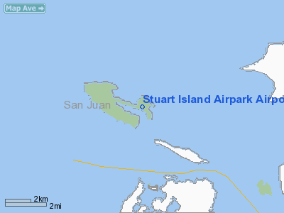
Stuart Island Airpark Airport |
Location & QuickFacts
| FAA Information Effective: | 2008-09-25 |
| Airport Identifier: | 7WA5 |
| Airport Status: | Operational |
| Longitude/Latitude: | 123-10-32.6830W/48-40-22.3600N
-123.175745/48.672878 (Estimated) |
| Elevation: | 10 ft / 3.05 m (Estimated) |
| Land: | 7 acres |
| From nearest city: | 2 nautical miles SE of Stuart Island, WA |
| Location: | San Juan County, WA |
| Magnetic Variation: | 21E (1985) |
Owner & Manager
| Ownership: | Privately owned |
| Owner: | Stuart Island Airway Park
REPLAT HOMEOWNERS ASSOCIATION. |
| Address: | Stuart Island
Friday Harbor, WA 98250 |
| Manager: | Stuart Island Airway Park |
| Address: | Stuart Island
Friday Harbor, WA 98250 |
Airport Operations and Facilities
| Airport Use: | Private |
| Wind indicator: | Yes |
| Segmented Circle: | No |
| Control Tower: | No |
| Landing fee charge: | Yes |
| Sectional chart: | Seattle |
| Region: | ANM - Northwest Mountain |
| Boundary ARTCC: | ZSE - Seattle |
| Responsible ARTCC: | ZVR - Vancouver |
| Tie-in FSS: | SEA - Seattle |
| FSS on Airport: | No |
| FSS Toll Free: | 1-800-WX-BRIEF |
Airport Services
| Airframe Repair: | NONE |
| Power Plant Repair: | NONE |
| Bottled Oxygen: | NONE |
| Bulk Oxygen: | NONE |
Runway Information
Runway 09/27
| Dimension: | 2000 x 55 ft / 609.6 x 16.8 m
RY 09/27 REMEASURED. |
| Surface: | TURF, |
| |
Runway 09 |
Runway 27 |
| Traffic Pattern: | Left | Left |
| Runway End Identifier: | No | No |
| Centerline Lights: | No | No |
| Touchdown Lights: | No | No |
|
Radio Navigation Aids
| ID |
Type |
Name |
Ch |
Freq |
Var |
Dist |
| YJ | NDB | Victoria | | 200.00 | 21E | 9.0 nm |
| FHR | NDB | Friday Harbor | | 284.00 | 20E | 10.6 nm |
| AP | NDB | Active Pass | | 378.00 | 21E | 12.9 nm |
| MB | NDB | Mill Bay | | 293.00 | 21E | 14.3 nm |
| OPZ | NDB | Lopez Island | | 356.00 | 21E | 15.4 nm |
| WC | NDB | White Rock | | 332.00 | 21E | 26.5 nm |
| VR | NDB | Vancouver | | 266.00 | 21E | 30.4 nm |
| V | NDB | Victor | | 368.00 | 22E | 31.2 nm |
| BVS | NDB | Skagit/bay View | | 240.00 | 21E | 32.5 nm |
| XX | NDB | Abbotsford | | 344.00 | 21E | 34.1 nm |
| CL | NDB | Elwha | | 515.00 | 22E | 37.1 nm |
| YCD | NDB | Nanaimo | | 251.00 | 21E | 38.8 nm |
| LU | NDB | Cultus | | 214.00 | 22E | 49.2 nm |
| NUW | TACAN | Whidbey Island | 085X | | 21E | 28.0 nm |
| YYJ | VOR/DME | Victoria | 084X | 113.70 | 21E | 12.7 nm |
| CVV | VOR/DME | Penn Cove | 119X | 117.20 | 19E | 31.4 nm |
| YVR | VORTAC | Vancouver | 44 | 115.90 | 21E | 24.3 nm |
| HUH | VORTAC | Whatcom | 077X | 113.00 | 20E | 28.7 nm |
Remarks
- <300 X 55' STWY RY 27; 200 X 30' STWY RY 09.
- ARPT SOFT WHEN WET.
- 2' DITCH ON EACH EDGE OF RWY-NO DAY MARKERS.
- DEER MAY BE ON RY - NGT OPERS DISCOURAGED.
- ESTABD PRIOR TO 1959.
Images and information placed above are from
http://www.airport-data.com/airport/7WA5/
We thank them for the data!
| General Info
|
| Country |
United States
|
| State |
WASHINGTON
|
| FAA ID |
7WA5
|
| Latitude |
48-40-22.360N
|
| Longitude |
123-10-32.683W
|
| Elevation |
10 feet
|
| Near City |
STUART ISLAND
|
We don't guarantee the information is fresh and accurate. The data may
be wrong or outdated.
For more up-to-date information please refer to other sources.
|
|


