 |
|
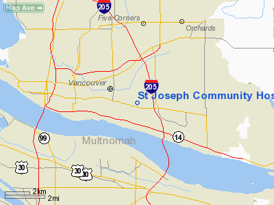
St Joseph Community Hospital Heliport |
Location & QuickFacts
| FAA Information Effective: | 2008-09-25 |
| Airport Identifier: | 21WA |
| Airport Status: | Operational |
| Longitude/Latitude: | 122-34-34.3420W/45-37-29.4230N
-122.576206/45.624840 (Estimated) |
| Elevation: | 313 ft / 95.40 m (Estimated) |
| Land: | 0 acres |
| From nearest city: | 5 nautical miles E of Vancouver, WA |
| Location: | Clark County, WA |
| Magnetic Variation: | 19E (1985) |
Owner & Manager
| Ownership: | Privately owned |
| Owner: | Southwest Wash Med Center |
| Address: | 400 Ne Mother Joseph Way
Vancouver Washington 98668 |
| Manager: | Ron Hulse,facilities Manager |
| Address: | P O Box 1600
Vncouver, WASHINGTON 98668 |
| Phone number: | 206-256-2000 |
Airport Operations and Facilities
| Airport Use: | Private
MEDICAL USE. |
| Wind indicator: | Yes |
| Segmented Circle: | No |
| Control Tower: | No |
| Lighting Schedule: | PHONE REQ
FOR PERIMETER LGTS PHONE 206-256-2000. |
| Sectional chart: | Seattle |
| Region: | ANM - Northwest Mountain |
| Boundary ARTCC: | ZSE - Seattle |
| Tie-in FSS: | SEA - Seattle |
| FSS Toll Free: | 1-800-WX-BRIEF |
Runway Information
Helipad H1
| Dimension: | 46 x 46 ft / 14.0 x 14.0 m |
| Surface: | CONC, Good Condition |
| |
Runway H1 |
Runway |
| Traffic Pattern: | Left | Left |
|
Radio Navigation Aids
| ID |
Type |
Name |
Ch |
Freq |
Var |
Dist |
| LBH | NDB | Laker | | 332.00 | 20E | 6.9 nm |
| PND | NDB | Banks | | 356.00 | 21E | 19.7 nm |
| LSO | NDB | Kelso | | 256.00 | 21E | 34.9 nm |
| CBU | TACAN | Columbia | 029X | | 20E | 2.6 nm |
| PDX | VOR/DME | Portland | 055X | 111.80 | 20E | 2.3 nm |
| UBG | VOR/DME | Newberg | 121X | 117.40 | 21E | 23.5 nm |
| BTG | VORTAC | Battle Ground | 113X | 116.60 | 21E | 7.4 nm |
| PDX | VOT | Portland Intl | | 111.00 | | 1.9 nm |
| HIO | VOT | Portland-hillsboro | | 115.20 | | 16.5 nm |
Remarks
- PRVDD INGRESS/EGRESS ARE EAST WEST.
Images and information placed above are from
http://www.airport-data.com/airport/21WA/
We thank them for the data!
| General Info
|
| Country |
United States
|
| State |
WASHINGTON
|
| FAA ID |
21WA
|
| Latitude |
45-37-29.423N
|
| Longitude |
122-34-34.342W
|
| Elevation |
313 feet
|
| Near City |
VANCOUVER
|
We don't guarantee the information is fresh and accurate. The data may
be wrong or outdated.
For more up-to-date information please refer to other sources.
|
|


